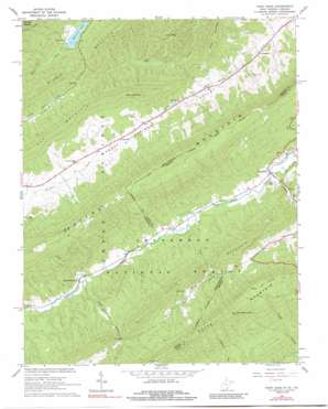
Paint Bank Topo Map West Virginia
To zoom in, hover over the map of Paint Bank
USGS Topo Quad 37080e3 - 1:24,000 scale
| Topo Map Name: | Paint Bank |
| USGS Topo Quad ID: | 37080e3 |
| Print Size: | ca. 21 1/4" wide x 27" high |
| Southeast Coordinates: | 37.5° N latitude / 80.25° W longitude |
| Map Center Coordinates: | 37.5625° N latitude / 80.3125° W longitude |
| U.S. States: | WV, VA |
| Filename: | o37080e3.jpg |
| Download Map JPG Image: | Paint Bank topo map 1:24,000 scale |
| Map Type: | Topographic |
| Topo Series: | 7.5´ |
| Map Scale: | 1:24,000 |
| Source of Map Images: | United States Geological Survey (USGS) |
| Alternate Map Versions: |
Paint Bank VA 1966, updated 1968 Download PDF Buy paper map Paint Bank VA 1966, updated 1991 Download PDF Buy paper map Paint Bank VA 2011 Download PDF Buy paper map Paint Bank VA 2013 Download PDF Buy paper map Paint Bank VA 2016 Download PDF Buy paper map |
| FStopo: | US Forest Service topo Paint Bank is available: Download FStopo PDF Download FStopo TIF |
1:24,000 Topo Quads surrounding Paint Bank
> Back to 37080e1 at 1:100,000 scale
> Back to 37080a1 at 1:250,000 scale
> Back to U.S. Topo Maps home
Paint Bank topo map: Gazetteer
Paint Bank: Dams
Moncove Lake Dam elevation 763m 2503′Paint Bank: Parks
Moncove Lake Wildlife Management Area elevation 766m 2513′Paint Bank: Populated Places
Centennial elevation 792m 2598′Laurel Branch elevation 624m 2047′
Paint Bank elevation 563m 1847′
Roxalia elevation 778m 2552′
Paint Bank: Ranges
Peters Mountain elevation 1123m 3684′Paint Bank: Reservoirs
Moncove Lake elevation 763m 2503′Moncove Lake elevation 921m 3021′
Paint Bank: Ridges
Little Mountain elevation 846m 2775′Little Mountain elevation 918m 3011′
Middle Mountain elevation 913m 2995′
Paint Bank: Springs
Allison Farm Spring elevation 704m 2309′Baker Spring elevation 720m 2362′
Charles Patton Spring elevation 750m 2460′
Ewin Run Spring elevation 698m 2290′
Kitchen Creek Spring elevation 760m 2493′
Left Fork Trout Branch Springs elevation 746m 2447′
Right Fork Trout Branch Spring elevation 765m 2509′
Paint Bank: Streams
Ewin Run elevation 586m 1922′Ewin Run elevation 828m 2716′
Paint Bank Branch elevation 562m 1843′
Trout Branch elevation 620m 2034′
Paint Bank: Summits
High Head Mountain elevation 1022m 3353′Wolf Hills elevation 916m 3005′
Paint Bank: Trails
Potts Mountain Trail elevation 1125m 3690′Paint Bank: Valleys
Back Valley elevation 683m 2240′Paint Bank digital topo map on disk
Buy this Paint Bank topo map showing relief, roads, GPS coordinates and other geographical features, as a high-resolution digital map file on DVD:
Western Virginia & Southern West Virginia
Buy digital topo maps: Western Virginia & Southern West Virginia


