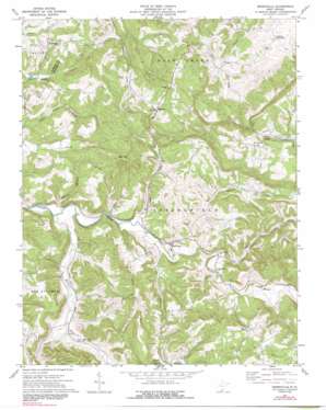
Greenville Topo Map West Virginia
To zoom in, hover over the map of Greenville
USGS Topo Quad 37080e6 - 1:24,000 scale
| Topo Map Name: | Greenville |
| USGS Topo Quad ID: | 37080e6 |
| Print Size: | ca. 21 1/4" wide x 27" high |
| Southeast Coordinates: | 37.5° N latitude / 80.625° W longitude |
| Map Center Coordinates: | 37.5625° N latitude / 80.6875° W longitude |
| U.S. State: | WV |
| Filename: | o37080e6.jpg |
| Download Map JPG Image: | Greenville topo map 1:24,000 scale |
| Map Type: | Topographic |
| Topo Series: | 7.5´ |
| Map Scale: | 1:24,000 |
| Source of Map Images: | United States Geological Survey (USGS) |
| Alternate Map Versions: |
Greenville WV 1971, updated 1975 Download PDF Buy paper map Greenville WV 1971, updated 1991 Download PDF Buy paper map Greenville WV 2011 Download PDF Buy paper map Greenville WV 2014 Download PDF Buy paper map Greenville WV 2016 Download PDF Buy paper map |
1:24,000 Topo Quads surrounding Greenville
> Back to 37080e1 at 1:100,000 scale
> Back to 37080a1 at 1:250,000 scale
> Back to U.S. Topo Maps home
Greenville topo map: Gazetteer
Greenville: Bridges
Laurel Creek Covered Bridge elevation 553m 1814′Greenville: Populated Places
Ballengee elevation 578m 1896′Greenville elevation 517m 1696′
Johnson Crossroads elevation 590m 1935′
Sarton elevation 738m 2421′
Wayside elevation 605m 1984′
Wikel elevation 664m 2178′
Greenville: Post Offices
Ballengee Post Office elevation 570m 1870′Greenville Post Office elevation 521m 1709′
Sarton Post Office elevation 728m 2388′
Wayside Post Office elevation 608m 1994′
Greenville: Ridges
Ellison Ridge elevation 719m 2358′Greenville: Springs
Silas Gore Spring elevation 500m 1640′Woodrum Spring elevation 590m 1935′
Greenville: Streams
Back Creek elevation 496m 1627′Cooks Run elevation 485m 1591′
Hans Creek elevation 474m 1555′
Laurel Creek elevation 507m 1663′
Slate Run elevation 478m 1568′
Symmes Branch elevation 475m 1558′
Greenville: Summits
High Top elevation 785m 2575′Kibble Hill elevation 608m 1994′
Greenville: Valleys
Indian Draft elevation 482m 1581′Greenville digital topo map on disk
Buy this Greenville topo map showing relief, roads, GPS coordinates and other geographical features, as a high-resolution digital map file on DVD:
Western Virginia & Southern West Virginia
Buy digital topo maps: Western Virginia & Southern West Virginia


