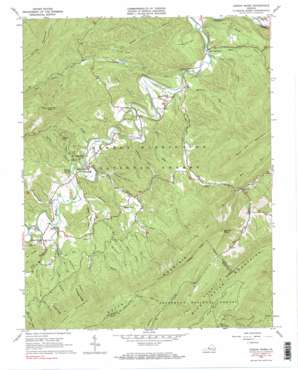
Jordan Mines Topo Map Virginia
To zoom in, hover over the map of Jordan Mines
USGS Topo Quad 37080f1 - 1:24,000 scale
| Topo Map Name: | Jordan Mines |
| USGS Topo Quad ID: | 37080f1 |
| Print Size: | ca. 21 1/4" wide x 27" high |
| Southeast Coordinates: | 37.625° N latitude / 80° W longitude |
| Map Center Coordinates: | 37.6875° N latitude / 80.0625° W longitude |
| U.S. State: | VA |
| Filename: | o37080f1.jpg |
| Download Map JPG Image: | Jordan Mines topo map 1:24,000 scale |
| Map Type: | Topographic |
| Topo Series: | 7.5´ |
| Map Scale: | 1:24,000 |
| Source of Map Images: | United States Geological Survey (USGS) |
| Alternate Map Versions: |
Jordan Mines VA 1966, updated 1967 Download PDF Buy paper map Jordan Mines VA 1966, updated 1983 Download PDF Buy paper map Jordan Mines VA 1966, updated 1983 Download PDF Buy paper map Jordan Mines VA 2011 Download PDF Buy paper map Jordan Mines VA 2013 Download PDF Buy paper map Jordan Mines VA 2016 Download PDF Buy paper map |
| FStopo: | US Forest Service topo Jordan Mines is available: Download FStopo PDF Download FStopo TIF |
1:24,000 Topo Quads surrounding Jordan Mines
> Back to 37080e1 at 1:100,000 scale
> Back to 37080a1 at 1:250,000 scale
> Back to U.S. Topo Maps home
Jordan Mines topo map: Gazetteer
Jordan Mines: Basins
The Sinks elevation 428m 1404′Jordan Mines: Bends
Moores Bottom elevation 440m 1443′Jordan Mines: Dams
Pond Lick Branch Dam elevation 394m 1292′Jordan Mines: Flats
Bowyer Flat elevation 622m 2040′Kimberlin Flat elevation 452m 1482′
Pond Flat elevation 503m 1650′
Jordan Mines: Parks
National Childrens Forest elevation 583m 1912′Jordan Mines: Populated Places
Boiling Spring elevation 452m 1482′Clifdale elevation 536m 1758′
Jordan Mines elevation 457m 1499′
Jordan Mines: Reservoirs
Pond Lick Branch Reservoir elevation 394m 1292′Jordan Mines: Ridges
Cowbone Ridge elevation 803m 2634′Double Ridge elevation 801m 2627′
Jordan Mines: Springs
Boiling Spring elevation 437m 1433′Jordan Mines: Streams
Bens Run elevation 426m 1397′Blue Spring Run elevation 392m 1286′
Cast Steel Run elevation 389m 1276′
Christleys Run elevation 448m 1469′
Cowbone Branch elevation 483m 1584′
Hays Creek elevation 383m 1256′
Kempers Run elevation 438m 1437′
Lick Run elevation 537m 1761′
Mill Branch elevation 449m 1473′
Millstone Run elevation 391m 1282′
Mud Run elevation 511m 1676′
Pond Lick Branch elevation 387m 1269′
Solomons Run elevation 406m 1332′
Spice Run elevation 510m 1673′
Spring Branch elevation 438m 1437′
Still Run elevation 403m 1322′
Sugar Run elevation 445m 1459′
Swamp Branch elevation 483m 1584′
Jordan Mines: Summits
Fork Mountain elevation 1039m 3408′Hickory Hill elevation 625m 2050′
Little Mountain elevation 948m 3110′
Morning Knob elevation 1035m 3395′
Nicholls Knob elevation 1084m 3556′
Jordan Mines: Valleys
Craft Hollow elevation 529m 1735′Crowder Hollow elevation 453m 1486′
Flat Rock Hollow elevation 495m 1624′
Hickory Hill Hollow elevation 433m 1420′
Incline Hollow elevation 396m 1299′
Lafes Hollow elevation 621m 2037′
Millstone Hollow elevation 413m 1354′
Shanty Hollow elevation 527m 1729′
Jordan Mines digital topo map on disk
Buy this Jordan Mines topo map showing relief, roads, GPS coordinates and other geographical features, as a high-resolution digital map file on DVD:
Western Virginia & Southern West Virginia
Buy digital topo maps: Western Virginia & Southern West Virginia


