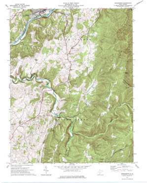
Ronceverte Topo Map West Virginia
To zoom in, hover over the map of Ronceverte
USGS Topo Quad 37080f4 - 1:24,000 scale
| Topo Map Name: | Ronceverte |
| USGS Topo Quad ID: | 37080f4 |
| Print Size: | ca. 21 1/4" wide x 27" high |
| Southeast Coordinates: | 37.625° N latitude / 80.375° W longitude |
| Map Center Coordinates: | 37.6875° N latitude / 80.4375° W longitude |
| U.S. State: | WV |
| Filename: | o37080f4.jpg |
| Download Map JPG Image: | Ronceverte topo map 1:24,000 scale |
| Map Type: | Topographic |
| Topo Series: | 7.5´ |
| Map Scale: | 1:24,000 |
| Source of Map Images: | United States Geological Survey (USGS) |
| Alternate Map Versions: |
Ronceverte WV 1971, updated 1975 Download PDF Buy paper map Ronceverte WV 2011 Download PDF Buy paper map Ronceverte WV 2014 Download PDF Buy paper map Ronceverte WV 2016 Download PDF Buy paper map |
1:24,000 Topo Quads surrounding Ronceverte
> Back to 37080e1 at 1:100,000 scale
> Back to 37080a1 at 1:250,000 scale
> Back to U.S. Topo Maps home
Ronceverte topo map: Gazetteer
Ronceverte: Populated Places
Monitor elevation 681m 2234′Organ Cave elevation 664m 2178′
Patton elevation 536m 1758′
Ronceverte elevation 511m 1676′
Secondcreek elevation 571m 1873′
Ronceverte: Post Offices
Ronceverte Post Office elevation 508m 1666′Ronceverte: Ridges
Daniels Ridge elevation 956m 3136′Eads Ridge elevation 848m 2782′
Ronceverte: Springs
Big Spring elevation 551m 1807′Burdette Spring elevation 649m 2129′
Ronceverte: Streams
Archer Fork elevation 728m 2388′Carpenter Creek elevation 588m 1929′
Laurel Branch elevation 502m 1646′
Laurel Creek elevation 596m 1955′
Plankcabin Creek elevation 572m 1876′
Ronceverte: Summits
Boggs Hightop elevation 921m 3021′Hokes Mountain elevation 842m 2762′
Jones Mountain elevation 918m 3011′
Ronceverte: Valleys
Rayburn Draft elevation 572m 1876′Ronceverte digital topo map on disk
Buy this Ronceverte topo map showing relief, roads, GPS coordinates and other geographical features, as a high-resolution digital map file on DVD:
Western Virginia & Southern West Virginia
Buy digital topo maps: Western Virginia & Southern West Virginia


