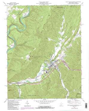
White Sulphur Springs Topo Map West Virginia
To zoom in, hover over the map of White Sulphur Springs
USGS Topo Quad 37080g3 - 1:24,000 scale
| Topo Map Name: | White Sulphur Springs |
| USGS Topo Quad ID: | 37080g3 |
| Print Size: | ca. 21 1/4" wide x 27" high |
| Southeast Coordinates: | 37.75° N latitude / 80.25° W longitude |
| Map Center Coordinates: | 37.8125° N latitude / 80.3125° W longitude |
| U.S. States: | WV, VA |
| Filename: | o37080g3.jpg |
| Download Map JPG Image: | White Sulphur Springs topo map 1:24,000 scale |
| Map Type: | Topographic |
| Topo Series: | 7.5´ |
| Map Scale: | 1:24,000 |
| Source of Map Images: | United States Geological Survey (USGS) |
| Alternate Map Versions: |
White Sulphur Springs WV 1972, updated 1975 Download PDF Buy paper map White Sulphur Springs WV 1972, updated 1984 Download PDF Buy paper map White Sulphur Springs WV 1995, updated 1998 Download PDF Buy paper map White Sulphur Springs WV 2011 Download PDF Buy paper map White Sulphur Springs WV 2014 Download PDF Buy paper map White Sulphur Springs WV 2016 Download PDF Buy paper map |
| FStopo: | US Forest Service topo White Sulphur Springs is available: Download FStopo PDF Download FStopo TIF |
1:24,000 Topo Quads surrounding White Sulphur Springs
> Back to 37080e1 at 1:100,000 scale
> Back to 37080a1 at 1:250,000 scale
> Back to U.S. Topo Maps home
White Sulphur Springs topo map: Gazetteer
White Sulphur Springs: Airports
Greenbrier Airport elevation 545m 1788′White Sulphur Springs: Crossings
Interchange 175 elevation 540m 1771′Interchange 181 elevation 599m 1965′
White Sulphur Springs: Populated Places
Alum Springs (historical) elevation 711m 2332′Bowes elevation 531m 1742′
Brink (historical) elevation 536m 1758′
Dickson elevation 564m 1850′
Hopper elevation 547m 1794′
Keister elevation 541m 1774′
Loopemount elevation 563m 1847′
Mapledale elevation 616m 2020′
Tuckahoe elevation 620m 2034′
White Sulphur Springs elevation 566m 1856′
White Sulphur Springs: Ridges
Bobs Ridge elevation 764m 2506′White Rock Mountain elevation 944m 3097′
White Sulphur Springs: Springs
Alum Springs elevation 637m 2089′Big Spring elevation 572m 1876′
Sterett Springs elevation 576m 1889′
White Sulphur Chalybeate Spring elevation 570m 1870′
White Sulphur Spring elevation 567m 1860′
White Sulphur Springs: Streams
Boulder Run elevation 520m 1706′Dry Creek elevation 562m 1843′
Harts Run elevation 535m 1755′
Jericho Draft elevation 576m 1889′
Mays Draft elevation 636m 2086′
Sulphur Lick Run elevation 616m 2020′
Wades Creek elevation 566m 1856′
White Sulphur Springs: Summits
Greenbrier Mountain elevation 1012m 3320′Kates Mountain elevation 1015m 3330′
O'Neill Knob elevation 959m 3146′
Wicks Knob elevation 970m 3182′
White Sulphur Springs: Valleys
Dutch Hollow elevation 593m 1945′Dynamite Hollow elevation 566m 1856′
Schuirmann Hollow elevation 593m 1945′
White Sulphur Springs digital topo map on disk
Buy this White Sulphur Springs topo map showing relief, roads, GPS coordinates and other geographical features, as a high-resolution digital map file on DVD:
Western Virginia & Southern West Virginia
Buy digital topo maps: Western Virginia & Southern West Virginia


