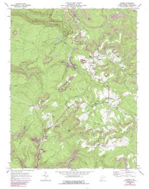
Danese Topo Map West Virginia
To zoom in, hover over the map of Danese
USGS Topo Quad 37080h8 - 1:24,000 scale
| Topo Map Name: | Danese |
| USGS Topo Quad ID: | 37080h8 |
| Print Size: | ca. 21 1/4" wide x 27" high |
| Southeast Coordinates: | 37.875° N latitude / 80.875° W longitude |
| Map Center Coordinates: | 37.9375° N latitude / 80.9375° W longitude |
| U.S. State: | WV |
| Filename: | o37080h8.jpg |
| Download Map JPG Image: | Danese topo map 1:24,000 scale |
| Map Type: | Topographic |
| Topo Series: | 7.5´ |
| Map Scale: | 1:24,000 |
| Source of Map Images: | United States Geological Survey (USGS) |
| Alternate Map Versions: |
Danese WV 1969, updated 1972 Download PDF Buy paper map Danese WV 1969, updated 1977 Download PDF Buy paper map Danese WV 1969, updated 1991 Download PDF Buy paper map Danese WV 2011 Download PDF Buy paper map Danese WV 2014 Download PDF Buy paper map Danese WV 2016 Download PDF Buy paper map |
1:24,000 Topo Quads surrounding Danese
> Back to 37080e1 at 1:100,000 scale
> Back to 37080a1 at 1:250,000 scale
> Back to U.S. Topo Maps home
Danese topo map: Gazetteer
Danese: Dams
Babcock State Park Lake Number One Dam elevation 751m 2463′Danese: Parks
Babcock State Park elevation 531m 1742′Danese: Populated Places
Chestnut Knob elevation 937m 3074′Crickmer elevation 912m 2992′
Danese elevation 802m 2631′
Greenwood (historical) elevation 751m 2463′
Kathryn elevation 640m 2099′
Landisburg elevation 761m 2496′
Layland elevation 741m 2431′
Layland Heights elevation 862m 2828′
Maplewood elevation 829m 2719′
Pittman elevation 803m 2634′
Danese: Ridges
Walnut Ridge elevation 1000m 3280′Danese: Streams
Bear Branch elevation 856m 2808′Bucklick Branch elevation 706m 2316′
Burnt Creek elevation 790m 2591′
Butler Branch elevation 719m 2358′
Davis Branch elevation 708m 2322′
Ellison Branch elevation 784m 2572′
Gibson Fork elevation 812m 2664′
Glade Creek elevation 510m 1673′
Laurel Creek elevation 713m 2339′
Lick Run elevation 774m 2539′
Long Branch elevation 778m 2552′
Pole Creek elevation 802m 2631′
Pond Branch elevation 748m 2454′
Red Spring Creek elevation 779m 2555′
Sandy Creek elevation 780m 2559′
Sandylick Branch elevation 742m 2434′
Shades Death Creek elevation 744m 2440′
Sidenstricker Branch elevation 719m 2358′
Smoky Branch elevation 751m 2463′
Terry Branch elevation 801m 2627′
Danese: Summits
Greenwood Mountain elevation 875m 2870′Highland Mountain elevation 849m 2785′
Mann Mountain elevation 955m 3133′
Walnut Knob elevation 1049m 3441′
Danese: Valleys
Hemlock Hollow elevation 653m 2142′Danese digital topo map on disk
Buy this Danese topo map showing relief, roads, GPS coordinates and other geographical features, as a high-resolution digital map file on DVD:
Western Virginia & Southern West Virginia
Buy digital topo maps: Western Virginia & Southern West Virginia


