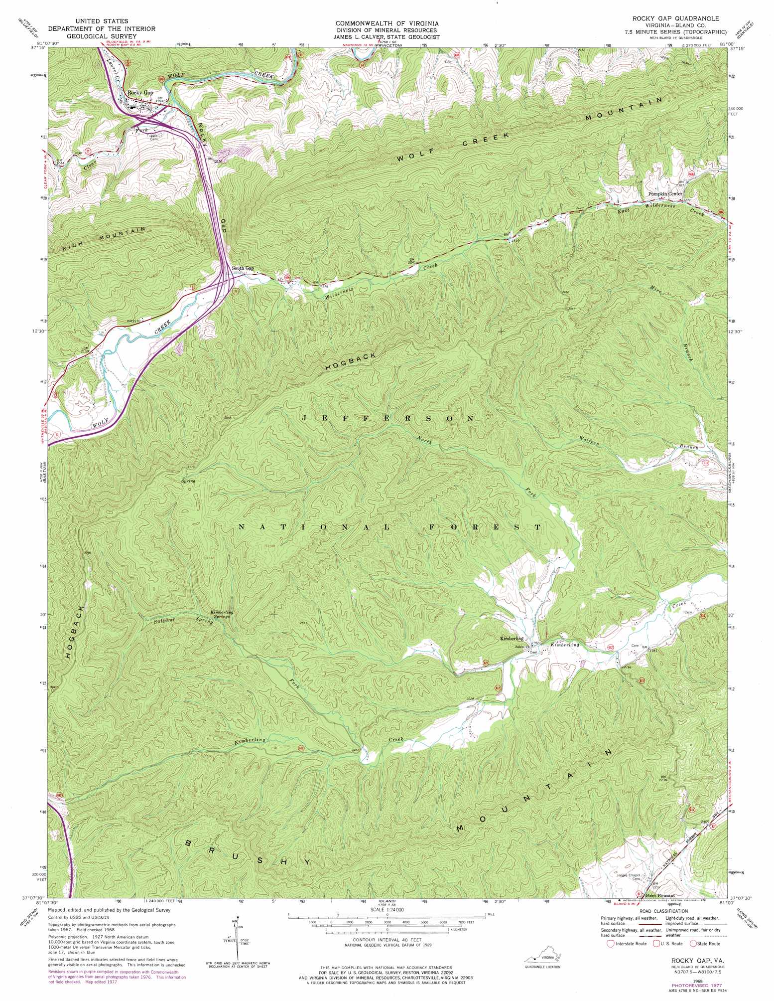
Rocky Gap Topo Map Virginia
To zoom in, hover over the map of Rocky Gap
USGS Topo Quad 37081b1 - 1:24,000 scale
| Topo Map Name: | Rocky Gap |
| USGS Topo Quad ID: | 37081b1 |
| Print Size: | ca. 21 1/4" wide x 27" high |
| Southeast Coordinates: | 37.125° N latitude / 81° W longitude |
| Map Center Coordinates: | 37.1875° N latitude / 81.0625° W longitude |
| U.S. State: | VA |
| Filename: | o37081b1.jpg |
| Download Map JPG Image: | Rocky Gap topo map 1:24,000 scale |
| Map Type: | Topographic |
| Topo Series: | 7.5´ |
| Map Scale: | 1:24,000 |
| Source of Map Images: | United States Geological Survey (USGS) |
| Alternate Map Versions: |
Rocky Gap VA 1968, updated 1970 Download PDF Buy paper map Rocky Gap VA 1968, updated 1978 Download PDF Buy paper map Rocky Gap VA 2011 Download PDF Buy paper map Rocky Gap VA 2013 Download PDF Buy paper map Rocky Gap VA 2016 Download PDF Buy paper map |
| FStopo: | US Forest Service topo Rocky Gap is available: Download FStopo PDF Download FStopo TIF |
1:24,000 Topo Quads surrounding Rocky Gap
Crumpler |
Matoaka |
Athens |
Lerona |
Peterstown |
Bramwell |
Bluefield |
Princeton |
Oakvale |
Narrows |
Cove Creek |
Bastian |
Rocky Gap |
Mechanicsburg |
White Gate |
Garden Mountain |
Big Bend |
Bland |
Long Spur |
Pulaski |
Rural Retreat |
Crockett |
Wytheville |
Max Meadows |
Fosters Falls |
> Back to 37081a1 at 1:100,000 scale
> Back to 37080a1 at 1:250,000 scale
> Back to U.S. Topo Maps home
Rocky Gap topo map: Gazetteer
Rocky Gap: Crossings
Interchange 62 elevation 628m 2060′Interchange 64 elevation 621m 2037′
Rocky Gap: Gaps
Rocky Gap elevation 633m 2076′Rocky Gap: Populated Places
Kimberling elevation 664m 2178′Pumpkin Center elevation 692m 2270′
Rocky Gap elevation 618m 2027′
South Gap elevation 635m 2083′
Rocky Gap: Ridges
Hogback elevation 1027m 3369′Rocky Gap: Springs
Kimberling Springs elevation 762m 2500′Rocky Gap: Streams
Clear Fork elevation 603m 1978′Laurel Creek elevation 602m 1975′
Middle Fork Kimberling Creek elevation 660m 2165′
North Fork Kimberling Creek elevation 657m 2155′
Sulphur Spring Fork elevation 688m 2257′
Wilderness Creek elevation 633m 2076′
Rocky Gap digital topo map on disk
Buy this Rocky Gap topo map showing relief, roads, GPS coordinates and other geographical features, as a high-resolution digital map file on DVD:
Western Virginia & Southern West Virginia
Buy digital topo maps: Western Virginia & Southern West Virginia