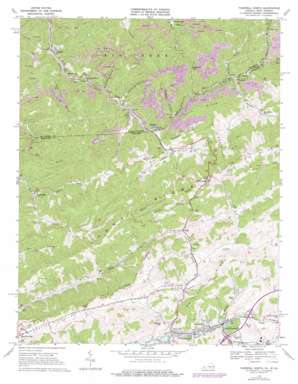
Tazewell North Topo Map Virginia
To zoom in, hover over the map of Tazewell North
USGS Topo Quad 37081b5 - 1:24,000 scale
| Topo Map Name: | Tazewell North |
| USGS Topo Quad ID: | 37081b5 |
| Print Size: | ca. 21 1/4" wide x 27" high |
| Southeast Coordinates: | 37.125° N latitude / 81.5° W longitude |
| Map Center Coordinates: | 37.1875° N latitude / 81.5625° W longitude |
| U.S. States: | VA, WV |
| Filename: | o37081b5.jpg |
| Download Map JPG Image: | Tazewell North topo map 1:24,000 scale |
| Map Type: | Topographic |
| Topo Series: | 7.5´ |
| Map Scale: | 1:24,000 |
| Source of Map Images: | United States Geological Survey (USGS) |
| Alternate Map Versions: |
Tazewell North VA 1968, updated 1971 Download PDF Buy paper map Tazewell North VA 1968, updated 1977 Download PDF Buy paper map Tazewell North VA 2011 Download PDF Buy paper map Tazewell North VA 2013 Download PDF Buy paper map Tazewell North VA 2016 Download PDF Buy paper map |
1:24,000 Topo Quads surrounding Tazewell North
> Back to 37081a1 at 1:100,000 scale
> Back to 37080a1 at 1:250,000 scale
> Back to U.S. Topo Maps home
Tazewell North topo map: Gazetteer
Tazewell North: Basins
Crocket Cove elevation 558m 1830′Crockett Cove elevation 558m 1830′
Tazewell North: Bridges
Willow Bridge elevation 756m 2480′Tazewell North: Dams
Dalton Branch Dam elevation 635m 2083′Tazewell North: Gaps
Dogwood Gap elevation 700m 2296′Tazewell North: Populated Places
Adria elevation 754m 2473′Bishop elevation 538m 1765′
Bishop elevation 552m 1811′
Brewsterdale elevation 538m 1765′
Horsepen elevation 603m 1978′
Horsepen Cove elevation 651m 2135′
Jacobs Fork elevation 520m 1706′
Johnstown elevation 519m 1702′
McCall Place elevation 670m 2198′
North Tazewell elevation 733m 2404′
River Jack elevation 721m 2365′
Rourkes Gap elevation 769m 2522′
Sayersville elevation 533m 1748′
Shraders elevation 553m 1814′
Squire elevation 507m 1663′
Stony Ridge elevation 865m 2837′
Tazewell North: Post Offices
North Tazewell Post Office elevation 727m 2385′Tazewell North: Reservoirs
Bishop Prep Plant Slurry Impoundment elevation 635m 2083′Tazewell North: Ridges
Big Stone Ridge elevation 981m 3218′Little Stone Ridge elevation 869m 2851′
Pine Ridge elevation 820m 2690′
Sandy Ridge elevation 819m 2687′
White Oak Ridge elevation 769m 2522′
Whitley Ridge elevation 881m 2890′
Tazewell North: Streams
Cavitts Creek elevation 725m 2378′Dix Creek elevation 518m 1699′
Ferguson Branch elevation 614m 2014′
Goose Creek elevation 651m 2135′
Horsepen Creek elevation 557m 1827′
Horsepen Creek elevation 540m 1771′
Johnson Branch elevation 744m 2440′
Laurel Fork elevation 539m 1768′
Lincolnshire Branch elevation 735m 2411′
Little Horsepen Creek elevation 593m 1945′
Low Gap Branch elevation 617m 2024′
Low Gap Branch elevation 618m 2027′
Middle Fork Big Creek elevation 536m 1758′
Mile Branch elevation 522m 1712′
Mundy Branch elevation 737m 2417′
North Fork Big Creek elevation 536m 1758′
Road Fork elevation 543m 1781′
Rockhouse Branch elevation 587m 1925′
Trace Branch elevation 511m 1676′
Whitley Branch elevation 735m 2411′
Tazewell North: Summits
Hubble Hill elevation 808m 2650′Tazewell North: Valleys
Brewster Hollow elevation 546m 1791′Deadman Hollow elevation 537m 1761′
Jailhouse Hollow elevation 537m 1761′
Johnson Hollow elevation 563m 1847′
Tazewell North digital topo map on disk
Buy this Tazewell North topo map showing relief, roads, GPS coordinates and other geographical features, as a high-resolution digital map file on DVD:
Western Virginia & Southern West Virginia
Buy digital topo maps: Western Virginia & Southern West Virginia


