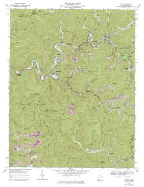
Davy Topo Map West Virginia
To zoom in, hover over the map of Davy
USGS Topo Quad 37081d6 - 1:24,000 scale
| Topo Map Name: | Davy |
| USGS Topo Quad ID: | 37081d6 |
| Print Size: | ca. 21 1/4" wide x 27" high |
| Southeast Coordinates: | 37.375° N latitude / 81.625° W longitude |
| Map Center Coordinates: | 37.4375° N latitude / 81.6875° W longitude |
| U.S. State: | WV |
| Filename: | o37081d6.jpg |
| Download Map JPG Image: | Davy topo map 1:24,000 scale |
| Map Type: | Topographic |
| Topo Series: | 7.5´ |
| Map Scale: | 1:24,000 |
| Source of Map Images: | United States Geological Survey (USGS) |
| Alternate Map Versions: |
Davy WV 1968, updated 1971 Download PDF Buy paper map Davy WV 1968, updated 1977 Download PDF Buy paper map Davy WV 2011 Download PDF Buy paper map Davy WV 2014 Download PDF Buy paper map Davy WV 2016 Download PDF Buy paper map |
1:24,000 Topo Quads surrounding Davy
> Back to 37081a1 at 1:100,000 scale
> Back to 37080a1 at 1:250,000 scale
> Back to U.S. Topo Maps home
Davy topo map: Gazetteer
Davy: Bends
Big Bend elevation 405m 1328′Davy: Populated Places
Big Sandy elevation 345m 1131′Clear Fork Junction elevation 317m 1040′
Coalwood elevation 442m 1450′
Davy elevation 361m 1184′
Erin elevation 358m 1174′
Hensley elevation 348m 1141′
Marine elevation 400m 1312′
Marytown elevation 358m 1174′
Mohegan elevation 375m 1230′
Premier elevation 448m 1469′
Roderfield elevation 344m 1128′
Twin Branch elevation 358m 1174′
Davy: Post Offices
Big Sandy Post Office elevation 341m 1118′Coalwood Post Office elevation 444m 1456′
Hensley Post Office elevation 345m 1131′
Premier Post Office elevation 445m 1459′
Roderfield Post Office elevation 335m 1099′
Twin Branch Post Office elevation 355m 1164′
Davy: Streams
Abbcamp Branch elevation 381m 1250′Badway Branch elevation 437m 1433′
Bee Branch elevation 348m 1141′
Big Branch elevation 417m 1368′
Clear Fork elevation 312m 1023′
Coon Branch elevation 426m 1397′
Coontree Branch elevation 423m 1387′
Crane Trace Branch elevation 403m 1322′
Cub Branch elevation 373m 1223′
Davy Branch elevation 356m 1167′
Daycamp Branch elevation 426m 1397′
Hensley Creek elevation 340m 1115′
Honeycamp Branch elevation 413m 1354′
Huntingshirt Branch elevation 346m 1135′
Jenny Branch elevation 359m 1177′
Jim Branch elevation 444m 1456′
Left Fork Davy Branch elevation 365m 1197′
Little Daycamp Branch elevation 417m 1368′
Little Jenny Branch elevation 367m 1204′
Long Branch elevation 359m 1177′
Lower Hensley Creek elevation 342m 1122′
Lower Twin Branch elevation 353m 1158′
Meathouse Branch elevation 399m 1309′
Moorecamp Branch elevation 449m 1473′
Mudhole Branch elevation 439m 1440′
Newson Branch elevation 445m 1459′
River Laurel Branch elevation 325m 1066′
Shabbyroom Branch elevation 344m 1128′
Short Branch elevation 365m 1197′
Snakeroot Branch elevation 442m 1450′
Spice Creek elevation 328m 1076′
Spice Laurel Branch elevation 347m 1138′
Stonecoal Branch elevation 427m 1400′
Twin Branch elevation 353m 1158′
Wolfpen Branch elevation 453m 1486′
Davy: Summits
Hensley Knob elevation 727m 2385′Davy digital topo map on disk
Buy this Davy topo map showing relief, roads, GPS coordinates and other geographical features, as a high-resolution digital map file on DVD:
Western Virginia & Southern West Virginia
Buy digital topo maps: Western Virginia & Southern West Virginia


