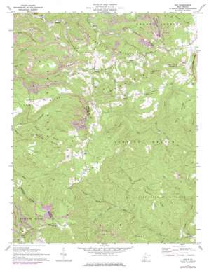
Odd Topo Map West Virginia
To zoom in, hover over the map of Odd
USGS Topo Quad 37081e2 - 1:24,000 scale
| Topo Map Name: | Odd |
| USGS Topo Quad ID: | 37081e2 |
| Print Size: | ca. 21 1/4" wide x 27" high |
| Southeast Coordinates: | 37.5° N latitude / 81.125° W longitude |
| Map Center Coordinates: | 37.5625° N latitude / 81.1875° W longitude |
| U.S. State: | WV |
| Filename: | o37081e2.jpg |
| Download Map JPG Image: | Odd topo map 1:24,000 scale |
| Map Type: | Topographic |
| Topo Series: | 7.5´ |
| Map Scale: | 1:24,000 |
| Source of Map Images: | United States Geological Survey (USGS) |
| Alternate Map Versions: |
Odd WV 1968, updated 1972 Download PDF Buy paper map Odd WV 1968, updated 1977 Download PDF Buy paper map Odd WV 2011 Download PDF Buy paper map Odd WV 2014 Download PDF Buy paper map Odd WV 2016 Download PDF Buy paper map |
1:24,000 Topo Quads surrounding Odd
> Back to 37081e1 at 1:100,000 scale
> Back to 37080a1 at 1:250,000 scale
> Back to U.S. Topo Maps home
Odd topo map: Gazetteer
Odd: Forests
Camp Creek State Forest elevation 790m 2591′Odd: Parks
Camp Creek State Park elevation 635m 2083′Odd: Populated Places
Egeria elevation 906m 2972′Josephine elevation 631m 2070′
Odd elevation 808m 2650′
Willibet elevation 718m 2355′
Odd: Post Offices
Odd Post Office elevation 829m 2719′Odd: Ridges
Bluff Ridge elevation 847m 2778′Chestnut Ridge elevation 928m 3044′
Devils Backbone elevation 899m 2949′
Guyan Ridge elevation 875m 2870′
Massie Ridge elevation 843m 2765′
Sams Ridge elevation 965m 3166′
Odd: Springs
Howard Shrewsbury Spring elevation 1011m 3316′Odd: Streams
Bear Creek elevation 661m 2168′Cassidy Branch elevation 718m 2355′
Clark Branch elevation 699m 2293′
Keaton Branch elevation 742m 2434′
Lefthand Fork Bluff Fork elevation 796m 2611′
Marsh Fork elevation 652m 2139′
Mash Fork elevation 617m 2024′
Meadow Fork elevation 760m 2493′
Mill Branch elevation 725m 2378′
Puzzle Branch elevation 718m 2355′
Seng Branch elevation 751m 2463′
Sugar Camp Branch elevation 710m 2329′
Odd: Summits
Bald Knob elevation 1044m 3425′Bluff Mountain elevation 1070m 3510′
Indian Grave Mountain elevation 1049m 3441′
Rich Knob elevation 1023m 3356′
Odd: Valleys
Miller Hollow elevation 714m 2342′Richland Hollow elevation 787m 2582′
Schreder Hollow elevation 705m 2312′
Odd digital topo map on disk
Buy this Odd topo map showing relief, roads, GPS coordinates and other geographical features, as a high-resolution digital map file on DVD:
Western Virginia & Southern West Virginia
Buy digital topo maps: Western Virginia & Southern West Virginia


