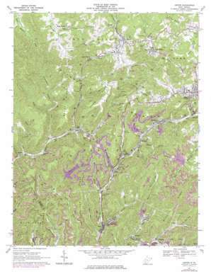
Lester Topo Map West Virginia
To zoom in, hover over the map of Lester
USGS Topo Quad 37081f3 - 1:24,000 scale
| Topo Map Name: | Lester |
| USGS Topo Quad ID: | 37081f3 |
| Print Size: | ca. 21 1/4" wide x 27" high |
| Southeast Coordinates: | 37.625° N latitude / 81.25° W longitude |
| Map Center Coordinates: | 37.6875° N latitude / 81.3125° W longitude |
| U.S. State: | WV |
| Filename: | o37081f3.jpg |
| Download Map JPG Image: | Lester topo map 1:24,000 scale |
| Map Type: | Topographic |
| Topo Series: | 7.5´ |
| Map Scale: | 1:24,000 |
| Source of Map Images: | United States Geological Survey (USGS) |
| Alternate Map Versions: |
Lester WV 1967, updated 1970 Download PDF Buy paper map Lester WV 1967, updated 1977 Download PDF Buy paper map Lester WV 2011 Download PDF Buy paper map Lester WV 2014 Download PDF Buy paper map Lester WV 2016 Download PDF Buy paper map |
1:24,000 Topo Quads surrounding Lester
> Back to 37081e1 at 1:100,000 scale
> Back to 37080a1 at 1:250,000 scale
> Back to U.S. Topo Maps home
Lester topo map: Gazetteer
Lester: Dams
Berry Branch Dam elevation 688m 2257′Riffe Branch Refuse Embankment Dam elevation 679m 2227′
Lester: Gaps
Jenny Gap elevation 666m 2185′Lester: Populated Places
Big Stick elevation 603m 1978′Eastgulf elevation 512m 1679′
Glen View elevation 764m 2506′
Glen White elevation 657m 2155′
Helen elevation 497m 1630′
Hoohoo elevation 621m 2037′
Hotchkiss elevation 515m 1689′
Jenny Gap (historical) elevation 653m 2142′
Killarney elevation 516m 1692′
Lester elevation 621m 2037′
Maple Meadow elevation 588m 1929′
McAlpin elevation 583m 1912′
Slab Fork elevation 561m 1840′
Sophia elevation 707m 2319′
Stotesbury elevation 561m 1840′
Tams elevation 524m 1719′
Ury elevation 513m 1683′
Lester: Post Offices
Helen Post Office elevation 501m 1643′Slab Fork Post Office elevation 567m 1860′
Lester: Ranges
Guyandotte Mountain elevation 750m 2460′Lester: Ridges
Acord Ridge elevation 728m 2388′Big Ridge elevation 781m 2562′
Burnt Ridge elevation 739m 2424′
Horsepen Ridge elevation 658m 2158′
Mitchell Ridge elevation 838m 2749′
Lester: Springs
Hallie Basham Spring elevation 646m 2119′Richard Cozart Spring elevation 608m 1994′
Lester: Streams
Alderson Branch elevation 539m 1768′Bailey Branch elevation 529m 1735′
Berry Branch elevation 500m 1640′
Burnt Fork elevation 530m 1738′
Farley Branch elevation 515m 1689′
Grave Fork elevation 512m 1679′
Low Gap Branch elevation 558m 1830′
Mill Branch elevation 513m 1683′
Mullens Branch elevation 560m 1837′
Old Shop Branch elevation 563m 1847′
Richardson Branch elevation 572m 1876′
Riffe Branch elevation 507m 1663′
Skinner Fork elevation 617m 2024′
Lester: Valleys
Slickrock Hollow elevation 514m 1686′Lester digital topo map on disk
Buy this Lester topo map showing relief, roads, GPS coordinates and other geographical features, as a high-resolution digital map file on DVD:
Western Virginia & Southern West Virginia
Buy digital topo maps: Western Virginia & Southern West Virginia


