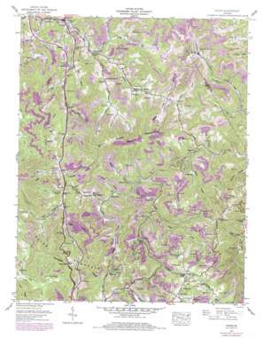
Pound Topo Map Virginia
To zoom in, hover over the map of Pound
USGS Topo Quad 37082a5 - 1:24,000 scale
| Topo Map Name: | Pound |
| USGS Topo Quad ID: | 37082a5 |
| Print Size: | ca. 21 1/4" wide x 27" high |
| Southeast Coordinates: | 37° N latitude / 82.5° W longitude |
| Map Center Coordinates: | 37.0625° N latitude / 82.5625° W longitude |
| U.S. State: | VA |
| Filename: | o37082a5.jpg |
| Download Map JPG Image: | Pound topo map 1:24,000 scale |
| Map Type: | Topographic |
| Topo Series: | 7.5´ |
| Map Scale: | 1:24,000 |
| Source of Map Images: | United States Geological Survey (USGS) |
| Alternate Map Versions: |
Indian Gap VA 1935 Download PDF Buy paper map Pound VA 1957, updated 1959 Download PDF Buy paper map Pound VA 1957, updated 1959 Download PDF Buy paper map Pound VA 1957, updated 1970 Download PDF Buy paper map Pound VA 1957, updated 1978 Download PDF Buy paper map Pound VA 1957, updated 1984 Download PDF Buy paper map Pound VA 2011 Download PDF Buy paper map Pound VA 2013 Download PDF Buy paper map Pound VA 2016 Download PDF Buy paper map |
| FStopo: | US Forest Service topo Pound is available: Download FStopo PDF Download FStopo TIF |
1:24,000 Topo Quads surrounding Pound
> Back to 37082a1 at 1:100,000 scale
> Back to 37082a1 at 1:250,000 scale
> Back to U.S. Topo Maps home
Pound topo map: Gazetteer
Pound: Dams
Moss Mine Number One Dam elevation 594m 1948′Pound: Gaps
Bean Gap elevation 589m 1932′Indian Gap elevation 753m 2470′
Pound: Mines
Clinchfield Moss Mines elevation 598m 1961′Pound: Populated Places
Big Laurel elevation 666m 2185′Hugh elevation 493m 1617′
Hurricane elevation 779m 2555′
Lanes Store elevation 474m 1555′
Peaks Store elevation 497m 1630′
Pound elevation 477m 1564′
Round Top elevation 754m 2473′
Short (historical) elevation 485m 1591′
Pound: Reservoirs
Lick Fork Pond elevation 594m 1948′Pound: Ridges
Indian Ridge elevation 710m 2329′Sally Ridge elevation 818m 2683′
Pound: Streams
Ambrose Branch elevation 513m 1683′Barn Branch elevation 489m 1604′
Big Branch elevation 487m 1597′
Big Branch elevation 508m 1666′
Bold Camp Creek elevation 470m 1541′
Cane Branch elevation 494m 1620′
Dale Branch elevation 672m 2204′
Dotson Creek elevation 491m 1610′
Dotson Fork elevation 486m 1594′
Duckcamp Branch elevation 514m 1686′
Hays Branch elevation 470m 1541′
Hurricane Branch elevation 615m 2017′
Indian Creek elevation 471m 1545′
Lane Branch elevation 464m 1522′
Left Fork Lick Fork elevation 463m 1519′
Lick Branch elevation 483m 1584′
McFall Fork elevation 484m 1587′
Meade Fork elevation 475m 1558′
Meadow Branch elevation 473m 1551′
Mullins Fork elevation 475m 1558′
North Fork Pound River elevation 471m 1545′
Potcamp Branch elevation 509m 1669′
Rickey Branch elevation 532m 1745′
Riley Branch elevation 498m 1633′
Rock Creek elevation 505m 1656′
South Fork Pound River elevation 470m 1541′
Stallard Branch elevation 535m 1755′
Steel Fork elevation 505m 1656′
Store House Branch elevation 492m 1614′
Trace Fork elevation 492m 1614′
Turkey Branch elevation 726m 2381′
Pound: Summits
Bold Camp Mountain elevation 809m 2654′Pound: Valleys
Baker Hollow elevation 549m 1801′Bowser Hollow elevation 521m 1709′
Cantrell Hollow elevation 471m 1545′
Cavenger Hollow elevation 497m 1630′
Happy Hollow elevation 474m 1555′
Hash Hollow elevation 510m 1673′
Killen Hollow elevation 491m 1610′
Peak Hollow elevation 497m 1630′
Tank Hollow elevation 537m 1761′
Yates Hollow elevation 494m 1620′
Pound digital topo map on disk
Buy this Pound topo map showing relief, roads, GPS coordinates and other geographical features, as a high-resolution digital map file on DVD:
Western Virginia & Southern West Virginia
Buy digital topo maps: Western Virginia & Southern West Virginia


