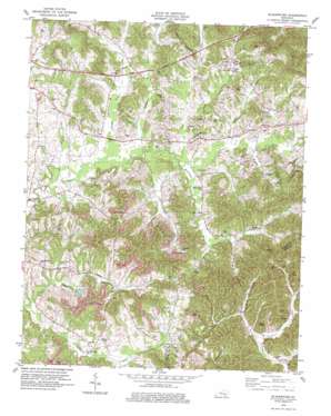
Blackwater Topo Map Kentucky
To zoom in, hover over the map of Blackwater
USGS Topo Quad 37083a8 - 1:24,000 scale
| Topo Map Name: | Blackwater |
| USGS Topo Quad ID: | 37083a8 |
| Print Size: | ca. 21 1/4" wide x 27" high |
| Southeast Coordinates: | 37° N latitude / 83.875° W longitude |
| Map Center Coordinates: | 37.0625° N latitude / 83.9375° W longitude |
| U.S. State: | KY |
| Filename: | o37083a8.jpg |
| Download Map JPG Image: | Blackwater topo map 1:24,000 scale |
| Map Type: | Topographic |
| Topo Series: | 7.5´ |
| Map Scale: | 1:24,000 |
| Source of Map Images: | United States Geological Survey (USGS) |
| Alternate Map Versions: |
Blackwater KY 1952, updated 1953 Download PDF Buy paper map Blackwater KY 1952, updated 1967 Download PDF Buy paper map Blackwater KY 1979, updated 1979 Download PDF Buy paper map Blackwater KY 2011 Download PDF Buy paper map Blackwater KY 2013 Download PDF Buy paper map Blackwater KY 2016 Download PDF Buy paper map |
| FStopo: | US Forest Service topo Blackwater is available: Download FStopo PDF Download FStopo TIF |
1:24,000 Topo Quads surrounding Blackwater
> Back to 37083a1 at 1:100,000 scale
> Back to 37082a1 at 1:250,000 scale
> Back to U.S. Topo Maps home
Blackwater topo map: Gazetteer
Blackwater: Pillars
Cave Rock elevation 328m 1076′Blackwater: Populated Places
Blackwater elevation 366m 1200′Brock elevation 353m 1158′
Cane Creek elevation 347m 1138′
Fletcher elevation 347m 1138′
Gibbs elevation 314m 1030′
Lake elevation 368m 1207′
Lesbas elevation 356m 1167′
Lida elevation 367m 1204′
Marydell elevation 362m 1187′
Sasser elevation 368m 1207′
Tedders elevation 321m 1053′
Tuttle elevation 371m 1217′
Blackwater: Post Offices
Gibbs Post Office (historical) elevation 317m 1040′Mink Post Office (historical) elevation 330m 1082′
Tedders Post Office (historical) elevation 326m 1069′
Blackwater: Streams
Bennets Branch elevation 348m 1141′Billies Branch elevation 307m 1007′
Blackwater Creek elevation 341m 1118′
Camp Branch elevation 351m 1151′
Camp Branch elevation 348m 1141′
Cane Creek elevation 341m 1118′
Hooppole Creek elevation 345m 1131′
John Creek elevation 341m 1118′
Lick Fork elevation 335m 1099′
Little Robinson Creek elevation 337m 1105′
Little Sandy Creek elevation 340m 1115′
Muddygut Creek elevation 346m 1135′
Rocky Branch elevation 335m 1099′
Sasser Branch elevation 315m 1033′
Sled Road Branch elevation 317m 1040′
Blackwater digital topo map on disk
Buy this Blackwater topo map showing relief, roads, GPS coordinates and other geographical features, as a high-resolution digital map file on DVD:
Western Virginia & Southern West Virginia
Buy digital topo maps: Western Virginia & Southern West Virginia


