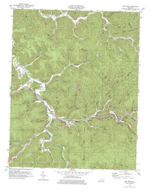
Big Creek Topo Map Kentucky
To zoom in, hover over the map of Big Creek
USGS Topo Quad 37083b5 - 1:24,000 scale
| Topo Map Name: | Big Creek |
| USGS Topo Quad ID: | 37083b5 |
| Print Size: | ca. 21 1/4" wide x 27" high |
| Southeast Coordinates: | 37.125° N latitude / 83.5° W longitude |
| Map Center Coordinates: | 37.1875° N latitude / 83.5625° W longitude |
| U.S. State: | KY |
| Filename: | o37083b5.jpg |
| Download Map JPG Image: | Big Creek topo map 1:24,000 scale |
| Map Type: | Topographic |
| Topo Series: | 7.5´ |
| Map Scale: | 1:24,000 |
| Source of Map Images: | United States Geological Survey (USGS) |
| Alternate Map Versions: |
Big Creek KY 1953, updated 1954 Download PDF Buy paper map Big Creek KY 1953, updated 1968 Download PDF Buy paper map Big Creek KY 1979, updated 1979 Download PDF Buy paper map Big Creek KY 2011 Download PDF Buy paper map Big Creek KY 2013 Download PDF Buy paper map Big Creek KY 2016 Download PDF Buy paper map |
| FStopo: | US Forest Service topo Big Creek is available: Download FStopo PDF Download FStopo TIF |
1:24,000 Topo Quads surrounding Big Creek
> Back to 37083a1 at 1:100,000 scale
> Back to 37082a1 at 1:250,000 scale
> Back to U.S. Topo Maps home
Big Creek topo map: Gazetteer
Big Creek: Areas
Flat Woods elevation 449m 1473′Big Creek: Flats
Flat Woods elevation 458m 1502′Big Creek: Populated Places
Bear Branch elevation 265m 869′Big Creek elevation 264m 866′
Bobs Fork elevation 274m 898′
Brutus elevation 275m 902′
Eriline elevation 255m 836′
Jacks Creek elevation 310m 1017′
Mouth of Hector elevation 249m 816′
Panco elevation 297m 974′
Peabody elevation 258m 846′
Red Star (historical) elevation 351m 1151′
Big Creek: Post Offices
Bear Branch Post Office elevation 265m 869′Big Creek Post Office elevation 260m 853′
Brutus Post Office (historical) elevation 272m 892′
Culton Post Office (historical) elevation 275m 902′
Erline Post Office (historical) elevation 255m 836′
Jacks Creek Post Office (historical) elevation 298m 977′
Panco Post Office (historical) elevation 290m 951′
Sizerock Post Office (historical) elevation 312m 1023′
Big Creek: Streams
Aaron Branch elevation 289m 948′Barger Branch elevation 281m 921′
Barger Branch elevation 275m 902′
Bear Branch elevation 266m 872′
Big Briar Branch elevation 288m 944′
Big Creek elevation 255m 836′
Big Double Creek elevation 255m 836′
Big Lick Branch elevation 339m 1112′
Bobs Fork elevation 273m 895′
Britton Branch elevation 256m 839′
Chandler Branch elevation 272m 892′
Charley Fork Dry Branch elevation 290m 951′
Cold Spring Branch elevation 266m 872′
Collins Fork elevation 286m 938′
Couch Fork elevation 279m 915′
Crane Branch elevation 266m 872′
Crib Branch elevation 263m 862′
Danger Branch elevation 270m 885′
Dry Branch elevation 246m 807′
Dry Branch elevation 266m 872′
Elk Creek elevation 252m 826′
Fish Trap Branch elevation 252m 826′
Grannys Branch elevation 257m 843′
Hals Fork elevation 272m 892′
Hector Branch elevation 247m 810′
Henry Fork elevation 285m 935′
Jacks Creek elevation 249m 816′
Left Fork Bear Branch elevation 277m 908′
Left Fork Dry Branch elevation 290m 951′
Left Fork Ulysses Creek elevation 275m 902′
Lip Branch elevation 257m 843′
Little Double Creek elevation 254m 833′
Little Fish Trap Branch elevation 271m 889′
Lost Branch elevation 264m 866′
Lower Jacks Branch elevation 250m 820′
Lucey Branch elevation 266m 872′
Lynn Branch elevation 243m 797′
Martin Branch elevation 272m 892′
Otter Branch elevation 283m 928′
Panco Branch elevation 287m 941′
Polly Marcum Branch elevation 254m 833′
Rices Fork elevation 270m 885′
Right Fork Bear Branch elevation 312m 1023′
Sams Branch elevation 254m 833′
Smithern Fork elevation 303m 994′
Sourwood Branch elevation 300m 984′
Spencers Branch elevation 255m 836′
Spurlock Fork elevation 291m 954′
Sugar Camp Branch elevation 284m 931′
Trace Branch elevation 292m 958′
Ulysses Creek elevation 275m 902′
Wiles Branch elevation 266m 872′
Wolf Branch elevation 287m 941′
Big Creek: Summits
Newberry Hill elevation 465m 1525′Big Creek digital topo map on disk
Buy this Big Creek topo map showing relief, roads, GPS coordinates and other geographical features, as a high-resolution digital map file on DVD:
Western Virginia & Southern West Virginia
Buy digital topo maps: Western Virginia & Southern West Virginia


