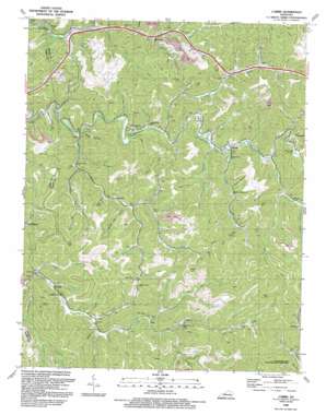
Carrie Topo Map Kentucky
To zoom in, hover over the map of Carrie
USGS Topo Quad 37083c1 - 1:24,000 scale
| Topo Map Name: | Carrie |
| USGS Topo Quad ID: | 37083c1 |
| Print Size: | ca. 21 1/4" wide x 27" high |
| Southeast Coordinates: | 37.25° N latitude / 83° W longitude |
| Map Center Coordinates: | 37.3125° N latitude / 83.0625° W longitude |
| U.S. State: | KY |
| Filename: | o37083c1.jpg |
| Download Map JPG Image: | Carrie topo map 1:24,000 scale |
| Map Type: | Topographic |
| Topo Series: | 7.5´ |
| Map Scale: | 1:24,000 |
| Source of Map Images: | United States Geological Survey (USGS) |
| Alternate Map Versions: |
Carrie KY 1954, updated 1956 Download PDF Buy paper map Carrie KY 1954, updated 1967 Download PDF Buy paper map Carrie KY 1954, updated 1977 Download PDF Buy paper map Carrie KY 1954, updated 1989 Download PDF Buy paper map Carrie KY 1992, updated 1992 Download PDF Buy paper map Carrie KY 2010 Download PDF Buy paper map Carrie KY 2013 Download PDF Buy paper map Carrie KY 2016 Download PDF Buy paper map |
1:24,000 Topo Quads surrounding Carrie
> Back to 37083a1 at 1:100,000 scale
> Back to 37082a1 at 1:250,000 scale
> Back to U.S. Topo Maps home
Carrie topo map: Gazetteer
Carrie: Gaps
Ash Bee Tree Gap elevation 389m 1276′Poplar Gap elevation 479m 1571′
Carrie: Populated Places
Bearville elevation 329m 1079′Big Branch elevation 288m 944′
Carrie elevation 304m 997′
Clear Fork (historical) elevation 469m 1538′
Cordia elevation 310m 1017′
Emmalena elevation 321m 1053′
Fisty elevation 275m 902′
Hardburly elevation 338m 1108′
Lotts Creek (historical) elevation 302m 990′
Montgomery elevation 346m 1135′
Ritchie elevation 303m 994′
Tina elevation 356m 1167′
Carrie: Post Offices
Bearville Post Office (historical) elevation 372m 1220′Carrie Post Office elevation 302m 990′
Cordia Post Office (historical) elevation 312m 1023′
Elic Post Office (historical) elevation 326m 1069′
Emmalena Post Office (historical) elevation 293m 961′
Fisty Post Office (historical) elevation 277m 908′
Mink Post Office (historical) elevation 295m 967′
Ritchie Post Office (historical) elevation 300m 984′
Talcom Post Office (historical) elevation 276m 905′
Tina Post Office (historical) elevation 317m 1040′
Yellow Creek Post Office (historical) elevation 414m 1358′
Carrie: Streams
Baker Branch elevation 315m 1033′Beech Creek elevation 293m 961′
Big Branch elevation 284m 931′
Big Branch elevation 305m 1000′
Big Fork elevation 301m 987′
Buck Branch elevation 335m 1099′
Buzzard Den Branch elevation 341m 1118′
Chestnut Log Branch elevation 327m 1072′
Clear Creek elevation 276m 905′
Clear Fork elevation 298m 977′
Cockerell Trace Branch elevation 293m 961′
Coles Fork elevation 298m 977′
Dicks Fork elevation 315m 1033′
Dickson Branch elevation 309m 1013′
Elisha Fork elevation 299m 980′
Elk Fork elevation 293m 961′
Elklick Fork elevation 353m 1158′
Gearhart Fork elevation 324m 1062′
Hickory With Branch elevation 322m 1056′
Jacks Branch elevation 289m 948′
Kelly Fork elevation 325m 1066′
Left Fork Elk Fork elevation 327m 1072′
Left Fork Trace Fork elevation 326m 1069′
Lick Branch elevation 315m 1033′
Lick Branch elevation 303m 994′
Long Branch elevation 277m 908′
Long Branch elevation 289m 948′
Mill Creek elevation 318m 1043′
Montgomery Creek elevation 325m 1066′
Ogden Branch elevation 305m 1000′
Peedee Branch elevation 337m 1105′
Push Back Branch elevation 312m 1023′
Right Fork Big Branch elevation 316m 1036′
Right Fork Elk Fork elevation 327m 1072′
Road Branch elevation 353m 1158′
Roaring Branch elevation 280m 918′
Rocklick Creek elevation 359m 1177′
Sandlick Branch elevation 368m 1207′
Short Branch elevation 302m 990′
Stable Branch elevation 329m 1079′
Stillhouse Branch elevation 329m 1079′
Sweetgum Branch elevation 322m 1056′
Swiftshoal Branch elevation 297m 974′
Sylvester Branch elevation 346m 1135′
Trace Branch elevation 281m 921′
Walkers Branch elevation 308m 1010′
Wolfpen Branch elevation 310m 1017′
Youngs Fork elevation 301m 987′
Carrie: Valleys
Calf Hollow elevation 347m 1138′Honey Gap Hollow elevation 310m 1017′
Lowerfield Hollow elevation 305m 1000′
Meadowbrook Hollow elevation 281m 921′
Rough Hollow elevation 318m 1043′
Shop Hollow elevation 275m 902′
Carrie digital topo map on disk
Buy this Carrie topo map showing relief, roads, GPS coordinates and other geographical features, as a high-resolution digital map file on DVD:
Western Virginia & Southern West Virginia
Buy digital topo maps: Western Virginia & Southern West Virginia


