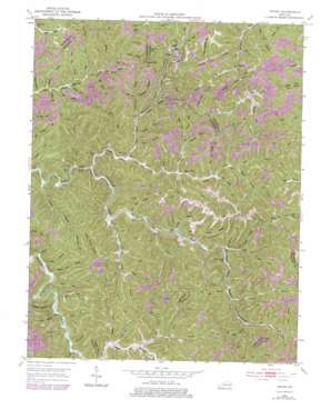
Tiptop Topo Map Kentucky
To zoom in, hover over the map of Tiptop
USGS Topo Quad 37083e1 - 1:24,000 scale
| Topo Map Name: | Tiptop |
| USGS Topo Quad ID: | 37083e1 |
| Print Size: | ca. 21 1/4" wide x 27" high |
| Southeast Coordinates: | 37.5° N latitude / 83° W longitude |
| Map Center Coordinates: | 37.5625° N latitude / 83.0625° W longitude |
| U.S. State: | KY |
| Filename: | o37083e1.jpg |
| Download Map JPG Image: | Tiptop topo map 1:24,000 scale |
| Map Type: | Topographic |
| Topo Series: | 7.5´ |
| Map Scale: | 1:24,000 |
| Source of Map Images: | United States Geological Survey (USGS) |
| Alternate Map Versions: |
Tiptop KY 1951, updated 1952 Download PDF Buy paper map Tiptop KY 1951, updated 1968 Download PDF Buy paper map Tiptop KY 1951, updated 1978 Download PDF Buy paper map Tiptop KY 1951, updated 1983 Download PDF Buy paper map Tiptop KY 2010 Download PDF Buy paper map Tiptop KY 2013 Download PDF Buy paper map Tiptop KY 2016 Download PDF Buy paper map |
1:24,000 Topo Quads surrounding Tiptop
> Back to 37083e1 at 1:100,000 scale
> Back to 37082a1 at 1:250,000 scale
> Back to U.S. Topo Maps home
Tiptop topo map: Gazetteer
Tiptop: Gaps
Beech Gap elevation 383m 1256′Buckhorn Gap elevation 378m 1240′
Caney Gap elevation 391m 1282′
Mullins Gap elevation 385m 1263′
Tiptop: Populated Places
Duco elevation 321m 1053′Evanston elevation 300m 984′
Tiptop elevation 315m 1033′
Tiptop: Post Offices
Decoy Post Office (historical) elevation 276m 905′Tiptop: Streams
Ball Jim Branch elevation 291m 954′Barnett Branch elevation 260m 853′
Beck Branch elevation 302m 990′
Betts Mann Branch elevation 267m 875′
Big Branch elevation 273m 895′
Big Cudge Branch elevation 291m 954′
Big Laurel Branch elevation 291m 954′
Big Lovely Branch elevation 268m 879′
Bill Mann Branch elevation 295m 967′
Boardinghouse Branch elevation 285m 935′
Bob Branch elevation 280m 918′
Brushy Fork elevation 274m 898′
Burnt House Branch elevation 268m 879′
Cabin Log Branch elevation 272m 892′
Came Branch elevation 300m 984′
Chick Fork elevation 303m 994′
Coles Fork elevation 261m 856′
Davis Branch elevation 273m 895′
Elvania Branch elevation 301m 987′
Equal Fork elevation 289m 948′
Flora Holliday Branch elevation 304m 997′
Garden Branch elevation 268m 879′
George Mullins Branch elevation 305m 1000′
Gouge Branch elevation 309m 1013′
Hawes Fork elevation 257m 843′
Horsemill Branch elevation 268m 879′
Hoskins Fork elevation 298m 977′
House Seat Branch elevation 284m 931′
Hughes Creek elevation 273m 895′
Jim Ritchie Branch elevation 266m 872′
Joe Push Branch elevation 303m 994′
Kates Branch elevation 264m 866′
Laurel Fork elevation 255m 836′
Line Branch elevation 304m 997′
Lish Branch elevation 278m 912′
Little Fork elevation 283m 928′
Mandy Fork elevation 277m 908′
Middle Fork elevation 289m 948′
Mill Branch elevation 262m 859′
Millstone Branch elevation 272m 892′
Mud Lick Branch elevation 289m 948′
Mullins Branch elevation 301m 987′
Nerve Fork elevation 303m 994′
Old House Branch elevation 299m 980′
Oliver Branch elevation 275m 902′
Oney Branch elevation 296m 971′
Orchard Branch elevation 279m 915′
Pitts Branch elevation 303m 994′
Polly Miller Branch elevation 305m 1000′
Poplar Branch elevation 277m 908′
Prater Branch elevation 289m 948′
Rich Branch elevation 302m 990′
Right Fork Little Fork elevation 300m 984′
Road Branch elevation 292m 958′
Road Fork elevation 292m 958′
Road Fork elevation 302m 990′
Robbins Branch elevation 303m 994′
Rose Branch elevation 273m 895′
Rowan Branch elevation 289m 948′
Sable Branch elevation 289m 948′
Sam Branch elevation 293m 961′
Sand Lick Branch elevation 304m 997′
Schoolhouse Branch elevation 268m 879′
Slusher Branch elevation 280m 918′
Spring Branch elevation 299m 980′
Stable Branch elevation 265m 869′
Stable Branch elevation 283m 928′
Steep Bank Branch elevation 260m 853′
Sugar Camp Branch elevation 260m 853′
Sulphur Spring Branch elevation 265m 869′
Sycamore Branch elevation 291m 954′
Thomas Conley Branch elevation 303m 994′
Twin Lick Branch elevation 286m 938′
Vanderpool Branch elevation 284m 931′
Wireman Fork elevation 299m 980′
Wolfpen Branch elevation 253m 830′
Wolfspur Branch elevation 300m 984′
Tiptop: Summits
Big Lovely Mountain elevation 427m 1400′Hogtown Knob elevation 460m 1509′
Tiptop: Valleys
Joe Hollow elevation 286m 938′Nelse Hollow elevation 280m 918′
Rough Hollow elevation 309m 1013′
Tiptop digital topo map on disk
Buy this Tiptop topo map showing relief, roads, GPS coordinates and other geographical features, as a high-resolution digital map file on DVD:
Western Virginia & Southern West Virginia
Buy digital topo maps: Western Virginia & Southern West Virginia


