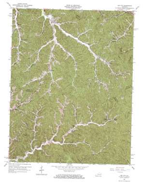
Lee City Topo Map Kentucky
To zoom in, hover over the map of Lee City
USGS Topo Quad 37083f3 - 1:24,000 scale
| Topo Map Name: | Lee City |
| USGS Topo Quad ID: | 37083f3 |
| Print Size: | ca. 21 1/4" wide x 27" high |
| Southeast Coordinates: | 37.625° N latitude / 83.25° W longitude |
| Map Center Coordinates: | 37.6875° N latitude / 83.3125° W longitude |
| U.S. State: | KY |
| Filename: | o37083f3.jpg |
| Download Map JPG Image: | Lee City topo map 1:24,000 scale |
| Map Type: | Topographic |
| Topo Series: | 7.5´ |
| Map Scale: | 1:24,000 |
| Source of Map Images: | United States Geological Survey (USGS) |
| Alternate Map Versions: |
Lee City KY 1951, updated 1965 Download PDF Buy paper map Lee City KY 2010 Download PDF Buy paper map Lee City KY 2013 Download PDF Buy paper map Lee City KY 2016 Download PDF Buy paper map |
1:24,000 Topo Quads surrounding Lee City
> Back to 37083e1 at 1:100,000 scale
> Back to 37082a1 at 1:250,000 scale
> Back to U.S. Topo Maps home
Lee City topo map: Gazetteer
Lee City: Populated Places
Belknap elevation 304m 997′Burkhart elevation 309m 1013′
Gillmore elevation 305m 1000′
Lee City elevation 292m 958′
Moct elevation 273m 895′
Mountain Valley elevation 271m 889′
Rock Lick elevation 253m 830′
Rosefork elevation 309m 1013′
Simpson elevation 265m 869′
Taulbee elevation 238m 780′
Upper Gillmore elevation 307m 1007′
Wheel Rim elevation 287m 941′
Wheelrim Fork elevation 274m 898′
Wolf Pen elevation 318m 1043′
Lee City: Post Offices
Belknap Post Office (historical) elevation 301m 987′Burg Post Office (historical) elevation 300m 984′
Burkhart Post Office (historical) elevation 309m 1013′
Rose Fork Post Office (historical) elevation 304m 997′
Shockey Post Office (historical) elevation 309m 1013′
Vina Post Office (historical) elevation 329m 1079′
Lee City: Streams
Allison Branch elevation 290m 951′Banks Fork elevation 304m 997′
Caney Branch elevation 313m 1026′
Clear Fork elevation 237m 777′
Cook Branch elevation 292m 958′
Davis Creek elevation 234m 767′
Elam Branch elevation 280m 918′
Field Branch elevation 242m 793′
Greenbriar Branch elevation 293m 961′
Hurricane Fork elevation 255m 836′
Joe Ward Fork elevation 258m 846′
Knatty Branch elevation 287m 941′
Lindon Fork elevation 302m 990′
Maddix Branch elevation 303m 994′
Negro Branch elevation 239m 784′
Poor Branch elevation 314m 1030′
Prater Branch elevation 278m 912′
Rock Lick Fork elevation 248m 813′
Rose Fork elevation 292m 958′
Rush Fork elevation 309m 1013′
Sam Hall Branch elevation 298m 977′
Shockey Fork elevation 304m 997′
Stamper Branch elevation 291m 954′
Straight Creek elevation 298m 977′
Taulbee Fork elevation 276m 905′
Trace Fork elevation 265m 869′
Trent Fork elevation 295m 967′
Tunnel Fork elevation 311m 1020′
Will Lindon Branch elevation 298m 977′
Wolf Pen Branch elevation 309m 1013′
Lee City digital topo map on disk
Buy this Lee City topo map showing relief, roads, GPS coordinates and other geographical features, as a high-resolution digital map file on DVD:
Western Virginia & Southern West Virginia
Buy digital topo maps: Western Virginia & Southern West Virginia


