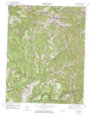
Campton Topo Map Kentucky
To zoom in, hover over the map of Campton
USGS Topo Quad 37083f5 - 1:24,000 scale
| Topo Map Name: | Campton |
| USGS Topo Quad ID: | 37083f5 |
| Print Size: | ca. 21 1/4" wide x 27" high |
| Southeast Coordinates: | 37.625° N latitude / 83.5° W longitude |
| Map Center Coordinates: | 37.6875° N latitude / 83.5625° W longitude |
| U.S. State: | KY |
| Filename: | o37083f5.jpg |
| Download Map JPG Image: | Campton topo map 1:24,000 scale |
| Map Type: | Topographic |
| Topo Series: | 7.5´ |
| Map Scale: | 1:24,000 |
| Source of Map Images: | United States Geological Survey (USGS) |
| Alternate Map Versions: |
Campton KY 1952, updated 1954 Download PDF Buy paper map Campton KY 1961, updated 1963 Download PDF Buy paper map Campton KY 1972, updated 1973 Download PDF Buy paper map Campton KY 2011 Download PDF Buy paper map Campton KY 2013 Download PDF Buy paper map Campton KY 2016 Download PDF Buy paper map |
| FStopo: | US Forest Service topo Campton is available: Download FStopo PDF Download FStopo TIF |
1:24,000 Topo Quads surrounding Campton
> Back to 37083e1 at 1:100,000 scale
> Back to 37082a1 at 1:250,000 scale
> Back to U.S. Topo Maps home
Campton topo map: Gazetteer
Campton: Populated Places
Antioch elevation 273m 895′Campton elevation 293m 961′
Grannie elevation 309m 1013′
High Falls elevation 307m 1007′
Hurst elevation 245m 803′
Mary elevation 272m 892′
Mullins Point elevation 340m 1115′
Nelson elevation 308m 1010′
Rye elevation 266m 872′
Vortex elevation 264m 866′
Campton: Post Offices
Campton Post Office elevation 292m 958′Flat Post Office (historical) elevation 266m 872′
Grannie Post Office (historical) elevation 307m 1007′
High Falls Post Office (historical) elevation 309m 1013′
Mary Post Office (historical) elevation 280m 918′
Vortex Post Office (historical) elevation 269m 882′
Whisman Post Office (historical) elevation 252m 826′
Campton: Reservoirs
Campton Lake elevation 300m 984′Campton: Ridges
Booth Ridge elevation 323m 1059′Sandy Ridge elevation 305m 1000′
Tar Ridge elevation 349m 1145′
Campton: Streams
Bear Pen Creek elevation 233m 764′Blankey Branch elevation 205m 672′
Bloody Creek elevation 200m 656′
Brush Creek elevation 208m 682′
Cave Branch elevation 198m 649′
Cow Hoof Branch elevation 203m 666′
Fraley Creek elevation 214m 702′
Hiram Branch elevation 306m 1003′
Hurricane Branch elevation 200m 656′
Left Fork Upper Devil Creek elevation 202m 662′
Little Bloody Creek elevation 209m 685′
Little Fork elevation 202m 662′
Lower Crooked Shoal Branch elevation 203m 666′
Lower Devil Creek elevation 197m 646′
Meadows Branch elevation 243m 797′
Middle Creek elevation 205m 672′
Middle Fork Lower Devil Creek elevation 232m 761′
Mill Branch elevation 201m 659′
Mill Branch elevation 200m 656′
Panther Branch elevation 233m 764′
Proffit Fork elevation 273m 895′
Right Fork Upper Devil Creek elevation 206m 675′
Smoky Branch elevation 269m 882′
Smoky Fork elevation 252m 826′
Upper Devil Creek elevation 197m 646′
Campton: Summits
Mullins Point elevation 324m 1062′Campton: Valleys
Smith Valley elevation 230m 754′Campton digital topo map on disk
Buy this Campton topo map showing relief, roads, GPS coordinates and other geographical features, as a high-resolution digital map file on DVD:
Western Virginia & Southern West Virginia
Buy digital topo maps: Western Virginia & Southern West Virginia


