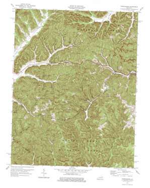
Frenchburg Topo Map Kentucky
To zoom in, hover over the map of Frenchburg
USGS Topo Quad 37083h6 - 1:24,000 scale
| Topo Map Name: | Frenchburg |
| USGS Topo Quad ID: | 37083h6 |
| Print Size: | ca. 21 1/4" wide x 27" high |
| Southeast Coordinates: | 37.875° N latitude / 83.625° W longitude |
| Map Center Coordinates: | 37.9375° N latitude / 83.6875° W longitude |
| U.S. State: | KY |
| Filename: | o37083h6.jpg |
| Download Map JPG Image: | Frenchburg topo map 1:24,000 scale |
| Map Type: | Topographic |
| Topo Series: | 7.5´ |
| Map Scale: | 1:24,000 |
| Source of Map Images: | United States Geological Survey (USGS) |
| Alternate Map Versions: |
Frenchburg KY 1952, updated 1953 Download PDF Buy paper map Frenchburg KY 1952, updated 1968 Download PDF Buy paper map Frenchburg KY 1977, updated 1978 Download PDF Buy paper map Frenchburg KY 2011 Download PDF Buy paper map Frenchburg KY 2013 Download PDF Buy paper map Frenchburg KY 2016 Download PDF Buy paper map |
| FStopo: | US Forest Service topo Frenchburg is available: Download FStopo PDF Download FStopo TIF |
1:24,000 Topo Quads surrounding Frenchburg
> Back to 37083e1 at 1:100,000 scale
> Back to 37082a1 at 1:250,000 scale
> Back to U.S. Topo Maps home
Frenchburg topo map: Gazetteer
Frenchburg: Populated Places
Ballard elevation 345m 1131′Coburn elevation 281m 921′
Cornwell elevation 279m 915′
Dog Trot elevation 296m 971′
East Fork Slate elevation 272m 892′
Fagan elevation 355m 1164′
Frenchburg elevation 266m 872′
Hathaway Creek elevation 316m 1036′
Hawkins Branch elevation 272m 892′
Myers Fork elevation 278m 912′
Peter Trace elevation 272m 892′
Rothwell elevation 295m 967′
Salt Lick Creek elevation 266m 872′
Stonequarry elevation 253m 830′
Frenchburg: Post Offices
Apperson Post Office (historical) elevation 238m 780′Cornwell Post Office (historical) elevation 279m 915′
Fagan Post Office (historical) elevation 338m 1108′
Rothwell Post Office (historical) elevation 293m 961′
Tabor Post Office (historical) elevation 256m 839′
Frenchburg: Ridges
McCausey Ridge elevation 403m 1322′Wildcat Ridge elevation 379m 1243′
Frenchburg: Streams
Adams Creek elevation 264m 866′Bean Branch elevation 274m 898′
Bear Branch elevation 247m 810′
Bear Branch elevation 255m 836′
Bee Branch elevation 248m 813′
Bet Cash Branch elevation 273m 895′
Big Amos Creek elevation 236m 774′
Blackburn Branch elevation 237m 777′
Blackstand Branch elevation 229m 751′
Bull Fork elevation 270m 885′
Cain Branch elevation 272m 892′
Camp Branch elevation 239m 784′
Cave Branch elevation 228m 748′
Clem Branch elevation 261m 856′
Coldiron Fork elevation 260m 853′
Commissary Branch elevation 274m 898′
Cornwell Branch elevation 278m 912′
Dog Trot Fork elevation 270m 885′
Falling Timber Branch elevation 287m 941′
Ferguson Branch elevation 268m 879′
Flat Rock Branch elevation 235m 770′
Greenland Branch elevation 240m 787′
Hall Sink Branch elevation 239m 784′
Hathaway Creek elevation 286m 938′
Haunted Cave Branch elevation 262m 859′
Jim Branch elevation 280m 918′
Joe Smallwood Branch elevation 249m 816′
Leatherwood Fork elevation 218m 715′
Little Amos Creek elevation 242m 793′
Little East Fork elevation 226m 741′
Mill Seat Branch elevation 236m 774′
Myers Fork elevation 252m 826′
Ore Bank Hill Branch elevation 277m 908′
Ox Yoke Branch elevation 246m 807′
Peter Trace elevation 262m 859′
Puncheon Camp Branch elevation 268m 879′
Ratliff Branch elevation 293m 961′
Rebel Trace elevation 250m 820′
Ringo Branch elevation 280m 918′
Sim Long Branch elevation 276m 905′
Smallwood Branch elevation 244m 800′
Spencer Branch elevation 266m 872′
Steels Branch elevation 284m 931′
Stone Quarry Branch elevation 247m 810′
Susans Branch elevation 268m 879′
Frenchburg: Valleys
Allen Hollow elevation 248m 813′Ballard Hollow elevation 278m 912′
Blevins Hollow elevation 269m 882′
Crisp Hollow elevation 279m 915′
Crowe Hollow elevation 255m 836′
Hatton Hollow elevation 266m 872′
Mack Hollow elevation 262m 859′
Norris Hollow elevation 273m 895′
Phillips Hollow elevation 272m 892′
Pigeon Roost Hollow elevation 284m 931′
Pitts Hollow elevation 292m 958′
Reffitt Hollow elevation 281m 921′
Richard Hollow elevation 252m 826′
Rothwell Hollow elevation 297m 974′
Sugar Camp Hollow elevation 244m 800′
Tackett Hollow elevation 298m 977′
Wills Hollow elevation 286m 938′
Frenchburg digital topo map on disk
Buy this Frenchburg topo map showing relief, roads, GPS coordinates and other geographical features, as a high-resolution digital map file on DVD:
Western Virginia & Southern West Virginia
Buy digital topo maps: Western Virginia & Southern West Virginia


