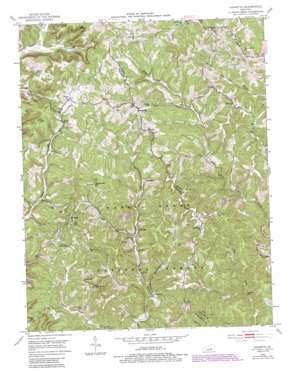
Johnetta Topo Map Kentucky
To zoom in, hover over the map of Johnetta
USGS Topo Quad 37084d2 - 1:24,000 scale
| Topo Map Name: | Johnetta |
| USGS Topo Quad ID: | 37084d2 |
| Print Size: | ca. 21 1/4" wide x 27" high |
| Southeast Coordinates: | 37.375° N latitude / 84.125° W longitude |
| Map Center Coordinates: | 37.4375° N latitude / 84.1875° W longitude |
| U.S. State: | KY |
| Filename: | o37084d2.jpg |
| Download Map JPG Image: | Johnetta topo map 1:24,000 scale |
| Map Type: | Topographic |
| Topo Series: | 7.5´ |
| Map Scale: | 1:24,000 |
| Source of Map Images: | United States Geological Survey (USGS) |
| Alternate Map Versions: |
Johnetta KY 1953, updated 1954 Download PDF Buy paper map Johnetta KY 1953, updated 1968 Download PDF Buy paper map Johnetta KY 1953, updated 1981 Download PDF Buy paper map Johnetta KY 1953, updated 1987 Download PDF Buy paper map Johnetta KY 2010 Download PDF Buy paper map Johnetta KY 2013 Download PDF Buy paper map Johnetta KY 2016 Download PDF Buy paper map |
| FStopo: | US Forest Service topo Johnetta is available: Download FStopo PDF Download FStopo TIF |
1:24,000 Topo Quads surrounding Johnetta
> Back to 37084a1 at 1:100,000 scale
> Back to 37084a1 at 1:250,000 scale
> Back to U.S. Topo Maps home
Johnetta topo map: Gazetteer
Johnetta: Falls
Anglin Falls elevation 466m 1528′Johnetta: Gaps
Poplar Gap elevation 422m 1384′Johnetta: Populated Places
Climax elevation 381m 1250′Clover Bottom elevation 444m 1456′
Cooksburg elevation 291m 954′
Dry Fork elevation 303m 994′
Eglon elevation 433m 1420′
Goochland elevation 314m 1030′
Johnetta elevation 304m 997′
Loam elevation 309m 1013′
Pine Grove elevation 441m 1446′
Rice Hill elevation 458m 1502′
Threelinks elevation 429m 1407′
Johnetta: Post Offices
Clover Bottom Post Office (historical) elevation 451m 1479′Eglon Post Office (historical) elevation 448m 1469′
Evergreen Post Office (historical) elevation 447m 1466′
Loam Post Office (historical) elevation 324m 1062′
Robinet Post Office (historical) elevation 457m 1499′
Sand Bluff Post Office (historical) elevation 386m 1266′
Three Links Post Office (historical) elevation 443m 1453′
Johnetta: Ridges
Cruse Ridge elevation 413m 1354′Johnetta: Streams
Anglin Fork elevation 319m 1046′Deer Lick elevation 305m 1000′
Dry Fork elevation 308m 1010′
Limestone Branch elevation 323m 1059′
Little Clover Creek elevation 389m 1276′
Sugar Cane Branch elevation 303m 994′
Johnetta: Summits
Loam Hill elevation 348m 1141′Johnetta: Valleys
Barnett Valley elevation 292m 958′Johnetta digital topo map on disk
Buy this Johnetta topo map showing relief, roads, GPS coordinates and other geographical features, as a high-resolution digital map file on DVD:


