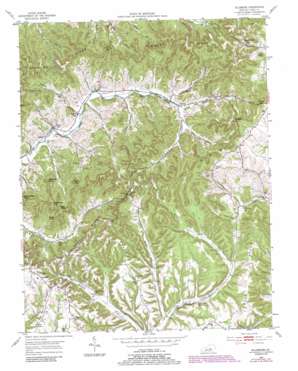
Ellisburg Topo Map Kentucky
To zoom in, hover over the map of Ellisburg
USGS Topo Quad 37084d8 - 1:24,000 scale
| Topo Map Name: | Ellisburg |
| USGS Topo Quad ID: | 37084d8 |
| Print Size: | ca. 21 1/4" wide x 27" high |
| Southeast Coordinates: | 37.375° N latitude / 84.875° W longitude |
| Map Center Coordinates: | 37.4375° N latitude / 84.9375° W longitude |
| U.S. State: | KY |
| Filename: | o37084d8.jpg |
| Download Map JPG Image: | Ellisburg topo map 1:24,000 scale |
| Map Type: | Topographic |
| Topo Series: | 7.5´ |
| Map Scale: | 1:24,000 |
| Source of Map Images: | United States Geological Survey (USGS) |
| Alternate Map Versions: |
Ellisburg KY 1952, updated 1953 Download PDF Buy paper map Ellisburg KY 1952, updated 1973 Download PDF Buy paper map Ellisburg KY 1952, updated 1987 Download PDF Buy paper map Ellisburg KY 2010 Download PDF Buy paper map Ellisburg KY 2013 Download PDF Buy paper map Ellisburg KY 2016 Download PDF Buy paper map |
1:24,000 Topo Quads surrounding Ellisburg
> Back to 37084a1 at 1:100,000 scale
> Back to 37084a1 at 1:250,000 scale
> Back to U.S. Topo Maps home
Ellisburg topo map: Gazetteer
Ellisburg: Cliffs
Rocky Point elevation 382m 1253′Ellisburg: Gaps
Coulter Gap elevation 379m 1243′Dogwood Gap elevation 405m 1328′
Neely Gap elevation 343m 1125′
Turkeyfoot Gap elevation 394m 1292′
Ellisburg: Populated Places
Chilton elevation 259m 849′Dogwood (historical) elevation 390m 1279′
Ellisburg elevation 317m 1040′
Frey Creek (historical) elevation 279m 915′
Martin Creek (historical) elevation 271m 889′
Peytons Store elevation 262m 859′
Snake Ridge (historical) elevation 326m 1069′
Ellisburg: Post Offices
Chilton Post Office (historical) elevation 257m 843′Ellisburg Post Office (historical) elevation 284m 931′
Nuby Post Office (historical) elevation 373m 1223′
Powers Post Office (historical) elevation 262m 859′
Rocky Ford Post Office (historical) elevation 262m 859′
Ellisburg: Ridges
Bark Ridge elevation 329m 1079′Chelf Ridge elevation 333m 1092′
Peyton Ridge elevation 347m 1138′
Snake Ridge elevation 333m 1092′
Ellisburg: Streams
Coffman Branch elevation 280m 918′Ellis Branch elevation 261m 856′
Gusty Branch elevation 262m 859′
Hill Branch elevation 258m 846′
Horse Lick Creek elevation 305m 1000′
Murphy Branch elevation 250m 820′
Peyton Branch elevation 272m 892′
Pruitt Branch elevation 256m 839′
Robin Lick Creek elevation 291m 954′
Shuck Creek elevation 268m 879′
Ellisburg: Summits
Burnt Cabin Knob elevation 406m 1332′Chandler Knob elevation 346m 1135′
Grape Knob elevation 358m 1174′
May Knob elevation 373m 1223′
Pine Knob elevation 371m 1217′
Rattlesnake Knob elevation 404m 1325′
Turkeyfoot Knob elevation 424m 1391′
Weatherford Knob elevation 329m 1079′
Ellisburg: Valleys
Long Hollow elevation 285m 935′Maxey Valley elevation 397m 1302′
Reed Hollow elevation 274m 898′
Ellisburg digital topo map on disk
Buy this Ellisburg topo map showing relief, roads, GPS coordinates and other geographical features, as a high-resolution digital map file on DVD:


