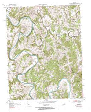
Palmer Topo Map Kentucky
To zoom in, hover over the map of Palmer
USGS Topo Quad 37084g1 - 1:24,000 scale
| Topo Map Name: | Palmer |
| USGS Topo Quad ID: | 37084g1 |
| Print Size: | ca. 21 1/4" wide x 27" high |
| Southeast Coordinates: | 37.75° N latitude / 84° W longitude |
| Map Center Coordinates: | 37.8125° N latitude / 84.0625° W longitude |
| U.S. State: | KY |
| Filename: | o37084g1.jpg |
| Download Map JPG Image: | Palmer topo map 1:24,000 scale |
| Map Type: | Topographic |
| Topo Series: | 7.5´ |
| Map Scale: | 1:24,000 |
| Source of Map Images: | United States Geological Survey (USGS) |
| Alternate Map Versions: |
Palmer KY 1952, updated 1953 Download PDF Buy paper map Palmer KY 1952, updated 1973 Download PDF Buy paper map Palmer KY 1952, updated 1984 Download PDF Buy paper map Palmer KY 2010 Download PDF Buy paper map Palmer KY 2013 Download PDF Buy paper map Palmer KY 2016 Download PDF Buy paper map |
1:24,000 Topo Quads surrounding Palmer
> Back to 37084e1 at 1:100,000 scale
> Back to 37084a1 at 1:250,000 scale
> Back to U.S. Topo Maps home
Palmer topo map: Gazetteer
Palmer: Areas
The Forks elevation 273m 895′Palmer: Bends
Lower Bend elevation 205m 672′Marsha Bottom elevation 189m 620′
Maupin Bend elevation 192m 629′
The Bend elevation 236m 774′
Thornsburg Bend elevation 186m 610′
Palmer: Cliffs
Falling Rock elevation 183m 600′Palmer: Crossings
Cobb Ferry elevation 182m 597′Lilly's Ferry elevation 177m 580′
Palmer: Dams
Lock Number 11 elevation 175m 574′Palmer: Populated Places
Alexander School Neighborhood elevation 265m 869′Bogie elevation 245m 803′
Clarksville elevation 188m 616′
College Hill elevation 272m 892′
Cotton Branch elevation 183m 600′
Cressy elevation 227m 744′
Epperson elevation 247m 810′
Fox elevation 276m 905′
Hargett elevation 216m 708′
Iron Mound elevation 246m 807′
Log Lick elevation 229m 751′
Mina elevation 245m 803′
Palmer elevation 249m 816′
Pine Ridge elevation 269m 882′
Sams elevation 239m 784′
The Forks elevation 275m 902′
Vianna elevation 187m 613′
Palmer: Post Offices
College Hill Post Office (historical) elevation 279m 915′Drownville Post Office (historical) elevation 195m 639′
Engle Post Office (historical) elevation 189m 620′
Fox Post Office (historical) elevation 265m 869′
Goodes Precinct Post Office (historical) elevation 238m 780′
Hargett Post Office (historical) elevation 213m 698′
Iron Mound Post Office (historical) elevation 246m 807′
Legibson Post Office (historical) elevation 238m 780′
Log Lick Post Office (historical) elevation 228m 748′
Merritt Post Office (historical) elevation 178m 583′
Palmer Post Office (historical) elevation 255m 836′
Parvin Post Office (historical) elevation 219m 718′
Puckett Post Office (historical) elevation 184m 603′
Palmer: Reservoirs
Puckett Lake elevation 210m 688′Palmer: Ridges
Devils Backbone elevation 213m 698′Dry Ridge elevation 238m 780′
Rose Ridge elevation 262m 859′
Walters Ridge elevation 249m 816′
Palmer: Streams
Bull Run elevation 176m 577′Caney Branch elevation 175m 574′
Cotton Creek elevation 176m 577′
Cow Creek elevation 174m 570′
Falling Branch elevation 183m 600′
Flint Creek elevation 182m 597′
Lick Run elevation 176m 577′
Log Lick Creek elevation 175m 574′
Long Branch elevation 189m 620′
Lulbegrud Creek elevation 176m 577′
Morgan Branch elevation 173m 567′
Noland Creek elevation 176m 577′
Polecat Creek elevation 183m 600′
Raven Branch elevation 177m 580′
Red River elevation 175m 574′
Snow Creek elevation 190m 623′
South Fork Noland Creek elevation 179m 587′
Twin Creek elevation 192m 629′
Twin Creek elevation 177m 580′
Woodward Creek elevation 177m 580′
Palmer: Summits
Hillsboro Heights elevation 246m 807′Iron Mountain elevation 359m 1177′
Sand Hill elevation 239m 784′
Palmer: Valleys
Dumford Hollow elevation 186m 610′Palmer digital topo map on disk
Buy this Palmer topo map showing relief, roads, GPS coordinates and other geographical features, as a high-resolution digital map file on DVD:


