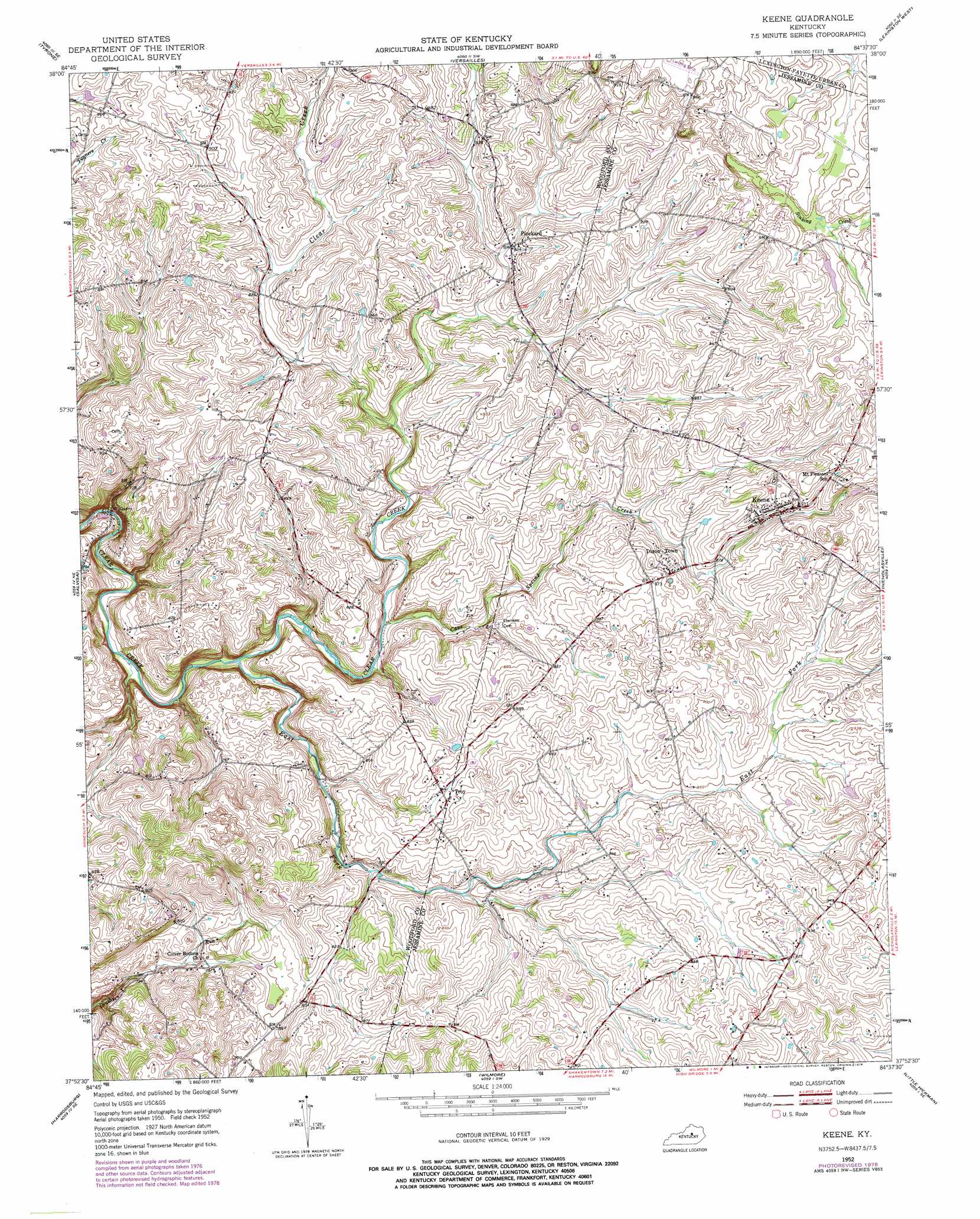
Keene Topo Map Kentucky
To zoom in, hover over the map of Keene
USGS Topo Quad 37084h6 - 1:24,000 scale
| Topo Map Name: | Keene |
| USGS Topo Quad ID: | 37084h6 |
| Print Size: | ca. 21 1/4" wide x 27" high |
| Southeast Coordinates: | 37.875° N latitude / 84.625° W longitude |
| Map Center Coordinates: | 37.9375° N latitude / 84.6875° W longitude |
| U.S. State: | KY |
| Filename: | o37084h6.jpg |
| Download Map JPG Image: | Keene topo map 1:24,000 scale |
| Map Type: | Topographic |
| Topo Series: | 7.5´ |
| Map Scale: | 1:24,000 |
| Source of Map Images: | United States Geological Survey (USGS) |
| Alternate Map Versions: |
Keene KY 1952, updated 1953 Download PDF Buy paper map Keene KY 1952, updated 1972 Download PDF Buy paper map Keene KY 1952, updated 1979 Download PDF Buy paper map Keene KY 2010 Download PDF Buy paper map Keene KY 2013 Download PDF Buy paper map Keene KY 2016 Download PDF Buy paper map |
1:24,000 Topo Quads surrounding Keene
Frankfort West |
Frankfort East |
Midway |
Georgetown |
Centerville |
Lawrenceburg |
Tyrone |
Versailles |
Lexington West |
Lexington East |
Mcbrayer |
Salvisa |
Keene |
Nicholasville |
Coletown |
Cornishville |
Harrodsburg |
Wilmore |
Little Hickman |
Valley View |
Perryville |
Danville |
Bryantsville |
Buckeye |
Kirksville |
> Back to 37084e1 at 1:100,000 scale
> Back to 37084a1 at 1:250,000 scale
> Back to U.S. Topo Maps home
Keene topo map: Gazetteer
Keene: Populated Places
Dixon Town elevation 274m 898′Keene elevation 276m 905′
Pinckard elevation 249m 816′
Troy elevation 254m 833′
Keene: Post Offices
Fort Garrett Post Office (historical) elevation 272m 892′Pinckard Post Office (historical) elevation 255m 836′
Keene: Springs
Cave Spring (historical) elevation 272m 892′Keene: Streams
Cave Spring Creek elevation 217m 711′East Fork Clear Creek elevation 204m 669′
Sinking Creek elevation 276m 905′
Keene: Summits
Meridian Hill elevation 297m 974′Pleasant Hill elevation 299m 980′
Keene digital topo map on disk
Buy this Keene topo map showing relief, roads, GPS coordinates and other geographical features, as a high-resolution digital map file on DVD: