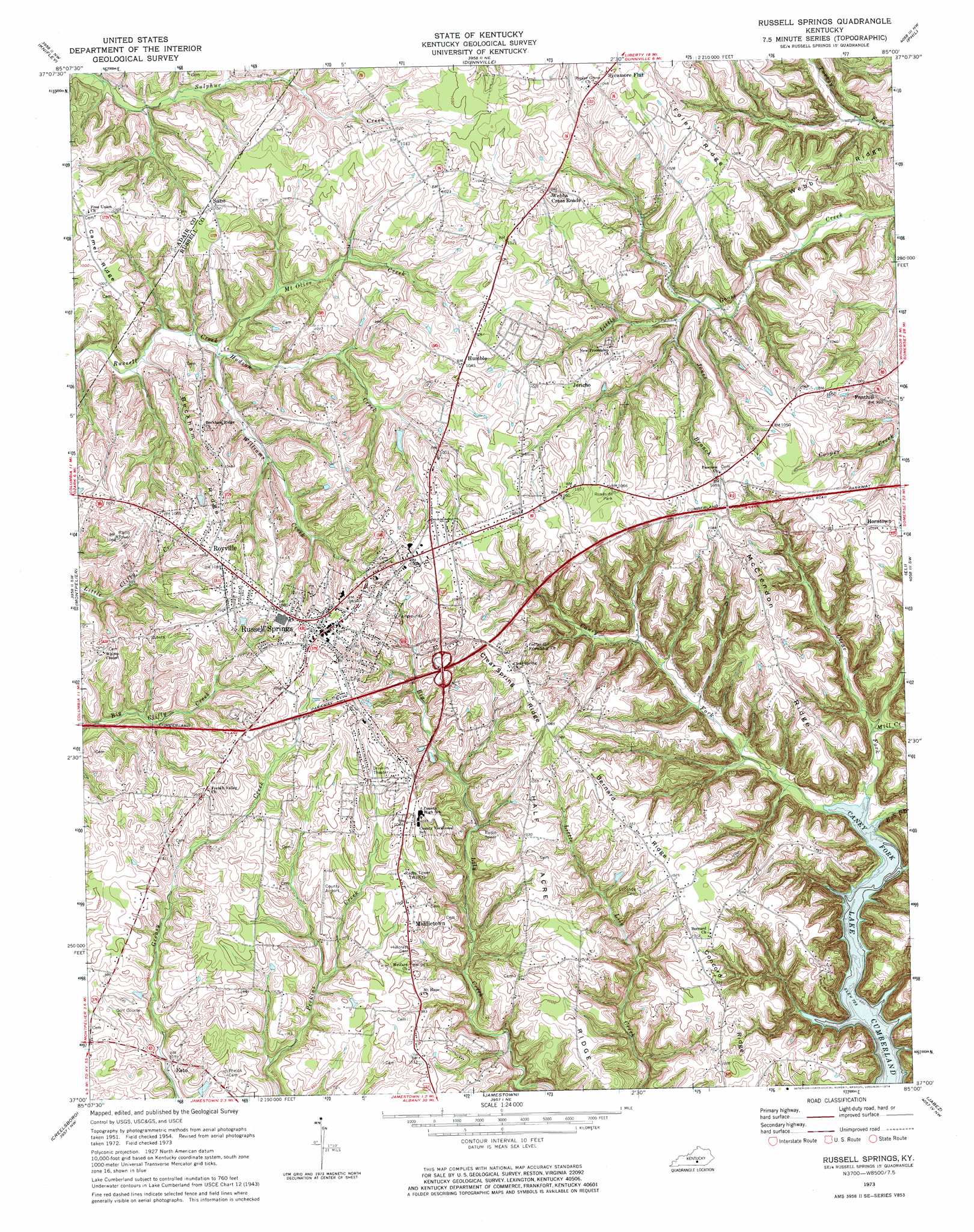
Russell Springs Topo Map Kentucky
To zoom in, hover over the map of Russell Springs
USGS Topo Quad 37085a1 - 1:24,000 scale
| Topo Map Name: | Russell Springs |
| USGS Topo Quad ID: | 37085a1 |
| Print Size: | ca. 21 1/4" wide x 27" high |
| Southeast Coordinates: | 37° N latitude / 85° W longitude |
| Map Center Coordinates: | 37.0625° N latitude / 85.0625° W longitude |
| U.S. State: | KY |
| Filename: | o37085a1.jpg |
| Download Map JPG Image: | Russell Springs topo map 1:24,000 scale |
| Map Type: | Topographic |
| Topo Series: | 7.5´ |
| Map Scale: | 1:24,000 |
| Source of Map Images: | United States Geological Survey (USGS) |
| Alternate Map Versions: |
Russell Springs KY 1954, updated 1955 Download PDF Buy paper map Russell Springs KY 1954, updated 1970 Download PDF Buy paper map Russell Springs KY 1973, updated 1974 Download PDF Buy paper map Russell Springs KY 2010 Download PDF Buy paper map Russell Springs KY 2013 Download PDF Buy paper map Russell Springs KY 2016 Download PDF Buy paper map |
1:24,000 Topo Quads surrounding Russell Springs
Campbellsville |
Mannsville |
Clementsville |
Liberty |
Yosemite |
Cane Valley |
Knifley |
Dunnville |
Phil |
Mintonville |
Columbia |
Montpelier |
Russell Springs |
Eli |
Faubush |
Amandaville |
Creelsboro |
Jamestown |
Jabez |
Mill Springs |
Burkesville |
Wolf Creek Dam |
Cumberland City |
Parnell |
Monticello |
> Back to 37085a1 at 1:100,000 scale
> Back to 37084a1 at 1:250,000 scale
> Back to U.S. Topo Maps home
Russell Springs topo map: Gazetteer
Russell Springs: Airports
Russell County Airport elevation 310m 1017′Russell Springs: Populated Places
Esto elevation 282m 925′Fonthill elevation 287m 941′
Horntown elevation 321m 1053′
Humble elevation 317m 1040′
Jericho elevation 311m 1020′
Middletown elevation 308m 1010′
Royville elevation 329m 1079′
Russell Springs elevation 331m 1085′
Sano elevation 311m 1020′
Sycamore Flat elevation 320m 1049′
Webbs Cross Roads elevation 318m 1043′
Russell Springs: Ridges
Beckham Ridge elevation 318m 1043′Bernard Ridge elevation 317m 1040′
Clear Spring Ridge elevation 329m 1079′
Concord Ridge elevation 305m 1000′
Foley Ridge elevation 320m 1049′
Half Acre Ridge elevation 312m 1023′
McClendon Ridge elevation 317m 1040′
Webb Ridge elevation 319m 1046′
Russell Springs: Streams
Bob Branch elevation 220m 721′Clear Fork elevation 221m 725′
Hudson Creek elevation 269m 882′
Jones Branch elevation 271m 889′
Mill Creek elevation 225m 738′
Mount Olive Creek elevation 269m 882′
Williams Creek elevation 268m 879′
Russell Springs digital topo map on disk
Buy this Russell Springs topo map showing relief, roads, GPS coordinates and other geographical features, as a high-resolution digital map file on DVD: