Sulphur Well Topo Map Kentucky
To zoom in, hover over the map of Sulphur Well
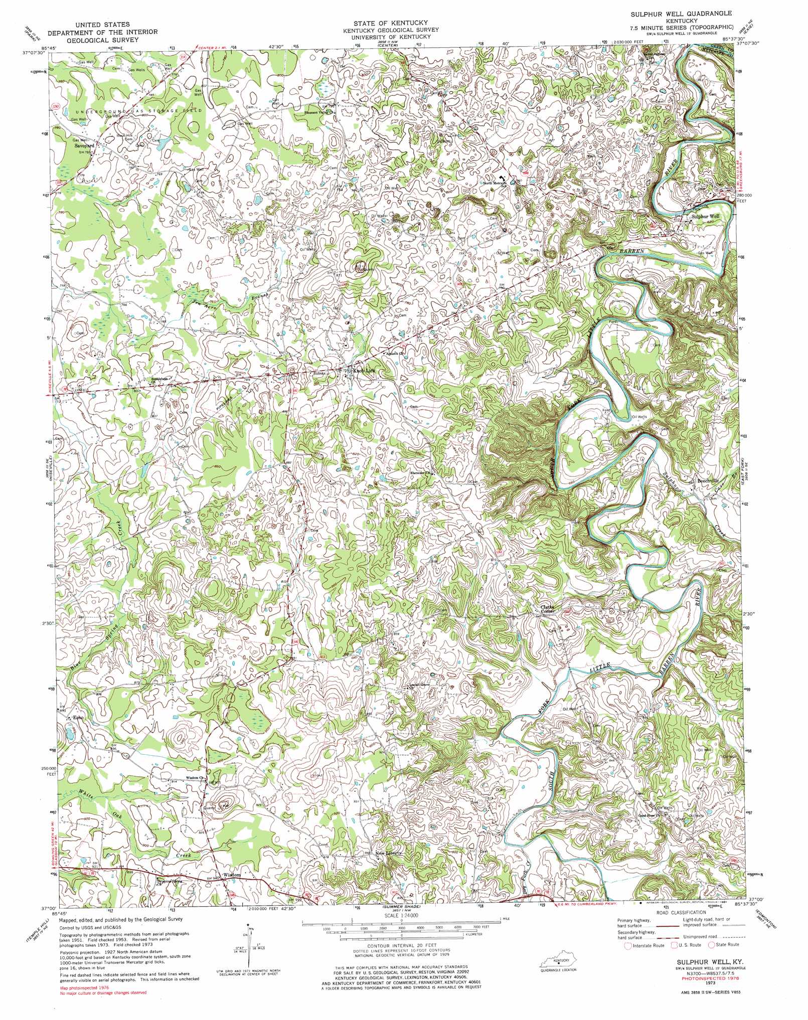
USGS Topo Quad 37085a6 - 1:24,000 scale
| Topo Map Name: | Sulphur Well |
| USGS Topo Quad ID: | 37085a6 |
| Print Size: | ca. 21 1/4" wide x 27" high |
| Southeast Coordinates: | 37° N latitude / 85.625° W longitude |
| Map Center Coordinates: | 37.0625° N latitude / 85.6875° W longitude |
| U.S. State: | KY |
| Filename: | o37085a6.jpg |
| Download Map JPG Image: | Sulphur Well topo map 1:24,000 scale |
| Map Type: | Topographic |
| Topo Series: | 7.5´ |
| Map Scale: | 1:24,000 |
| Source of Map Images: | United States Geological Survey (USGS) |
| Alternate Map Versions: |
Sulphur Well KY 1953, updated 1954 Download PDF Buy paper map Sulphur Well KY 1953, updated 1966 Download PDF Buy paper map Sulphur Well KY 1973, updated 1975 Download PDF Buy paper map Sulphur Well KY 1973, updated 1984 Download PDF Buy paper map Sulphur Well KY 2010 Download PDF Buy paper map Sulphur Well KY 2013 Download PDF Buy paper map Sulphur Well KY 2016 Download PDF Buy paper map |
1:24,000 Topo Quads surrounding Sulphur Well
Munfordville |
Canmer |
Hudgins |
Summersville |
Greensburg |
Horse Cave |
Park |
Center |
Exie |
Gresham |
Glasgow North |
Hiseville |
Sulphur Well |
East Fork |
Gradyville |
Glasgow South |
Temple Hill |
Summer Shade |
Edmonton |
Breeding |
Tracy |
Freedom |
Sulphur Lick |
Dubre |
Waterview |
> Back to 37085a1 at 1:100,000 scale
> Back to 37084a1 at 1:250,000 scale
> Back to U.S. Topo Maps home
Sulphur Well topo map: Gazetteer
Sulphur Well: Populated Places
Beechville elevation 212m 695′Clarks Corner elevation 256m 839′
Echo elevation 271m 889′
Knob Lick elevation 244m 800′
New Liberty elevation 290m 951′
Savoyard elevation 241m 790′
Wisdom elevation 286m 938′
Sulphur Well: Streams
Cave Branch elevation 207m 679′Dry Fork Creek elevation 216m 708′
Sulphur Creek elevation 198m 649′
Ten Acre Branch elevation 232m 761′
Sulphur Well digital topo map on disk
Buy this Sulphur Well topo map showing relief, roads, GPS coordinates and other geographical features, as a high-resolution digital map file on DVD: