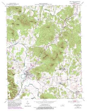
New Haven Topo Map Kentucky
To zoom in, hover over the map of New Haven
USGS Topo Quad 37085f5 - 1:24,000 scale
| Topo Map Name: | New Haven |
| USGS Topo Quad ID: | 37085f5 |
| Print Size: | ca. 21 1/4" wide x 27" high |
| Southeast Coordinates: | 37.625° N latitude / 85.5° W longitude |
| Map Center Coordinates: | 37.6875° N latitude / 85.5625° W longitude |
| U.S. State: | KY |
| Filename: | o37085f5.jpg |
| Download Map JPG Image: | New Haven topo map 1:24,000 scale |
| Map Type: | Topographic |
| Topo Series: | 7.5´ |
| Map Scale: | 1:24,000 |
| Source of Map Images: | United States Geological Survey (USGS) |
| Alternate Map Versions: |
New Haven KY 1953, updated 1954 Download PDF Buy paper map New Haven KY 1953, updated 1968 Download PDF Buy paper map New Haven KY 1953, updated 1981 Download PDF Buy paper map New Haven KY 1953, updated 1987 Download PDF Buy paper map New Haven KY 2010 Download PDF Buy paper map New Haven KY 2013 Download PDF Buy paper map New Haven KY 2016 Download PDF Buy paper map |
1:24,000 Topo Quads surrounding New Haven
> Back to 37085e1 at 1:100,000 scale
> Back to 37084a1 at 1:250,000 scale
> Back to U.S. Topo Maps home
New Haven topo map: Gazetteer
New Haven: Capes
Buzzard Roost elevation 244m 800′New Haven: Populated Places
Athertonville elevation 144m 472′Balltown elevation 193m 633′
Blue Gap elevation 189m 620′
Culvertown elevation 197m 646′
Gethsemane elevation 153m 501′
Lyons elevation 151m 495′
New Haven elevation 145m 475′
New Hope elevation 166m 544′
New Haven: Streams
Bull Run elevation 132m 433′Davis Run elevation 137m 449′
Knob Creek elevation 140m 459′
Landing Run elevation 131m 429′
Monks Creek elevation 144m 472′
Pottinger Creek elevation 140m 459′
Price Creek elevation 134m 439′
Stony Run elevation 130m 426′
Vittitow Creek elevation 134m 439′
New Haven: Summits
Barnes Knob elevation 257m 843′Blue Gap Knob elevation 290m 951′
Brown Knob elevation 266m 872′
Bull Run Knob elevation 270m 885′
Cambron Knob elevation 294m 964′
Carter Knob elevation 259m 849′
Forty Acre Knob elevation 294m 964′
Ice Knob elevation 257m 843′
Miller Knob elevation 244m 800′
Potato Hill Knob elevation 269m 882′
Strang Knob elevation 261m 856′
Troutman Knob elevation 251m 823′
Vineyard Knob elevation 291m 954′
Watson Knob elevation 295m 967′
Wolf Knob elevation 262m 859′
New Haven: Valleys
Potts Hollow elevation 134m 439′Salt Spring Hollow elevation 165m 541′
New Haven digital topo map on disk
Buy this New Haven topo map showing relief, roads, GPS coordinates and other geographical features, as a high-resolution digital map file on DVD:


