Dunmor Topo Map Kentucky
To zoom in, hover over the map of Dunmor
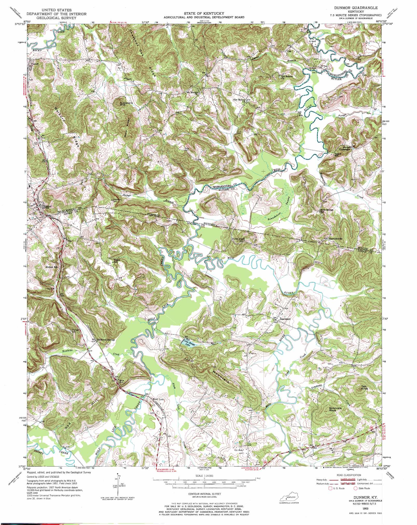
USGS Topo Quad 37086a8 - 1:24,000 scale
| Topo Map Name: | Dunmor |
| USGS Topo Quad ID: | 37086a8 |
| Print Size: | ca. 21 1/4" wide x 27" high |
| Southeast Coordinates: | 37° N latitude / 86.875° W longitude |
| Map Center Coordinates: | 37.0625° N latitude / 86.9375° W longitude |
| U.S. State: | KY |
| Filename: | o37086a8.jpg |
| Download Map JPG Image: | Dunmor topo map 1:24,000 scale |
| Map Type: | Topographic |
| Topo Series: | 7.5´ |
| Map Scale: | 1:24,000 |
| Source of Map Images: | United States Geological Survey (USGS) |
| Alternate Map Versions: |
Dunmor KY 1953, updated 1954 Download PDF Buy paper map Dunmor KY 1953, updated 1968 Download PDF Buy paper map Dunmor KY 2010 Download PDF Buy paper map Dunmor KY 2013 Download PDF Buy paper map Dunmor KY 2016 Download PDF Buy paper map |
1:24,000 Topo Quads surrounding Dunmor
Central City West |
Central City East |
Paradise |
Cromwell |
Flener |
Greenville |
Drakesboro |
Rochester |
South Hill |
Morgantown |
Kirkmansville |
Rosewood |
Dunmor |
Quality |
Sugar Grove |
Allegre |
Sharon Grove |
Lewisburg |
Homer |
South Union |
Elkton |
Olmstead |
Russellville |
Dennis |
Auburn |
> Back to 37086a1 at 1:100,000 scale
> Back to 37086a1 at 1:250,000 scale
> Back to U.S. Topo Maps home
Dunmor topo map: Gazetteer
Dunmor: Gaps
Blue Cut elevation 143m 469′Dunmor: Populated Places
Beechland elevation 147m 482′Diamond Springs elevation 130m 426′
Dunmor elevation 180m 590′
Gus elevation 146m 479′
Harper Crossroads elevation 171m 561′
Harreldsville elevation 191m 626′
Hollow Bill elevation 142m 465′
Penrod elevation 132m 433′
Wolf Lick elevation 131m 429′
Dunmor: Reservoirs
Coon Range Lake elevation 127m 416′Dunmor: Ridges
Chestnut Oak Ridge elevation 207m 679′Ware Ridge elevation 213m 698′
Welburn Ridge elevation 205m 672′
Dunmor: Streams
Alum Lick Creek elevation 122m 400′Biggerstaff Creek elevation 121m 396′
Dead Creek elevation 125m 410′
Forgys Branch elevation 121m 396′
Jockys Branch elevation 122m 400′
Lyons Branch elevation 119m 390′
Rawhide Creek elevation 122m 400′
Simmons Creek elevation 128m 419′
Wolf Lick Creek elevation 122m 400′
Dunmor: Summits
Huckleberry Knob elevation 179m 587′Iron Mountain elevation 215m 705′
Red Hill elevation 201m 659′
Simmons Knob elevation 210m 688′
Tan Knob elevation 214m 702′
Dunmor: Swamps
Roundabout Swamp elevation 122m 400′Dunmor digital topo map on disk
Buy this Dunmor topo map showing relief, roads, GPS coordinates and other geographical features, as a high-resolution digital map file on DVD: