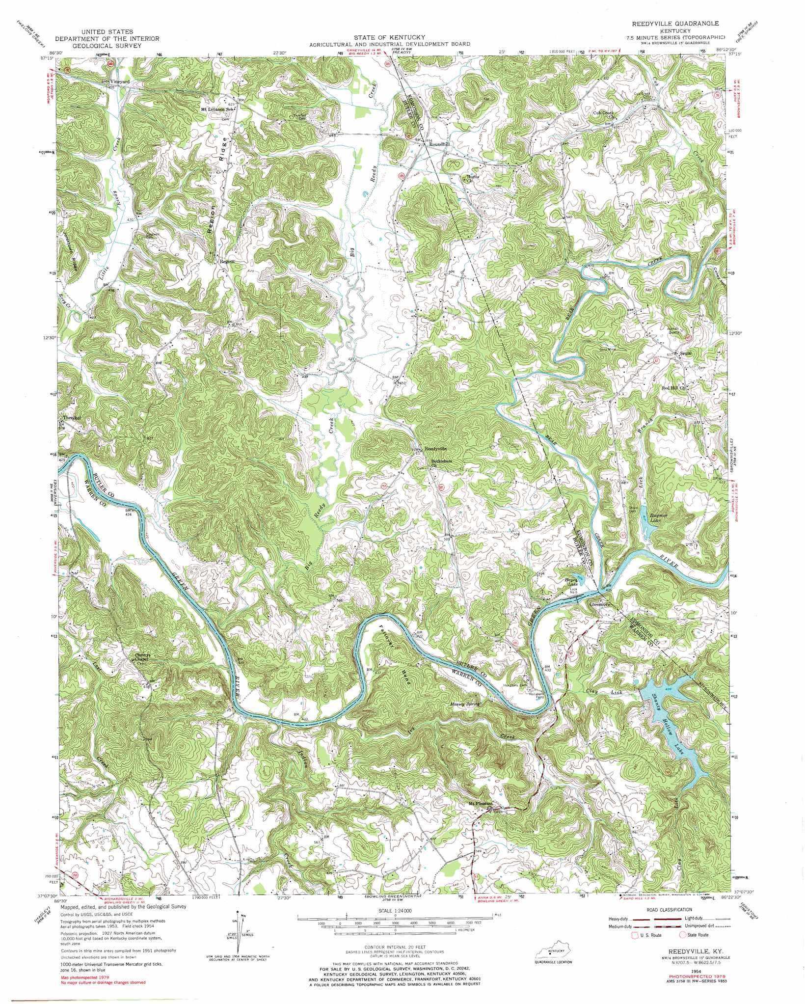
Reedyville Topo Map Kentucky
To zoom in, hover over the map of Reedyville
USGS Topo Quad 37086b4 - 1:24,000 scale
| Topo Map Name: | Reedyville |
| USGS Topo Quad ID: | 37086b4 |
| Print Size: | ca. 21 1/4" wide x 27" high |
| Southeast Coordinates: | 37.125° N latitude / 86.375° W longitude |
| Map Center Coordinates: | 37.1875° N latitude / 86.4375° W longitude |
| U.S. State: | KY |
| Filename: | o37086b4.jpg |
| Download Map JPG Image: | Reedyville topo map 1:24,000 scale |
| Map Type: | Topographic |
| Topo Series: | 7.5´ |
| Map Scale: | 1:24,000 |
| Source of Map Images: | United States Geological Survey (USGS) |
| Alternate Map Versions: |
Reedyville KY 1954, updated 1955 Download PDF Buy paper map Reedyville KY 1954, updated 1973 Download PDF Buy paper map Reedyville KY 1954, updated 1984 Download PDF Buy paper map Reedyville KY 2010 Download PDF Buy paper map Reedyville KY 2013 Download PDF Buy paper map Reedyville KY 2016 Download PDF Buy paper map |
1:24,000 Topo Quads surrounding Reedyville
Rosine |
Spring Lick |
Caneyville |
Leitchfield |
Clarkson |
Flener |
Welchs Creek |
Ready |
Bee Spring |
Nolin Lake |
Morgantown |
Riverside |
Reedyville |
Brownsville |
Rhoda |
Sugar Grove |
Hadley |
Bowling Green North |
Bristow |
Smiths Grove |
South Union |
Rockfield |
Bowling Green South |
Polkville |
Meador |
> Back to 37086a1 at 1:100,000 scale
> Back to 37086a1 at 1:250,000 scale
> Back to U.S. Topo Maps home
Reedyville topo map: Gazetteer
Reedyville: Bends
Fallover Bend elevation 173m 567′Reedyville: Lakes
Raymer Lake elevation 127m 416′Reedyville: Populated Places
Glenmore elevation 155m 508′Reedyville elevation 158m 518′
Roundhill elevation 138m 452′
Segal elevation 188m 616′
Vineyard elevation 134m 439′
Reedyville: Reservoirs
Shanty Hollow Lake elevation 132m 433′Reedyville: Ridges
Region Ridge elevation 179m 587′Reedyville: Springs
Massey Spring elevation 136m 446′Reedyville: Streams
Bear Creek elevation 124m 406′Big Reedy Creek elevation 120m 393′
Clay Lick elevation 123m 403′
Greenfield Branch elevation 134m 439′
Indian Creek elevation 120m 393′
Ivy Creek elevation 122m 400′
Lick Branch elevation 127m 416′
Rosy Creek elevation 128m 419′
Reedyville: Valleys
Caney Hollow elevation 127m 416′Reedyville digital topo map on disk
Buy this Reedyville topo map showing relief, roads, GPS coordinates and other geographical features, as a high-resolution digital map file on DVD: