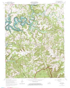
Cub Run Topo Map Kentucky
To zoom in, hover over the map of Cub Run
USGS Topo Quad 37086c1 - 1:24,000 scale
| Topo Map Name: | Cub Run |
| USGS Topo Quad ID: | 37086c1 |
| Print Size: | ca. 21 1/4" wide x 27" high |
| Southeast Coordinates: | 37.25° N latitude / 86° W longitude |
| Map Center Coordinates: | 37.3125° N latitude / 86.0625° W longitude |
| U.S. State: | KY |
| Filename: | o37086c1.jpg |
| Download Map JPG Image: | Cub Run topo map 1:24,000 scale |
| Map Type: | Topographic |
| Topo Series: | 7.5´ |
| Map Scale: | 1:24,000 |
| Source of Map Images: | United States Geological Survey (USGS) |
| Alternate Map Versions: |
Cub Run KY 1954, updated 1955 Download PDF Buy paper map Cub Run KY 1954, updated 1965 Download PDF Buy paper map Cub Run KY 1966, updated 1968 Download PDF Buy paper map Cub Run KY 2010 Download PDF Buy paper map Cub Run KY 2013 Download PDF Buy paper map Cub Run KY 2016 Download PDF Buy paper map |
1:24,000 Topo Quads surrounding Cub Run
> Back to 37086a1 at 1:100,000 scale
> Back to 37086a1 at 1:250,000 scale
> Back to U.S. Topo Maps home
Cub Run topo map: Gazetteer
Cub Run: Basins
Big Sink elevation 208m 682′Cub Run: Populated Places
Bee elevation 258m 846′Big Windy elevation 239m 784′
Cub Run elevation 232m 761′
Lines Mill elevation 178m 583′
Macon elevation 245m 803′
Pearman elevation 191m 626′
Pine Springs elevation 191m 626′
Roseburg elevation 200m 656′
Sportsmens Paradise elevation 187m 613′
Wax elevation 183m 600′
Winesap elevation 267m 875′
Cub Run: Streams
Bacon Creek elevation 160m 524′Barton Run elevation 157m 515′
Cane Run elevation 157m 515′
Cub Run elevation 138m 452′
Lick Run elevation 157m 515′
Pine Branch elevation 168m 551′
Sinking Creek elevation 186m 610′
Cub Run: Valleys
Kissinger Hollow elevation 169m 554′Cub Run digital topo map on disk
Buy this Cub Run topo map showing relief, roads, GPS coordinates and other geographical features, as a high-resolution digital map file on DVD:


