Flener Topo Map Kentucky
To zoom in, hover over the map of Flener
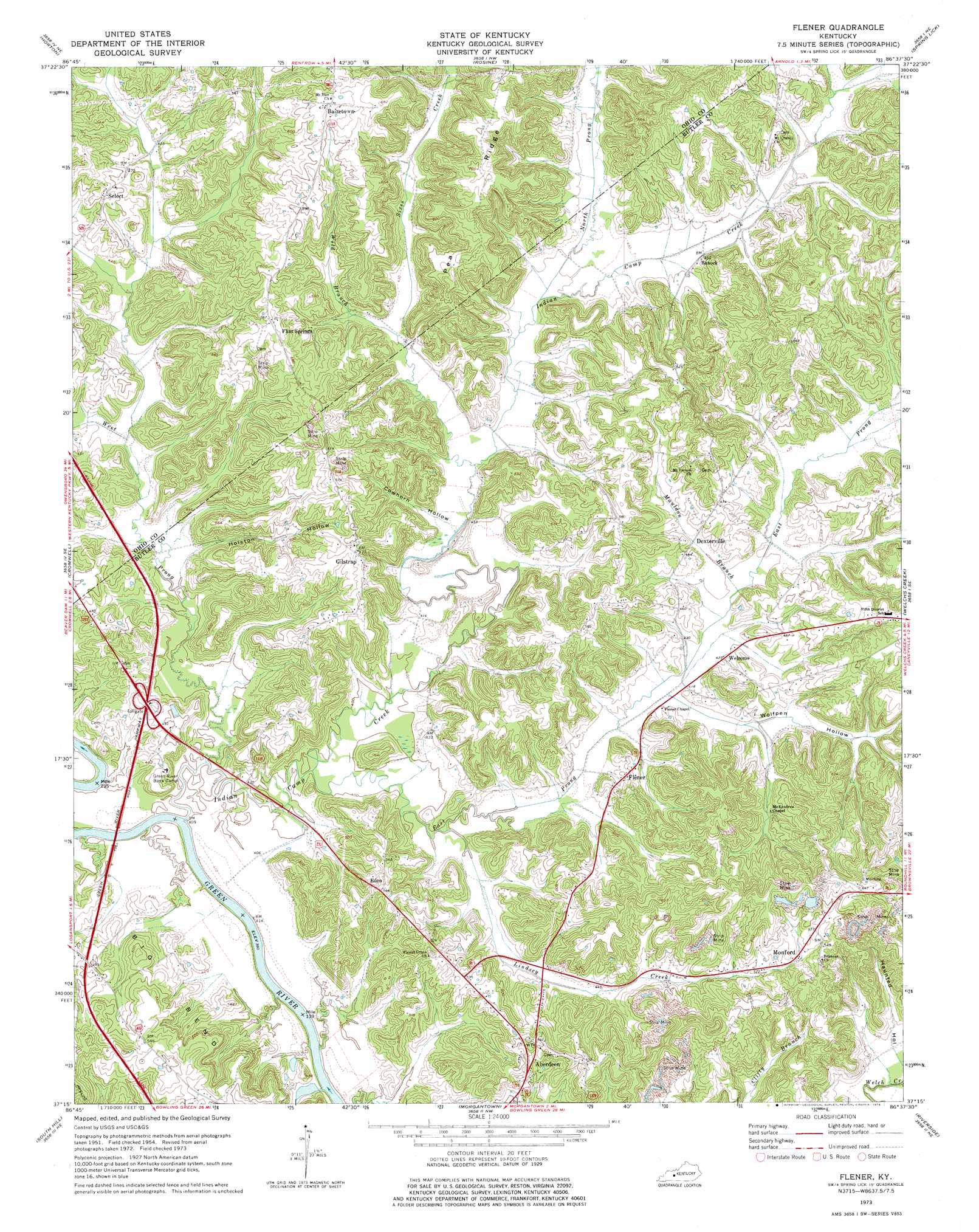
USGS Topo Quad 37086c6 - 1:24,000 scale
| Topo Map Name: | Flener |
| USGS Topo Quad ID: | 37086c6 |
| Print Size: | ca. 21 1/4" wide x 27" high |
| Southeast Coordinates: | 37.25° N latitude / 86.625° W longitude |
| Map Center Coordinates: | 37.3125° N latitude / 86.6875° W longitude |
| U.S. State: | KY |
| Filename: | o37086c6.jpg |
| Download Map JPG Image: | Flener topo map 1:24,000 scale |
| Map Type: | Topographic |
| Topo Series: | 7.5´ |
| Map Scale: | 1:24,000 |
| Source of Map Images: | United States Geological Survey (USGS) |
| Alternate Map Versions: |
Flener KY 1954, updated 1955 Download PDF Buy paper map Flener KY 1973, updated 1974 Download PDF Buy paper map Flener KY 1973, updated 1974 Download PDF Buy paper map Flener KY 2010 Download PDF Buy paper map Flener KY 2013 Download PDF Buy paper map Flener KY 2016 Download PDF Buy paper map |
1:24,000 Topo Quads surrounding Flener
Pleasant Ridge |
Dundee |
Olaton |
Falls Of Rough |
Mcdaniels |
Hartford |
Horton |
Rosine |
Spring Lick |
Caneyville |
Paradise |
Cromwell |
Flener |
Welchs Creek |
Ready |
Rochester |
South Hill |
Morgantown |
Riverside |
Reedyville |
Dunmor |
Quality |
Sugar Grove |
Hadley |
Bowling Green North |
> Back to 37086a1 at 1:100,000 scale
> Back to 37086a1 at 1:250,000 scale
> Back to U.S. Topo Maps home
Flener topo map: Gazetteer
Flener: Populated Places
Aberdeen elevation 162m 531′Baizetown elevation 190m 623′
Banock elevation 137m 449′
Dexterville elevation 129m 423′
Eden elevation 172m 564′
Flener elevation 135m 442′
Flint Springs elevation 143m 469′
Gilstrap elevation 175m 574′
Monford elevation 162m 531′
Select elevation 159m 521′
Welcome elevation 134m 439′
Flener: Streams
East Prong Indian Camp Creek elevation 119m 390′Indian Camp Creek elevation 121m 396′
Lindsey Creek elevation 121m 396′
Mauldon Branch elevation 124m 406′
North Prong Indian Camp Creek elevation 125m 410′
Sixes Creek elevation 127m 416′
West Prong Indian Camp Creek elevation 119m 390′
Wild Branch elevation 124m 406′
Flener: Valleys
Cowhorn Hollow elevation 125m 410′Haunted Hollow elevation 125m 410′
Holston Hollow elevation 177m 580′
Wolfpen Hollow elevation 137m 449′
Flener digital topo map on disk
Buy this Flener topo map showing relief, roads, GPS coordinates and other geographical features, as a high-resolution digital map file on DVD: