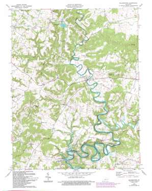
Millerstown Topo Map Kentucky
To zoom in, hover over the map of Millerstown
USGS Topo Quad 37086d1 - 1:24,000 scale
| Topo Map Name: | Millerstown |
| USGS Topo Quad ID: | 37086d1 |
| Print Size: | ca. 21 1/4" wide x 27" high |
| Southeast Coordinates: | 37.375° N latitude / 86° W longitude |
| Map Center Coordinates: | 37.4375° N latitude / 86.0625° W longitude |
| U.S. State: | KY |
| Filename: | o37086d1.jpg |
| Download Map JPG Image: | Millerstown topo map 1:24,000 scale |
| Map Type: | Topographic |
| Topo Series: | 7.5´ |
| Map Scale: | 1:24,000 |
| Source of Map Images: | United States Geological Survey (USGS) |
| Alternate Map Versions: |
Millerstown KY 1954, updated 1955 Download PDF Buy paper map Millerstown KY 1967, updated 1971 Download PDF Buy paper map Millerstown KY 1967, updated 1984 Download PDF Buy paper map Millerstown KY 1967, updated 1993 Download PDF Buy paper map Millerstown KY 2010 Download PDF Buy paper map Millerstown KY 2013 Download PDF Buy paper map Millerstown KY 2016 Download PDF Buy paper map |
1:24,000 Topo Quads surrounding Millerstown
> Back to 37086a1 at 1:100,000 scale
> Back to 37086a1 at 1:250,000 scale
> Back to U.S. Topo Maps home
Millerstown topo map: Gazetteer
Millerstown: Bends
Bush Bend elevation 176m 577′Millerstown: Islands
Joyce Island elevation 168m 551′Millerstown: Populated Places
Broad Ford elevation 198m 649′Hilltop elevation 245m 803′
Lacon elevation 241m 790′
Lone Oak elevation 226m 741′
Millerstown elevation 179m 587′
Royal elevation 238m 780′
Spike elevation 190m 623′
Spurrier elevation 178m 583′
Wheelers Mill elevation 182m 597′
Millerstown: Reservoirs
Nichols Lake elevation 231m 757′Millerstown: Ridges
Buzzard Ridge elevation 295m 967′Millerstown: Springs
Mill Spring elevation 173m 567′Millerstown: Streams
Berry Run elevation 178m 583′Dry Run elevation 175m 574′
Laurel Run elevation 154m 505′
Nosey Creek elevation 176m 577′
Round Stone Creek elevation 162m 531′
Sinking Fork elevation 170m 557′
Slab Camp Creek elevation 158m 518′
Millerstown: Summits
Buzzard Roost elevation 292m 958′Fox Den Hill elevation 264m 866′
Millerstown: Valleys
Akers Valley elevation 178m 583′Copelin Valley elevation 171m 561′
Millerstown digital topo map on disk
Buy this Millerstown topo map showing relief, roads, GPS coordinates and other geographical features, as a high-resolution digital map file on DVD:


