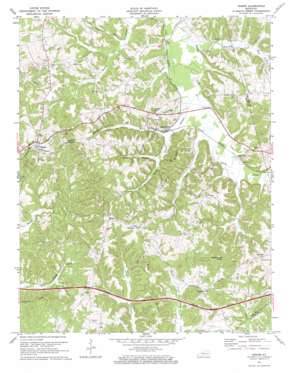
Rosine Topo Map Kentucky
To zoom in, hover over the map of Rosine
USGS Topo Quad 37086d6 - 1:24,000 scale
| Topo Map Name: | Rosine |
| USGS Topo Quad ID: | 37086d6 |
| Print Size: | ca. 21 1/4" wide x 27" high |
| Southeast Coordinates: | 37.375° N latitude / 86.625° W longitude |
| Map Center Coordinates: | 37.4375° N latitude / 86.6875° W longitude |
| U.S. State: | KY |
| Filename: | o37086d6.jpg |
| Download Map JPG Image: | Rosine topo map 1:24,000 scale |
| Map Type: | Topographic |
| Topo Series: | 7.5´ |
| Map Scale: | 1:24,000 |
| Source of Map Images: | United States Geological Survey (USGS) |
| Alternate Map Versions: |
Rosine KY 1954, updated 1955 Download PDF Buy paper map Rosine KY 1971, updated 1972 Download PDF Buy paper map Rosine KY 2010 Download PDF Buy paper map Rosine KY 2013 Download PDF Buy paper map Rosine KY 2016 Download PDF Buy paper map |
1:24,000 Topo Quads surrounding Rosine
> Back to 37086a1 at 1:100,000 scale
> Back to 37086a1 at 1:250,000 scale
> Back to U.S. Topo Maps home
Rosine topo map: Gazetteer
Rosine: Populated Places
Arnold elevation 151m 495′Dogwalk elevation 196m 643′
Horse Branch elevation 142m 465′
Renfrow elevation 209m 685′
Rosine elevation 171m 561′
White Run elevation 133m 436′
Windy Hill elevation 212m 695′
Rosine: Ridges
Arnold Ridge elevation 190m 623′Pea Ridge elevation 203m 666′
Rosine: Streams
Cow Creek elevation 133m 436′East Fork McGrady Creek elevation 135m 442′
Ford Run elevation 131m 429′
Horse Branch elevation 128m 419′
Jenny Branch elevation 131m 429′
McGrady Creek elevation 125m 410′
North Fork McGrady Creek elevation 135m 442′
Richland Creek elevation 134m 439′
Sled Run elevation 130m 426′
Rosine: Summits
Hickory Knob elevation 191m 626′Rattlesnake Knob elevation 232m 761′
Tunnel Hill elevation 211m 692′
Wildcat Knob elevation 183m 600′
Rosine: Valleys
Crow Hollow elevation 136m 446′Rosine digital topo map on disk
Buy this Rosine topo map showing relief, roads, GPS coordinates and other geographical features, as a high-resolution digital map file on DVD:


