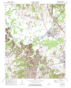
Hartford Topo Map Kentucky
To zoom in, hover over the map of Hartford
USGS Topo Quad 37086d8 - 1:24,000 scale
| Topo Map Name: | Hartford |
| USGS Topo Quad ID: | 37086d8 |
| Print Size: | ca. 21 1/4" wide x 27" high |
| Southeast Coordinates: | 37.375° N latitude / 86.875° W longitude |
| Map Center Coordinates: | 37.4375° N latitude / 86.9375° W longitude |
| U.S. State: | KY |
| Filename: | o37086d8.jpg |
| Download Map JPG Image: | Hartford topo map 1:24,000 scale |
| Map Type: | Topographic |
| Topo Series: | 7.5´ |
| Map Scale: | 1:24,000 |
| Source of Map Images: | United States Geological Survey (USGS) |
| Alternate Map Versions: |
Hartford KY 1954, updated 1956 Download PDF Buy paper map Hartford KY 1973, updated 1975 Download PDF Buy paper map Hartford KY 2010 Download PDF Buy paper map Hartford KY 2013 Download PDF Buy paper map Hartford KY 2016 Download PDF Buy paper map |
1:24,000 Topo Quads surrounding Hartford
> Back to 37086a1 at 1:100,000 scale
> Back to 37086a1 at 1:250,000 scale
> Back to U.S. Topo Maps home
Hartford topo map: Gazetteer
Hartford: Airports
Sunshine Heliport elevation 119m 390′Hartford: Cliffs
Hawkers Bluff elevation 124m 406′Hartford: Guts
McCormick Slough elevation 116m 380′Hartford: Mines
Taylor Mines elevation 150m 492′Hartford: Populated Places
Beaver Dam elevation 125m 410′Centertown elevation 135m 442′
Hartford elevation 127m 416′
McHenry elevation 128m 419′
No Creek elevation 145m 475′
Hartford: Streams
Bens Lick elevation 115m 377′Big Run elevation 115m 377′
Little No Creek elevation 116m 380′
Muddy Creek elevation 119m 390′
North Fork Muddy Creek elevation 116m 380′
Rock House Slough elevation 115m 377′
Toms Branch elevation 117m 383′
Walton Creek elevation 115m 377′
Hartford digital topo map on disk
Buy this Hartford topo map showing relief, roads, GPS coordinates and other geographical features, as a high-resolution digital map file on DVD:


