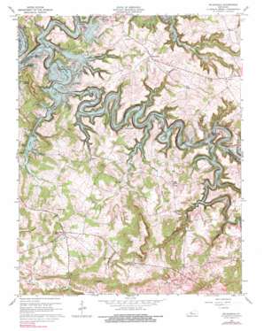
Mcdaniels Topo Map Kentucky
To zoom in, hover over the map of Mcdaniels
USGS Topo Quad 37086e4 - 1:24,000 scale
| Topo Map Name: | Mcdaniels |
| USGS Topo Quad ID: | 37086e4 |
| Print Size: | ca. 21 1/4" wide x 27" high |
| Southeast Coordinates: | 37.5° N latitude / 86.375° W longitude |
| Map Center Coordinates: | 37.5625° N latitude / 86.4375° W longitude |
| U.S. State: | KY |
| Filename: | o37086e4.jpg |
| Download Map JPG Image: | Mcdaniels topo map 1:24,000 scale |
| Map Type: | Topographic |
| Topo Series: | 7.5´ |
| Map Scale: | 1:24,000 |
| Source of Map Images: | United States Geological Survey (USGS) |
| Alternate Map Versions: |
Mc Daniels KY 1953, updated 1954 Download PDF Buy paper map Mc Daniels KY 1963, updated 1964 Download PDF Buy paper map Mc Daniels KY 1963, updated 1975 Download PDF Buy paper map Mc Daniels KY 1963, updated 1990 Download PDF Buy paper map McDaniels KY 2010 Download PDF Buy paper map McDaniels KY 2013 Download PDF Buy paper map McDaniels KY 2016 Download PDF Buy paper map |
1:24,000 Topo Quads surrounding Mcdaniels
> Back to 37086e1 at 1:100,000 scale
> Back to 37086a1 at 1:250,000 scale
> Back to U.S. Topo Maps home
Mcdaniels topo map: Gazetteer
Mcdaniels: Populated Places
Cannons Point elevation 171m 561′Cobblers Knob elevation 158m 518′
Concord elevation 169m 554′
Duff elevation 198m 649′
Falling Branch elevation 179m 587′
Fentress McMahan elevation 169m 554′
Hinton Hills elevation 181m 593′
Horn Back Mill elevation 180m 590′
Indian Valley elevation 186m 610′
McCoy elevation 221m 725′
McDaniels elevation 204m 669′
Short Creek elevation 177m 580′
Mcdaniels: Reservoirs
Rough River Lake elevation 161m 528′Mcdaniels: Streams
Ashcraft Branch elevation 159m 521′Cave Creek elevation 150m 492′
George Branch elevation 150m 492′
Little Clifty Creek elevation 150m 492′
Long Hollow Branch elevation 157m 515′
Long Lick Creek elevation 150m 492′
North Fork Rough River elevation 150m 492′
Panther Creek elevation 150m 492′
Pleasant Hill Branch elevation 150m 492′
Rocky Branch elevation 158m 518′
Walter Creek elevation 150m 492′
Mcdaniels: Valleys
Copper Slick Hollow elevation 158m 518′Stones Hollow elevation 159m 521′
Wildcat Hollow elevation 155m 508′
Mcdaniels digital topo map on disk
Buy this Mcdaniels topo map showing relief, roads, GPS coordinates and other geographical features, as a high-resolution digital map file on DVD:


