Philpot Topo Map Kentucky
To zoom in, hover over the map of Philpot
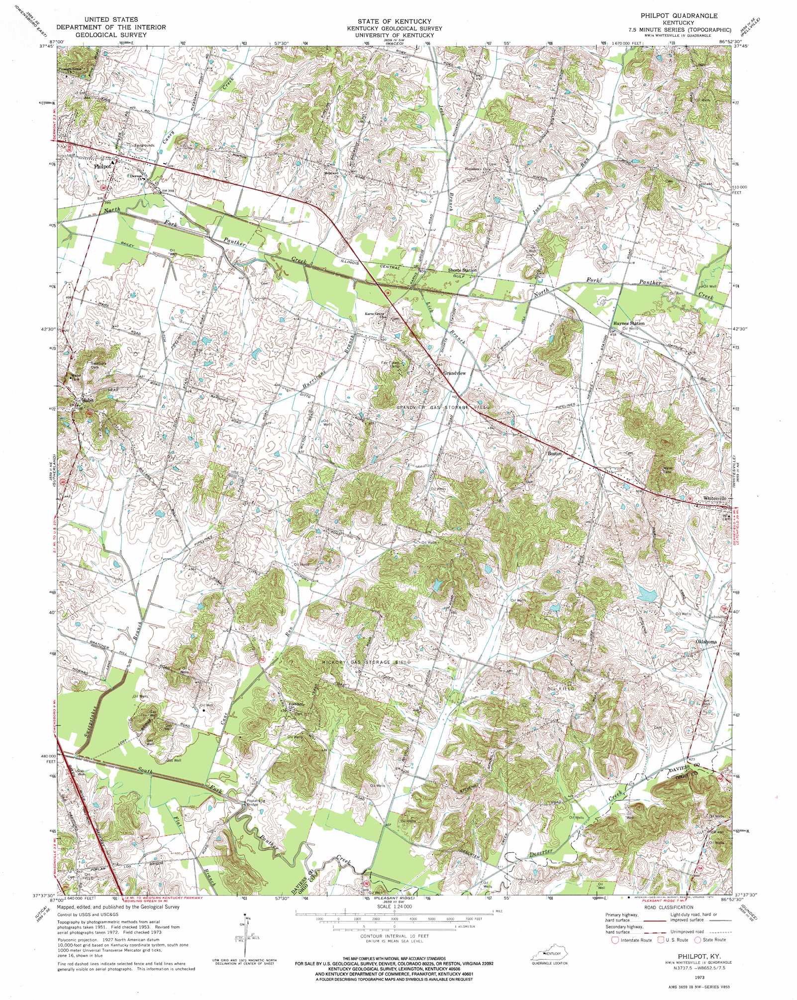
USGS Topo Quad 37086f8 - 1:24,000 scale
| Topo Map Name: | Philpot |
| USGS Topo Quad ID: | 37086f8 |
| Print Size: | ca. 21 1/4" wide x 27" high |
| Southeast Coordinates: | 37.625° N latitude / 86.875° W longitude |
| Map Center Coordinates: | 37.6875° N latitude / 86.9375° W longitude |
| U.S. State: | KY |
| Filename: | o37086f8.jpg |
| Download Map JPG Image: | Philpot topo map 1:24,000 scale |
| Map Type: | Topographic |
| Topo Series: | 7.5´ |
| Map Scale: | 1:24,000 |
| Source of Map Images: | United States Geological Survey (USGS) |
| Alternate Map Versions: |
Philpot KY 1953, updated 1954 Download PDF Buy paper map Philpot KY 1973, updated 1974 Download PDF Buy paper map Philpot KY 2010 Download PDF Buy paper map Philpot KY 2013 Download PDF Buy paper map Philpot KY 2016 Download PDF Buy paper map |
1:24,000 Topo Quads surrounding Philpot
Richland City |
Rockport |
Lewisport |
Tell City |
Cannelton |
Owensboro West |
Owensboro East |
Maceo |
Pellville |
Cloverport |
Panther |
Sutherland |
Philpot |
Whitesville |
Fordsville |
Glenville |
Utica |
Pleasant Ridge |
Dundee |
Olaton |
Livermore |
Equality |
Hartford |
Horton |
Rosine |
> Back to 37086e1 at 1:100,000 scale
> Back to 37086a1 at 1:250,000 scale
> Back to U.S. Topo Maps home
Philpot topo map: Gazetteer
Philpot: Bridges
Poplar Log Bridge elevation 122m 400′Philpot: Canals
Bailey Ditch elevation 122m 400′Philpot: Oilfields
Grandview Gas Storage Field elevation 129m 423′Hickory Gas Storage Field elevation 137m 449′
Philpot: Populated Places
Boston elevation 142m 465′Grandview elevation 137m 449′
Habit elevation 169m 554′
Oklahoma elevation 133m 436′
Philpot elevation 131m 429′
Philpot: Streams
Cane Run elevation 122m 400′Caney Creek elevation 119m 390′
Flat Branch elevation 122m 400′
Hurricane Branch elevation 122m 400′
Joes Branch elevation 122m 400′
Joes Run elevation 123m 403′
Lick Branch elevation 122m 400′
Sweepstakes Branch elevation 122m 400′
Philpot digital topo map on disk
Buy this Philpot topo map showing relief, roads, GPS coordinates and other geographical features, as a high-resolution digital map file on DVD: