Cloverport Topo Map Kentucky
To zoom in, hover over the map of Cloverport
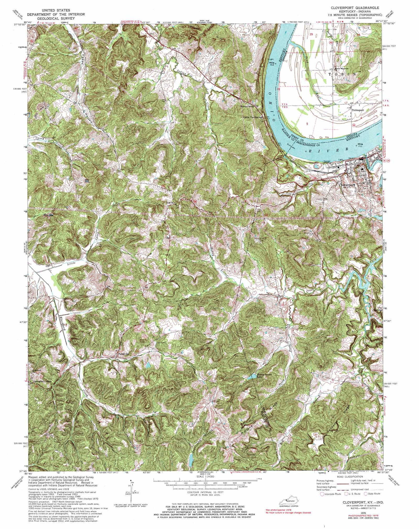
USGS Topo Quad 37086g6 - 1:24,000 scale
| Topo Map Name: | Cloverport |
| USGS Topo Quad ID: | 37086g6 |
| Print Size: | ca. 21 1/4" wide x 27" high |
| Southeast Coordinates: | 37.75° N latitude / 86.625° W longitude |
| Map Center Coordinates: | 37.8125° N latitude / 86.6875° W longitude |
| U.S. States: | KY, IN |
| Filename: | o37086g6.jpg |
| Download Map JPG Image: | Cloverport topo map 1:24,000 scale |
| Map Type: | Topographic |
| Topo Series: | 7.5´ |
| Map Scale: | 1:24,000 |
| Source of Map Images: | United States Geological Survey (USGS) |
| Alternate Map Versions: |
Cloverport KY 1953, updated 1955 Download PDF Buy paper map Cloverport KY 1953, updated 1965 Download PDF Buy paper map Cloverport KY 1970, updated 1972 Download PDF Buy paper map Cloverport KY 1970, updated 1983 Download PDF Buy paper map Cloverport KY 2011 Download PDF Buy paper map Cloverport KY 2013 Download PDF Buy paper map Cloverport KY 2016 Download PDF Buy paper map |
| FStopo: | US Forest Service topo Cloverport is available: Download FStopo PDF Download FStopo TIF |
1:24,000 Topo Quads surrounding Cloverport
Santa Claus |
Fulda |
Gatchel |
Derby |
Alton |
Lewisport |
Tell City |
Cannelton |
Rome |
Lodiburg |
Maceo |
Pellville |
Cloverport |
Mattingly |
Hardinsburg |
Philpot |
Whitesville |
Fordsville |
Glen Dean |
Kingswood |
Pleasant Ridge |
Dundee |
Olaton |
Falls Of Rough |
Mcdaniels |
> Back to 37086e1 at 1:100,000 scale
> Back to 37086a1 at 1:250,000 scale
> Back to U.S. Topo Maps home
Cloverport topo map: Gazetteer
Cloverport: Populated Places
Arrington Corner elevation 177m 580′Cloverport elevation 149m 488′
Dukes elevation 215m 705′
Patesville elevation 148m 485′
Sunny Corner elevation 155m 508′
Tobinsport elevation 124m 406′
Cloverport: Reservoirs
Honey Locust Lake elevation 146m 479′Cloverport: Ridges
Mullens Ridge elevation 187m 613′Tuckers Ridge elevation 211m 692′
Cloverport: Springs
Tar Springs elevation 142m 465′Cloverport: Streams
Clover Creek elevation 116m 380′Faucett Creek elevation 118m 387′
Honey Locust Creek elevation 119m 390′
Keg Branch elevation 119m 390′
Little Caney Creek elevation 134m 439′
Pond Run elevation 116m 380′
Slick Creek elevation 116m 380′
South Fork Honey Locust Creek elevation 122m 400′
Cloverport digital topo map on disk
Buy this Cloverport topo map showing relief, roads, GPS coordinates and other geographical features, as a high-resolution digital map file on DVD: