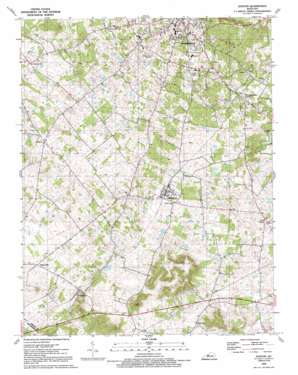
Guston Topo Map Kentucky
To zoom in, hover over the map of Guston
USGS Topo Quad 37086h2 - 1:24,000 scale
| Topo Map Name: | Guston |
| USGS Topo Quad ID: | 37086h2 |
| Print Size: | ca. 21 1/4" wide x 27" high |
| Southeast Coordinates: | 37.875° N latitude / 86.125° W longitude |
| Map Center Coordinates: | 37.9375° N latitude / 86.1875° W longitude |
| U.S. State: | KY |
| Filename: | o37086h2.jpg |
| Download Map JPG Image: | Guston topo map 1:24,000 scale |
| Map Type: | Topographic |
| Topo Series: | 7.5´ |
| Map Scale: | 1:24,000 |
| Source of Map Images: | United States Geological Survey (USGS) |
| Alternate Map Versions: |
Guston KY 1948 Download PDF Buy paper map Guston KY 1961, updated 1962 Download PDF Buy paper map Guston KY 1961, updated 1977 Download PDF Buy paper map Guston KY 1991, updated 1992 Download PDF Buy paper map Guston KY 2010 Download PDF Buy paper map Guston KY 2013 Download PDF Buy paper map Guston KY 2016 Download PDF Buy paper map |
1:24,000 Topo Quads surrounding Guston
> Back to 37086e1 at 1:100,000 scale
> Back to 37086a1 at 1:250,000 scale
> Back to U.S. Topo Maps home
Guston topo map: Gazetteer
Guston: Parks
Meade Olin Park elevation 191m 626′Guston: Populated Places
Brandenburg elevation 173m 567′Brandenburg Station elevation 203m 666′
Buck Grove elevation 199m 652′
Eastwood Hills elevation 177m 580′
Ekron elevation 200m 656′
Guston elevation 216m 708′
Haysville elevation 210m 688′
Hillgrove elevation 213m 698′
Midway elevation 195m 639′
Guston digital topo map on disk
Buy this Guston topo map showing relief, roads, GPS coordinates and other geographical features, as a high-resolution digital map file on DVD:


