Irvington Topo Map Kentucky
To zoom in, hover over the map of Irvington
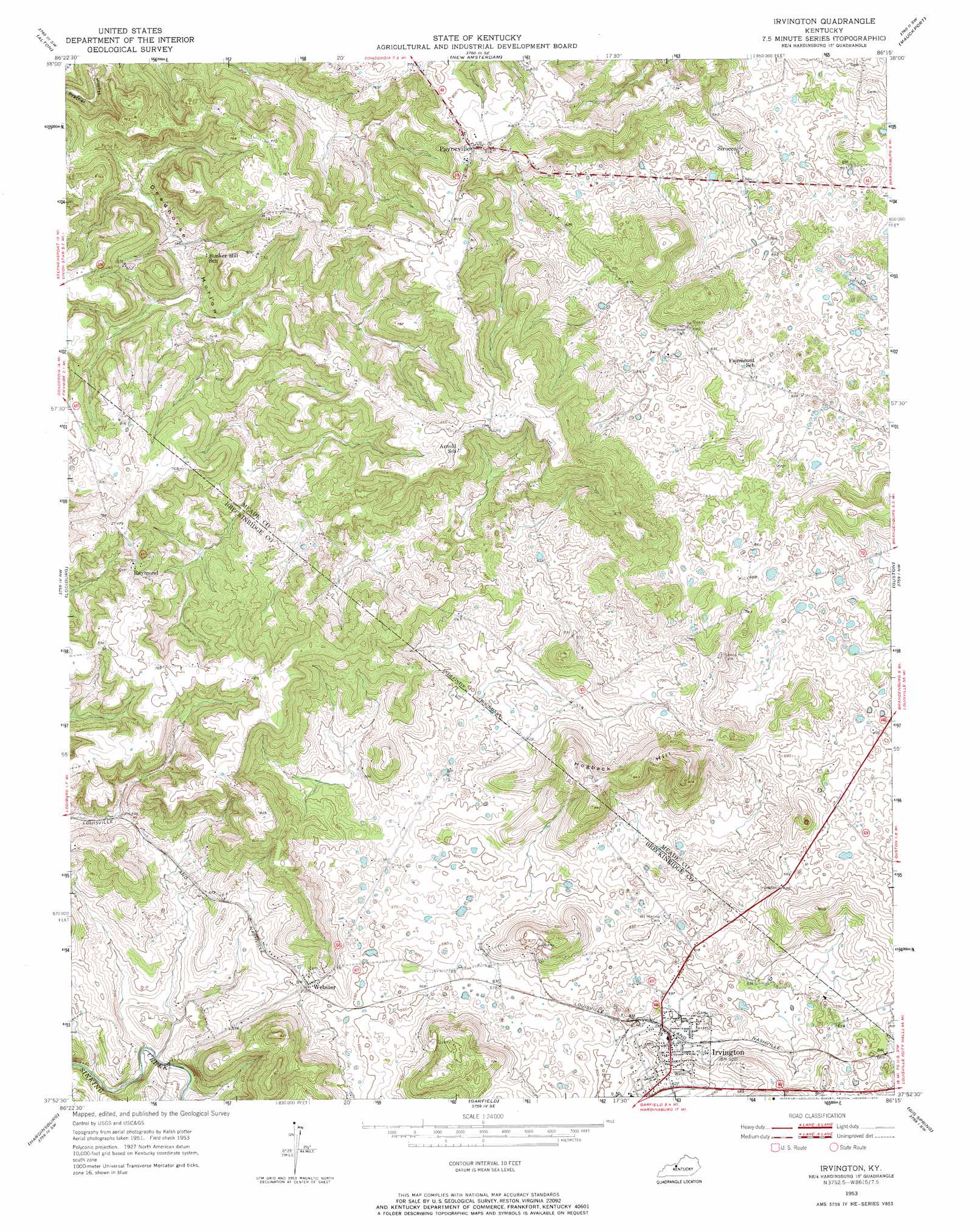
USGS Topo Quad 37086h3 - 1:24,000 scale
| Topo Map Name: | Irvington |
| USGS Topo Quad ID: | 37086h3 |
| Print Size: | ca. 21 1/4" wide x 27" high |
| Southeast Coordinates: | 37.875° N latitude / 86.25° W longitude |
| Map Center Coordinates: | 37.9375° N latitude / 86.3125° W longitude |
| U.S. State: | KY |
| Filename: | o37086h3.jpg |
| Download Map JPG Image: | Irvington topo map 1:24,000 scale |
| Map Type: | Topographic |
| Topo Series: | 7.5´ |
| Map Scale: | 1:24,000 |
| Source of Map Images: | United States Geological Survey (USGS) |
| Alternate Map Versions: |
Irvington KY 1947 Download PDF Buy paper map Irvington KY 1953, updated 1954 Download PDF Buy paper map Irvington KY 2010 Download PDF Buy paper map Irvington KY 2013 Download PDF Buy paper map Irvington KY 2016 Download PDF Buy paper map |
1:24,000 Topo Quads surrounding Irvington
Branchville |
Beechwood |
Leavenworth |
Corydon West |
Corydon East |
Derby |
Alton |
New Amsterdam |
Mauckport |
Laconia |
Rome |
Lodiburg |
Irvington |
Guston |
Rock Haven |
Mattingly |
Hardinsburg |
Garfield |
Big Spring |
Flaherty |
Glen Dean |
Kingswood |
Custer |
Constantine |
Howe Valley |
> Back to 37086e1 at 1:100,000 scale
> Back to 37086a1 at 1:250,000 scale
> Back to U.S. Topo Maps home
Irvington topo map: Gazetteer
Irvington: Basins
Deadhorse Hollow elevation 171m 561′Irvington: Populated Places
Irvington elevation 189m 620′Payneville elevation 247m 810′
Raymond elevation 238m 780′
Sirocco elevation 205m 672′
Webster elevation 178m 583′
Irvington: Summits
Hogback Hill elevation 280m 918′Irvington: Valleys
Prather Hollow elevation 149m 488′Irvington digital topo map on disk
Buy this Irvington topo map showing relief, roads, GPS coordinates and other geographical features, as a high-resolution digital map file on DVD: