Saint Charles Topo Map Kentucky
To zoom in, hover over the map of Saint Charles
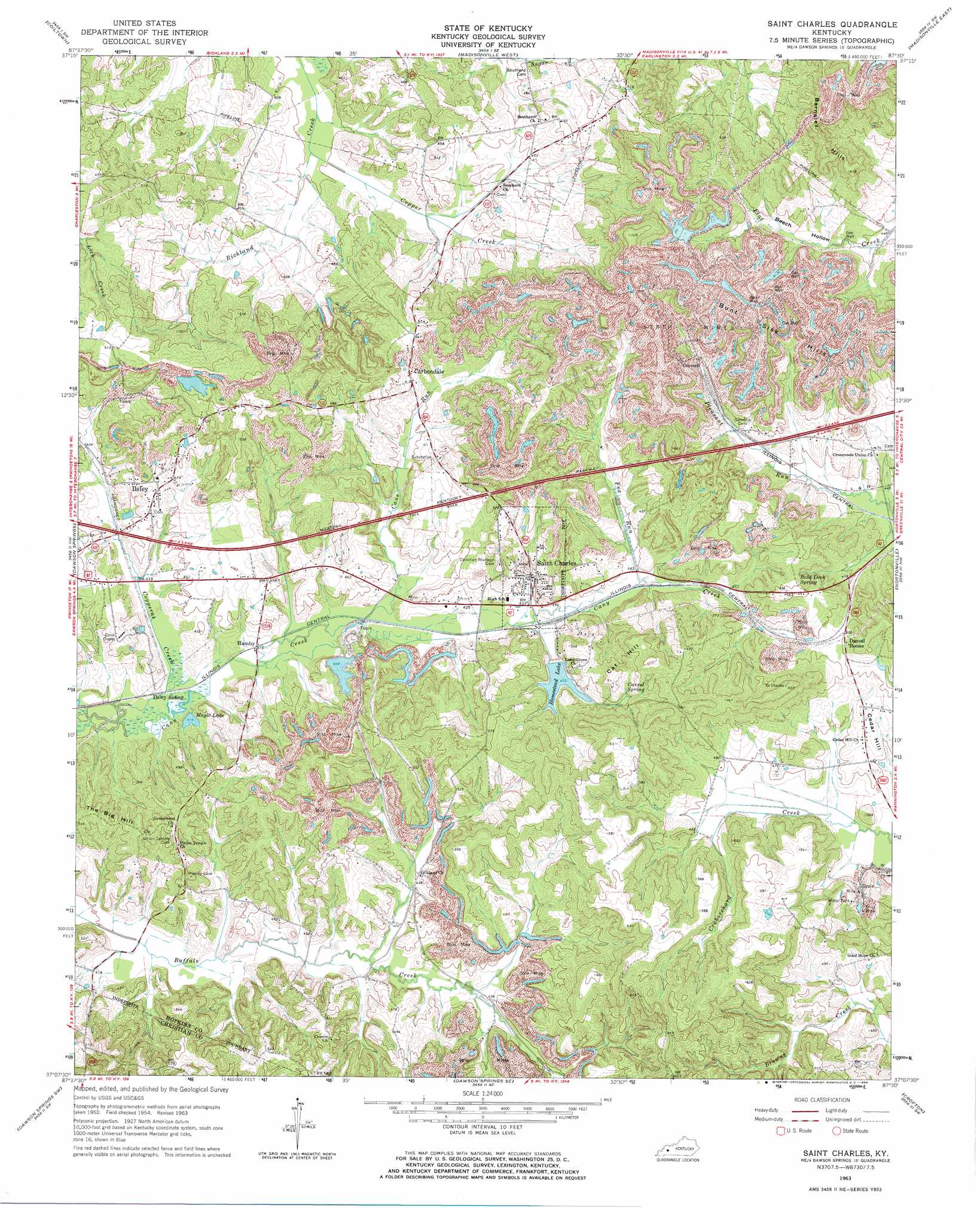
USGS Topo Quad 37087b5 - 1:24,000 scale
| Topo Map Name: | Saint Charles |
| USGS Topo Quad ID: | 37087b5 |
| Print Size: | ca. 21 1/4" wide x 27" high |
| Southeast Coordinates: | 37.125° N latitude / 87.5° W longitude |
| Map Center Coordinates: | 37.1875° N latitude / 87.5625° W longitude |
| U.S. State: | KY |
| Filename: | o37087b5.jpg |
| Download Map JPG Image: | Saint Charles topo map 1:24,000 scale |
| Map Type: | Topographic |
| Topo Series: | 7.5´ |
| Map Scale: | 1:24,000 |
| Source of Map Images: | United States Geological Survey (USGS) |
| Alternate Map Versions: |
Saint Charles KY 1954, updated 1956 Download PDF Buy paper map Saint Charles KY 1963, updated 1964 Download PDF Buy paper map Saint Charles KY 2010 Download PDF Buy paper map Saint Charles KY 2013 Download PDF Buy paper map Saint Charles KY 2016 Download PDF Buy paper map |
1:24,000 Topo Quads surrounding Saint Charles
Providence |
Nebo |
Slaughtersville |
Hanson |
Sacramento |
Dalton |
Coiltown |
Madisonville West |
Madisonville East |
Millport |
Olney |
Dawson Springs |
Saint Charles |
Nortonville |
Graham |
Princeton East |
Dawson Springs Sw |
Dawson Springs Se |
Crofton |
Haleys Mill |
Cobb |
Gracey |
Pleasant Green Hill |
Kelly |
Honey Grove |
> Back to 37087a1 at 1:100,000 scale
> Back to 37086a1 at 1:250,000 scale
> Back to U.S. Topo Maps home
Saint Charles topo map: Gazetteer
Saint Charles: Lakes
Magic Lake elevation 126m 413′Saint Charles: Populated Places
Daniel Boone elevation 154m 505′Hamby elevation 125m 410′
Ilsley elevation 148m 485′
Saint Charles elevation 134m 439′
Saint Charles: Ranges
Barnsley Hills elevation 196m 643′Bunt Sisk Hills elevation 210m 688′
Saint Charles: Reservoirs
Homestead Lake elevation 144m 472′Saint Charles: Springs
Bald Duck Spring elevation 160m 524′Carrol Spring elevation 158m 518′
Saint Charles: Streams
Cane Run elevation 126m 413′Copper Creek elevation 121m 396′
Copperas Creek elevation 122m 400′
Fox Run elevation 134m 439′
Saint Charles: Summits
Cat Hill elevation 158m 518′Cedar Hill elevation 144m 472′
Saint Charles: Valleys
Beech Hollow elevation 136m 446′Saint Charles digital topo map on disk
Buy this Saint Charles topo map showing relief, roads, GPS coordinates and other geographical features, as a high-resolution digital map file on DVD: