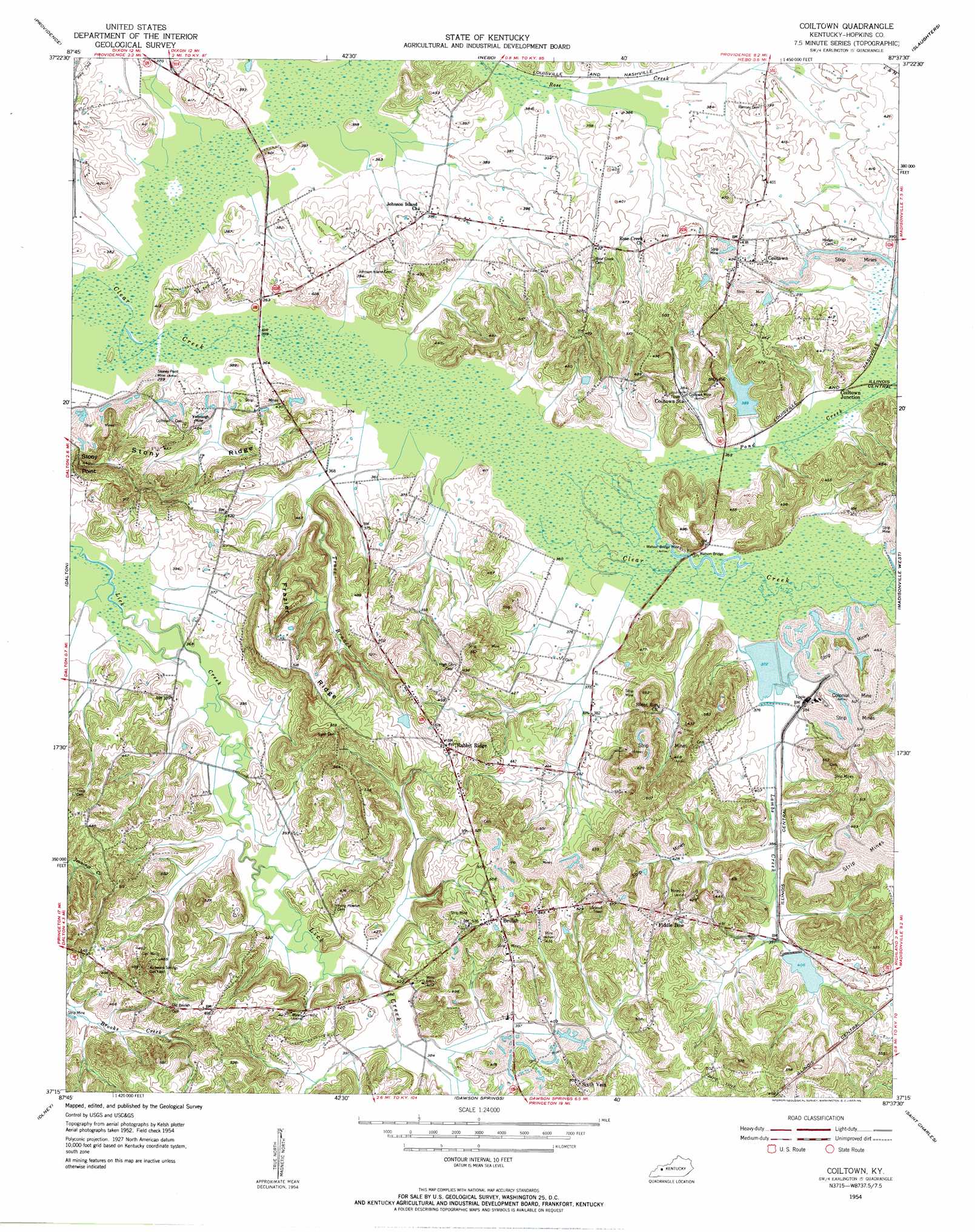
Coiltown Topo Map Kentucky
To zoom in, hover over the map of Coiltown
USGS Topo Quad 37087c6 - 1:24,000 scale
| Topo Map Name: | Coiltown |
| USGS Topo Quad ID: | 37087c6 |
| Print Size: | ca. 21 1/4" wide x 27" high |
| Southeast Coordinates: | 37.25° N latitude / 87.625° W longitude |
| Map Center Coordinates: | 37.3125° N latitude / 87.6875° W longitude |
| U.S. State: | KY |
| Filename: | o37087c6.jpg |
| Download Map JPG Image: | Coiltown topo map 1:24,000 scale |
| Map Type: | Topographic |
| Topo Series: | 7.5´ |
| Map Scale: | 1:24,000 |
| Source of Map Images: | United States Geological Survey (USGS) |
| Alternate Map Versions: |
Coiltown KY 1954, updated 1955 Download PDF Buy paper map Coiltown KY 2010 Download PDF Buy paper map Coiltown KY 2013 Download PDF Buy paper map Coiltown KY 2016 Download PDF Buy paper map |
1:24,000 Topo Quads surrounding Coiltown
Sturgis |
Bordley |
Dixon |
Sebree |
Beech Grove |
Blackford |
Providence |
Nebo |
Slaughtersville |
Hanson |
Shady Grove |
Dalton |
Coiltown |
Madisonville West |
Madisonville East |
Crider |
Olney |
Dawson Springs |
Saint Charles |
Nortonville |
Princeton West |
Princeton East |
Dawson Springs Sw |
Dawson Springs Se |
Crofton |
> Back to 37087a1 at 1:100,000 scale
> Back to 37086a1 at 1:250,000 scale
> Back to U.S. Topo Maps home
Coiltown topo map: Gazetteer
Coiltown: Bridges
Watson Bridge elevation 113m 370′Coiltown: Mines
Coiltown Mine elevation 122m 400′Colonial Mine elevation 132m 433′
Stoney Point Mine elevation 115m 377′
Watson Bridge Mine elevation 120m 393′
Yarbrough Mine elevation 122m 400′
Coiltown: Oilfields
Kirkwood Springs Gas Field elevation 151m 495′Coiltown: Populated Places
Beulah elevation 161m 528′Coiltown elevation 134m 439′
Colitown Junction elevation 116m 380′
Fiddle Bow elevation 157m 515′
Rabbit Ridge elevation 152m 498′
Sixth Vein elevation 154m 505′
Coiltown: Ridges
Frazier Ridge elevation 156m 511′Stony Ridge elevation 130m 426′
Coiltown: Streams
Lambs Creek elevation 122m 400′Pond Creek elevation 110m 360′
Trace Branch elevation 109m 357′
Weirs Creek elevation 109m 357′
Coiltown: Summits
Stony Point elevation 163m 534′Coiltown digital topo map on disk
Buy this Coiltown topo map showing relief, roads, GPS coordinates and other geographical features, as a high-resolution digital map file on DVD: