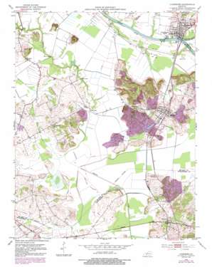
Livermore Topo Map Kentucky
To zoom in, hover over the map of Livermore
USGS Topo Quad 37087d2 - 1:24,000 scale
| Topo Map Name: | Livermore |
| USGS Topo Quad ID: | 37087d2 |
| Print Size: | ca. 21 1/4" wide x 27" high |
| Southeast Coordinates: | 37.375° N latitude / 87.125° W longitude |
| Map Center Coordinates: | 37.4375° N latitude / 87.1875° W longitude |
| U.S. State: | KY |
| Filename: | o37087d2.jpg |
| Download Map JPG Image: | Livermore topo map 1:24,000 scale |
| Map Type: | Topographic |
| Topo Series: | 7.5´ |
| Map Scale: | 1:24,000 |
| Source of Map Images: | United States Geological Survey (USGS) |
| Alternate Map Versions: |
Livermore KY 1952, updated 1953 Download PDF Buy paper map Livermore KY 1952, updated 1969 Download PDF Buy paper map Livermore KY 1952, updated 1983 Download PDF Buy paper map Livermore KY 2010 Download PDF Buy paper map Livermore KY 2013 Download PDF Buy paper map Livermore KY 2016 Download PDF Buy paper map |
1:24,000 Topo Quads surrounding Livermore
> Back to 37087a1 at 1:100,000 scale
> Back to 37086a1 at 1:250,000 scale
> Back to U.S. Topo Maps home
Livermore topo map: Gazetteer
Livermore: Airports
David Lowe Airport elevation 141m 462′Livermore: Bridges
Bryant Bridge elevation 113m 370′Sketo Bridge elevation 116m 380′
Stroud Bridge elevation 113m 370′
Vicker Bridge elevation 113m 370′
Livermore: Flats
Cypress Bottom elevation 116m 380′Livermore: Populated Places
Buttonsberry elevation 130m 426′Island elevation 137m 449′
Livermore elevation 124m 406′
Moorman elevation 127m 416′
Semiway elevation 119m 390′
Stroud elevation 128m 419′
Livermore: Streams
Rough River elevation 112m 367′Livermore: Summits
Bates Knob elevation 166m 544′Boehler Knob elevation 154m 505′
Livermore digital topo map on disk
Buy this Livermore topo map showing relief, roads, GPS coordinates and other geographical features, as a high-resolution digital map file on DVD:


