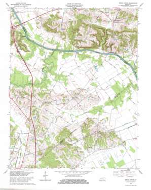
Beech Grove Topo Map Kentucky
To zoom in, hover over the map of Beech Grove
USGS Topo Quad 37087e4 - 1:24,000 scale
| Topo Map Name: | Beech Grove |
| USGS Topo Quad ID: | 37087e4 |
| Print Size: | ca. 21 1/4" wide x 27" high |
| Southeast Coordinates: | 37.5° N latitude / 87.375° W longitude |
| Map Center Coordinates: | 37.5625° N latitude / 87.4375° W longitude |
| U.S. State: | KY |
| Filename: | o37087e4.jpg |
| Download Map JPG Image: | Beech Grove topo map 1:24,000 scale |
| Map Type: | Topographic |
| Topo Series: | 7.5´ |
| Map Scale: | 1:24,000 |
| Source of Map Images: | United States Geological Survey (USGS) |
| Alternate Map Versions: |
Beech Grove KY 1952, updated 1954 Download PDF Buy paper map Beech Grove KY 1952, updated 1968 Download PDF Buy paper map Beech Grove KY 1969, updated 1971 Download PDF Buy paper map Beech Grove KY 1969, updated 1981 Download PDF Buy paper map Beech Grove KY 2010 Download PDF Buy paper map Beech Grove KY 2013 Download PDF Buy paper map Beech Grove KY 2016 Download PDF Buy paper map |
1:24,000 Topo Quads surrounding Beech Grove
> Back to 37087e1 at 1:100,000 scale
> Back to 37086a1 at 1:250,000 scale
> Back to U.S. Topo Maps home
Beech Grove topo map: Gazetteer
Beech Grove: Bridges
Gresham Bridge elevation 106m 347′Beech Grove: Populated Places
Beech Grove elevation 125m 410′Congleton elevation 140m 459′
Elmwood elevation 122m 400′
Lemon elevation 115m 377′
Onton elevation 139m 456′
Roland Landing elevation 116m 380′
Steamport Landing elevation 106m 347′
Wrightsburg elevation 128m 419′
Beech Grove: Streams
Deer Creek elevation 112m 367′Sugar Camp Creek elevation 119m 390′
Yellow Creek elevation 106m 347′
Beech Grove digital topo map on disk
Buy this Beech Grove topo map showing relief, roads, GPS coordinates and other geographical features, as a high-resolution digital map file on DVD:


