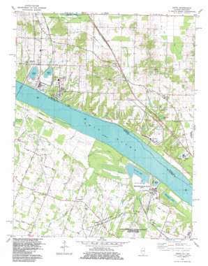
Joppa Topo Map Kentucky
To zoom in, hover over the map of Joppa
USGS Topo Quad 37088b7 - 1:24,000 scale
| Topo Map Name: | Joppa |
| USGS Topo Quad ID: | 37088b7 |
| Print Size: | ca. 21 1/4" wide x 27" high |
| Southeast Coordinates: | 37.125° N latitude / 88.75° W longitude |
| Map Center Coordinates: | 37.1875° N latitude / 88.8125° W longitude |
| U.S. States: | KY, IL |
| Filename: | o37088b7.jpg |
| Download Map JPG Image: | Joppa topo map 1:24,000 scale |
| Map Type: | Topographic |
| Topo Series: | 7.5´ |
| Map Scale: | 1:24,000 |
| Source of Map Images: | United States Geological Survey (USGS) |
| Alternate Map Versions: |
Joppa IL 1954, updated 1955 Download PDF Buy paper map Joppa IL 1954, updated 1964 Download PDF Buy paper map Joppa IL 1967, updated 1968 Download PDF Buy paper map Joppa IL 1967, updated 1977 Download PDF Buy paper map Joppa IL 1982, updated 1983 Download PDF Buy paper map Joppa IL 2010 Download PDF Buy paper map Joppa IL 2012 Download PDF Buy paper map Joppa IL 2015 Download PDF Buy paper map |
1:24,000 Topo Quads surrounding Joppa
> Back to 37088a1 at 1:100,000 scale
> Back to 37088a1 at 1:250,000 scale
> Back to U.S. Topo Maps home
Joppa topo map: Gazetteer
Joppa: Airports
Metropolis Municipal Airport elevation 116m 380′Joppa: Canals
Crutcher Slough elevation 94m 308′Joppa: Guts
Snake Slough elevation 97m 318′Joppa: Lakes
Metropolis Lake elevation 96m 314′Joppa: Parks
Mermet Swamp Nature Preserve elevation 104m 341′Joppa: Populated Places
Choat elevation 114m 374′Joppa elevation 108m 354′
Rossington elevation 109m 357′
Joppa: Reservoirs
Oak Glen Lake elevation 109m 357′Joppa: Streams
Bayou Creek elevation 99m 324′Bayou Creek elevation 88m 288′
Bean Branch elevation 94m 308′
Brushy Creek elevation 104m 341′
Deer Lick Creek elevation 98m 321′
Little Bayou Creek elevation 91m 298′
Nasty Creek elevation 94m 308′
Rocky Branch elevation 88m 288′
Joppa digital topo map on disk
Buy this Joppa topo map showing relief, roads, GPS coordinates and other geographical features, as a high-resolution digital map file on DVD:


