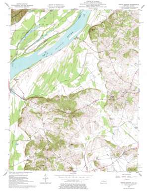
Grove Center Topo Map Kentucky
To zoom in, hover over the map of Grove Center
USGS Topo Quad 37088f1 - 1:24,000 scale
| Topo Map Name: | Grove Center |
| USGS Topo Quad ID: | 37088f1 |
| Print Size: | ca. 21 1/4" wide x 27" high |
| Southeast Coordinates: | 37.625° N latitude / 88° W longitude |
| Map Center Coordinates: | 37.6875° N latitude / 88.0625° W longitude |
| U.S. States: | KY, IL |
| Filename: | o37088f1.jpg |
| Download Map JPG Image: | Grove Center topo map 1:24,000 scale |
| Map Type: | Topographic |
| Topo Series: | 7.5´ |
| Map Scale: | 1:24,000 |
| Source of Map Images: | United States Geological Survey (USGS) |
| Alternate Map Versions: |
Grove Center KY 1953, updated 1954 Download PDF Buy paper map Grove Center KY 1959, updated 1960 Download PDF Buy paper map Grove Center KY 1959, updated 1977 Download PDF Buy paper map Grove Center KY 2010 Download PDF Buy paper map Grove Center KY 2013 Download PDF Buy paper map Grove Center KY 2016 Download PDF Buy paper map |
1:24,000 Topo Quads surrounding Grove Center
> Back to 37088e1 at 1:100,000 scale
> Back to 37088a1 at 1:250,000 scale
> Back to U.S. Topo Maps home
Grove Center topo map: Gazetteer
Grove Center: Canals
Goose Pond Ditch elevation 104m 341′Grove Center: Islands
Bell Island elevation 101m 331′Grove Center: Lakes
Big Lake elevation 98m 321′Black Lake elevation 103m 337′
Fish Lake elevation 98m 321′
Geiger Lake elevation 104m 341′
Mullin Pond elevation 114m 374′
Welsh Lake (historical) elevation 104m 341′
Grove Center: Populated Places
Blackburn elevation 106m 347′Grove Center elevation 118m 387′
Raleigh elevation 104m 341′
Spring Grove elevation 128m 419′
The Rocks elevation 119m 390′
Grove Center: Streams
Millrace Slough elevation 99m 324′Wash Creek elevation 107m 351′
Grove Center: Summits
Bald Hill elevation 187m 613′Grundy Hill elevation 166m 544′
Grove Center: Swamps
Harding Pond elevation 110m 360′Grove Center digital topo map on disk
Buy this Grove Center topo map showing relief, roads, GPS coordinates and other geographical features, as a high-resolution digital map file on DVD:


