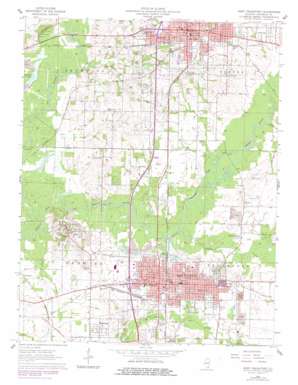
West Frankfort Topo Map Illinois
To zoom in, hover over the map of West Frankfort
USGS Topo Quad 37088h8 - 1:24,000 scale
| Topo Map Name: | West Frankfort |
| USGS Topo Quad ID: | 37088h8 |
| Print Size: | ca. 21 1/4" wide x 27" high |
| Southeast Coordinates: | 37.875° N latitude / 88.875° W longitude |
| Map Center Coordinates: | 37.9375° N latitude / 88.9375° W longitude |
| U.S. State: | IL |
| Filename: | o37088h8.jpg |
| Download Map JPG Image: | West Frankfort topo map 1:24,000 scale |
| Map Type: | Topographic |
| Topo Series: | 7.5´ |
| Map Scale: | 1:24,000 |
| Source of Map Images: | United States Geological Survey (USGS) |
| Alternate Map Versions: |
West Frankfort IL 1963, updated 1964 Download PDF Buy paper map West Frankfort IL 1963, updated 1978 Download PDF Buy paper map West Frankfort IL 2012 Download PDF Buy paper map West Frankfort IL 2015 Download PDF Buy paper map |
1:24,000 Topo Quads surrounding West Frankfort
> Back to 37088e1 at 1:100,000 scale
> Back to 37088a1 at 1:250,000 scale
> Back to U.S. Topo Maps home
West Frankfort topo map: Gazetteer
West Frankfort: Crossings
Interchange 65 elevation 121m 396′Interchange 71 elevation 140m 459′
West Frankfort: Lakes
Buckner Pond elevation 114m 374′West Frankfort: Oilfields
Benton Oil Field elevation 146m 479′West Frankfort Oil Field elevation 116m 380′
West Frankfort South Oil Field elevation 122m 400′
West Frankfort: Parks
Benton City Park elevation 137m 449′West Frankfort: Populated Places
Benton elevation 144m 472′Cambon elevation 119m 390′
Deering City elevation 119m 390′
Frankfort elevation 145m 475′
Orient elevation 147m 482′
Pershing elevation 122m 400′
Steel City elevation 132m 433′
West City elevation 139m 456′
West Frankfort elevation 122m 400′
West Frankfort: Post Offices
Benton Post Office elevation 143m 469′West Frankfort Post Office elevation 125m 410′
West Frankfort: Streams
Andy Creek elevation 111m 364′Ewing Creek elevation 116m 380′
Gatling Branch elevation 118m 387′
Green River elevation 112m 367′
West Frankfort digital topo map on disk
Buy this West Frankfort topo map showing relief, roads, GPS coordinates and other geographical features, as a high-resolution digital map file on DVD:


