Cache Topo Map Illinois
To zoom in, hover over the map of Cache
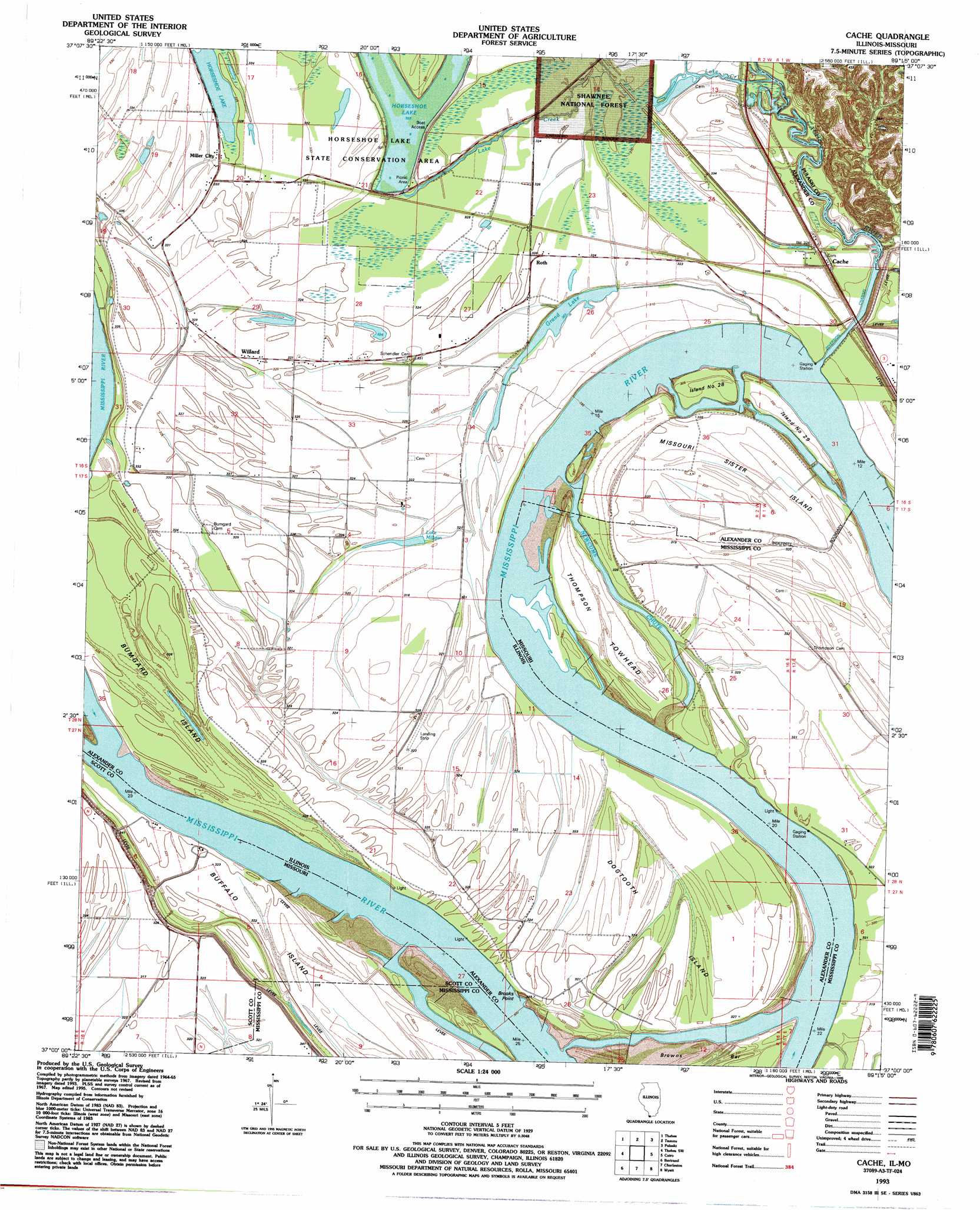
USGS Topo Quad 37089a3 - 1:24,000 scale
| Topo Map Name: | Cache |
| USGS Topo Quad ID: | 37089a3 |
| Print Size: | ca. 21 1/4" wide x 27" high |
| Southeast Coordinates: | 37° N latitude / 89.25° W longitude |
| Map Center Coordinates: | 37.0625° N latitude / 89.3125° W longitude |
| U.S. States: | IL, MO |
| Filename: | o37089a3.jpg |
| Download Map JPG Image: | Cache topo map 1:24,000 scale |
| Map Type: | Topographic |
| Topo Series: | 7.5´ |
| Map Scale: | 1:24,000 |
| Source of Map Images: | United States Geological Survey (USGS) |
| Alternate Map Versions: |
Cache IL 1967, updated 1968 Download PDF Buy paper map Cache IL 1967, updated 1979 Download PDF Buy paper map Cache IL 1993, updated 1996 Download PDF Buy paper map Cache IL 2012 Download PDF Buy paper map Cache IL 2015 Download PDF Buy paper map |
| FStopo: | US Forest Service topo Cache is available: Download FStopo PDF Download FStopo TIF |
1:24,000 Topo Quads surrounding Cache
Cape Girardeau |
Mcclure |
Mill Creek |
Dongola |
Cypress |
Scott City |
Thebes |
Tamms |
Pulaski |
Olmsted |
Morley |
Thebes Sw |
Cache |
Cairo |
Barlow |
Sikeston North |
Bertrand |
Charleston |
Wyatt |
Wickliffe |
Sikeston South |
East Prairie |
Anniston |
Wickliffe Sw |
Arlington |
> Back to 37089a1 at 1:100,000 scale
> Back to 37088a1 at 1:250,000 scale
> Back to U.S. Topo Maps home
Cache topo map: Gazetteer
Cache: Airports
Hunter Raffety Elevators Inc Airport elevation 97m 318′Cache: Bends
Dogtooth Bend elevation 97m 318′Cache: Capes
Brooks Point elevation 97m 318′Cache: Guts
Newcums Chute elevation 93m 305′Cache: Islands
Buffalo Island elevation 98m 321′Bumgard Island elevation 97m 318′
Dogtooth Island elevation 98m 321′
Island Number 28 elevation 97m 318′
Island Number 29 elevation 98m 321′
Missouri Sister Island elevation 95m 311′
Price Towhead (historical) elevation 97m 318′
Thompson Towhead elevation 97m 318′
Cache: Lakes
Grand Lake elevation 94m 308′Lake Milligan elevation 97m 318′
Cache: Populated Places
Cache elevation 102m 334′Miller City elevation 101m 331′
Roth elevation 98m 321′
Willard elevation 98m 321′
Cache: Post Offices
Miller City Post Office elevation 100m 328′Cache: Streams
Lake Creek elevation 92m 301′Cache: Summits
Dogtooth Bend Mounds elevation 99m 324′Cache digital topo map on disk
Buy this Cache topo map showing relief, roads, GPS coordinates and other geographical features, as a high-resolution digital map file on DVD: