Bell City Topo Map Missouri
To zoom in, hover over the map of Bell City
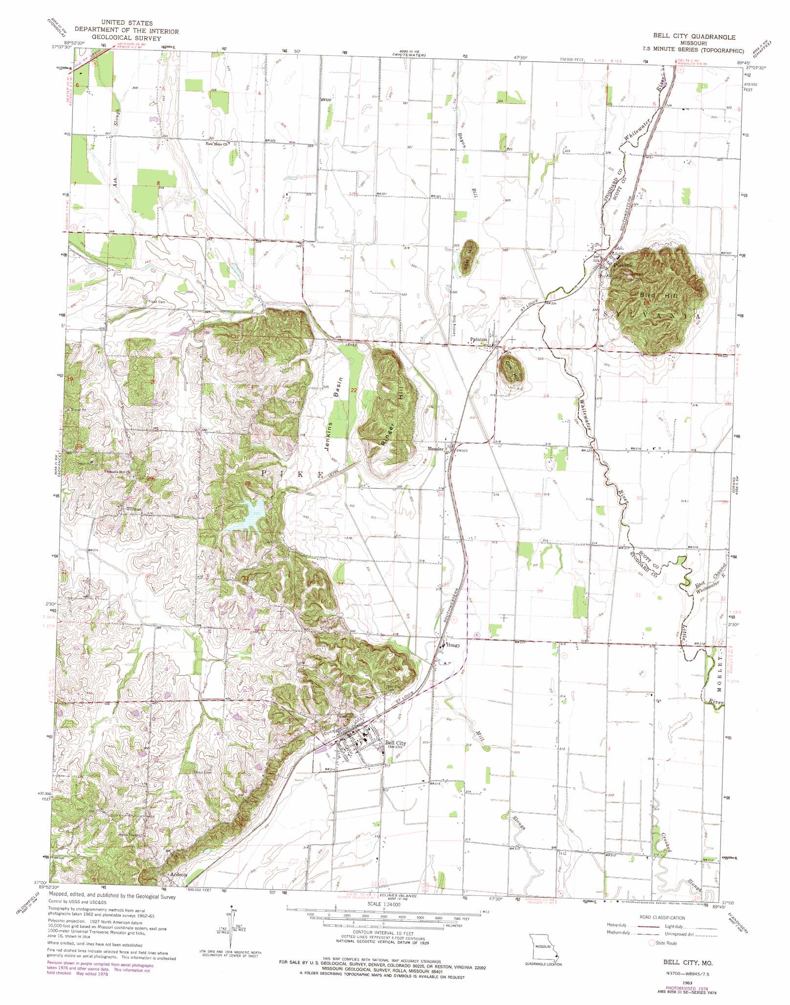
USGS Topo Quad 37089a7 - 1:24,000 scale
| Topo Map Name: | Bell City |
| USGS Topo Quad ID: | 37089a7 |
| Print Size: | ca. 21 1/4" wide x 27" high |
| Southeast Coordinates: | 37° N latitude / 89.75° W longitude |
| Map Center Coordinates: | 37.0625° N latitude / 89.8125° W longitude |
| U.S. State: | MO |
| Filename: | o37089a7.jpg |
| Download Map JPG Image: | Bell City topo map 1:24,000 scale |
| Map Type: | Topographic |
| Topo Series: | 7.5´ |
| Map Scale: | 1:24,000 |
| Source of Map Images: | United States Geological Survey (USGS) |
| Alternate Map Versions: |
Bell City MO 1963, updated 1964 Download PDF Buy paper map Bell City MO 1963, updated 1978 Download PDF Buy paper map Bell City MO 2012 Download PDF Buy paper map Bell City MO 2015 Download PDF Buy paper map |
1:24,000 Topo Quads surrounding Bell City
Glenallen |
Marble Hill |
Bufordville |
Gordonville |
Cape Girardeau |
Zalma |
Dongola |
Whitewater |
Chaffee |
Scott City |
Sturdivant |
Advance |
Bell City |
Oran |
Morley |
Acorn Ridge |
Bloomfield |
Clines Island |
Vanduser |
Sikeston North |
Dudley |
Dexter |
Essex |
Morehouse |
Sikeston South |
> Back to 37089a1 at 1:100,000 scale
> Back to 37088a1 at 1:250,000 scale
> Back to U.S. Topo Maps home
Bell City topo map: Gazetteer
Bell City: Airports
E A A Chapter 453 Airport elevation 97m 318′Georger Farms Airport elevation 101m 331′
Bell City: Basins
Jenkins Basin elevation 99m 324′Bell City: Dams
Andersons Whippoorwill Farm Lake Dam elevation 118m 387′Bell City: Populated Places
Ardeola elevation 110m 360′Bell City elevation 100m 328′
Heagy elevation 98m 321′
Messler elevation 95m 311′
Painton elevation 96m 314′
Perkins elevation 103m 337′
Tillman elevation 138m 452′
Bell City: Streams
Ash Slough elevation 103m 337′Bayou Bill elevation 98m 321′
Lower Whitewater Creek elevation 95m 311′
Tilly Branch elevation 97m 318′
Bell City: Summits
Bird Hill elevation 143m 469′Cow Hill elevation 143m 469′
Lost Hill elevation 141m 462′
Ringer Hill elevation 140m 459′
Bell City digital topo map on disk
Buy this Bell City topo map showing relief, roads, GPS coordinates and other geographical features, as a high-resolution digital map file on DVD: