Advance Topo Map Missouri
To zoom in, hover over the map of Advance
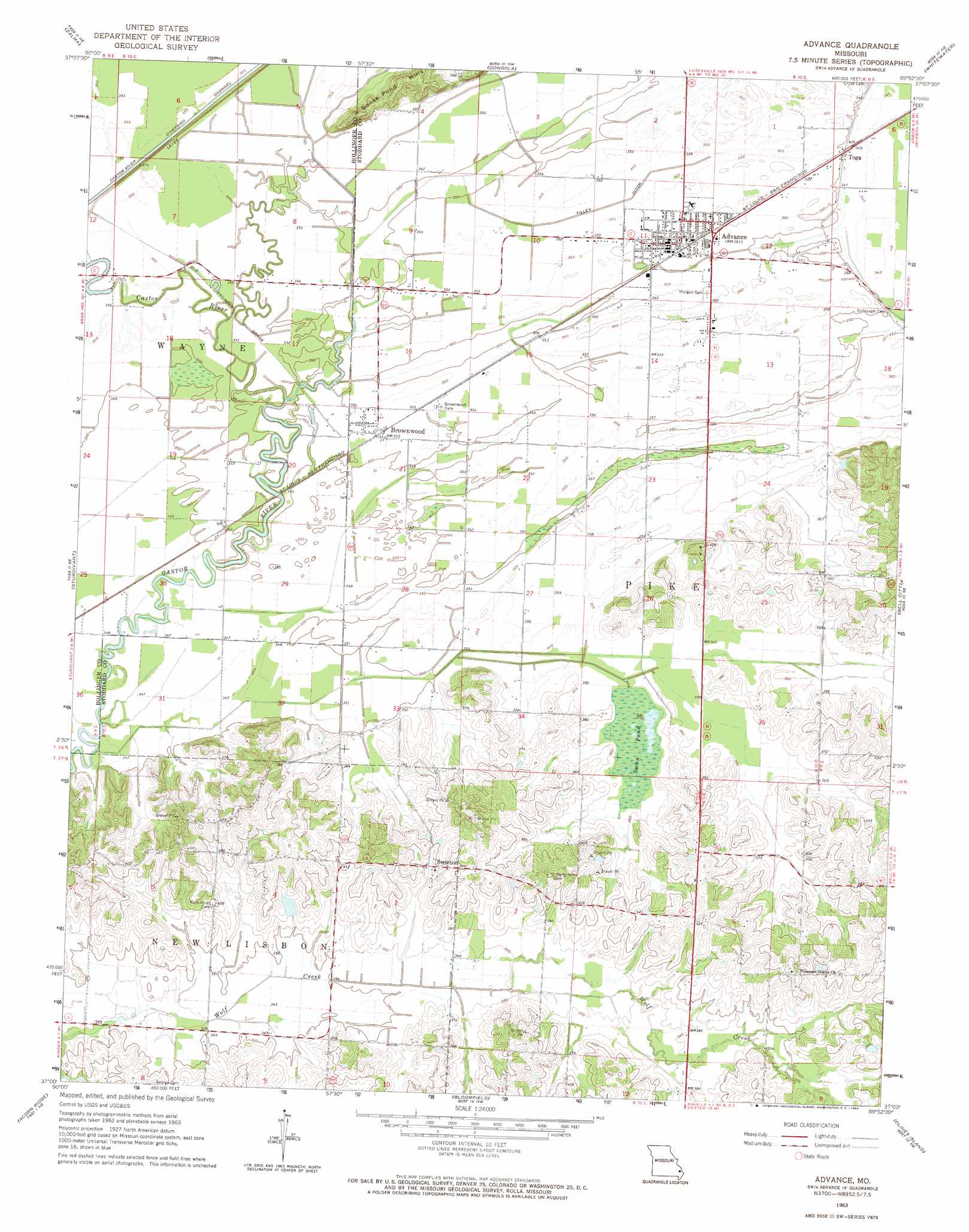
USGS Topo Quad 37089a8 - 1:24,000 scale
| Topo Map Name: | Advance |
| USGS Topo Quad ID: | 37089a8 |
| Print Size: | ca. 21 1/4" wide x 27" high |
| Southeast Coordinates: | 37° N latitude / 89.875° W longitude |
| Map Center Coordinates: | 37.0625° N latitude / 89.9375° W longitude |
| U.S. State: | MO |
| Filename: | o37089a8.jpg |
| Download Map JPG Image: | Advance topo map 1:24,000 scale |
| Map Type: | Topographic |
| Topo Series: | 7.5´ |
| Map Scale: | 1:24,000 |
| Source of Map Images: | United States Geological Survey (USGS) |
| Alternate Map Versions: |
Advance MO 1963, updated 1964 Download PDF Buy paper map Advance MO 2012 Download PDF Buy paper map Advance MO 2015 Download PDF Buy paper map |
1:24,000 Topo Quads surrounding Advance
Allbright |
Glenallen |
Marble Hill |
Bufordville |
Gordonville |
Gipsy |
Zalma |
Dongola |
Whitewater |
Chaffee |
Mcgee |
Sturdivant |
Advance |
Bell City |
Oran |
Puxico |
Acorn Ridge |
Bloomfield |
Clines Island |
Vanduser |
Fisk |
Dudley |
Dexter |
Essex |
Morehouse |
> Back to 37089a1 at 1:100,000 scale
> Back to 37088a1 at 1:250,000 scale
> Back to U.S. Topo Maps home
Advance topo map: Gazetteer
Advance: Canals
Tilley Ditch elevation 106m 347′Advance: Dams
Johnsons Lake Dam elevation 115m 377′Rendleman Lake Dam elevation 118m 387′
Advance: Lakes
Horseshoe Lake (historical) elevation 109m 357′Advance: Populated Places
Advance elevation 110m 360′Brownwood elevation 108m 354′
Castor elevation 107m 351′
Swinton elevation 117m 383′
Toga elevation 106m 347′
Advance: Reservoirs
Johnsons Lake elevation 115m 377′Advance: Streams
Wolf Creek elevation 101m 331′Advance: Swamps
Swan Pond (historical) elevation 108m 354′Advance digital topo map on disk
Buy this Advance topo map showing relief, roads, GPS coordinates and other geographical features, as a high-resolution digital map file on DVD: