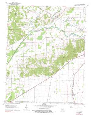
Whitewater Topo Map Missouri
To zoom in, hover over the map of Whitewater
USGS Topo Quad 37089b7 - 1:24,000 scale
| Topo Map Name: | Whitewater |
| USGS Topo Quad ID: | 37089b7 |
| Print Size: | ca. 21 1/4" wide x 27" high |
| Southeast Coordinates: | 37.125° N latitude / 89.75° W longitude |
| Map Center Coordinates: | 37.1875° N latitude / 89.8125° W longitude |
| U.S. State: | MO |
| Filename: | o37089b7.jpg |
| Download Map JPG Image: | Whitewater topo map 1:24,000 scale |
| Map Type: | Topographic |
| Topo Series: | 7.5´ |
| Map Scale: | 1:24,000 |
| Source of Map Images: | United States Geological Survey (USGS) |
| Alternate Map Versions: |
Whitewater MO 1963, updated 1964 Download PDF Buy paper map Whitewater MO 1963, updated 1979 Download PDF Buy paper map Whitewater MO 2012 Download PDF Buy paper map Whitewater MO 2015 Download PDF Buy paper map |
1:24,000 Topo Quads surrounding Whitewater
> Back to 37089a1 at 1:100,000 scale
> Back to 37088a1 at 1:250,000 scale
> Back to U.S. Topo Maps home
Whitewater topo map: Gazetteer
Whitewater: Basins
Block Hole elevation 103m 337′Whitewater: Bridges
Allenville Covered Bridge elevation 103m 337′Whitewater: Guts
Horseshoe Bend Slough elevation 104m 341′Whitewater: Lakes
Round Pond (historical) elevation 111m 364′Whitewater: Populated Places
Allenville elevation 108m 354′Arbor elevation 102m 334′
Cliff elevation 103m 337′
Green Cox elevation 99m 324′
Hickory Ridge elevation 162m 531′
Randles elevation 102m 334′
Rum Branch elevation 110m 360′
Stroderville (historical) elevation 121m 396′
Whitewater elevation 114m 374′
Whitewater: Ridges
Hickory Ridge elevation 158m 518′Whitewater: Streams
Crooked Creek elevation 103m 337′Gizzard Creek elevation 106m 347′
Upper Castor River elevation 103m 337′
Whitewater digital topo map on disk
Buy this Whitewater topo map showing relief, roads, GPS coordinates and other geographical features, as a high-resolution digital map file on DVD:


