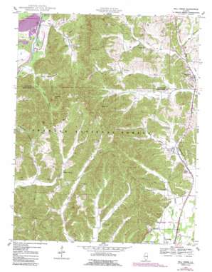
Mill Creek Topo Map Illinois
To zoom in, hover over the map of Mill Creek
USGS Topo Quad 37089c3 - 1:24,000 scale
| Topo Map Name: | Mill Creek |
| USGS Topo Quad ID: | 37089c3 |
| Print Size: | ca. 21 1/4" wide x 27" high |
| Southeast Coordinates: | 37.25° N latitude / 89.25° W longitude |
| Map Center Coordinates: | 37.3125° N latitude / 89.3125° W longitude |
| U.S. State: | IL |
| Filename: | o37089c3.jpg |
| Download Map JPG Image: | Mill Creek topo map 1:24,000 scale |
| Map Type: | Topographic |
| Topo Series: | 7.5´ |
| Map Scale: | 1:24,000 |
| Source of Map Images: | United States Geological Survey (USGS) |
| Alternate Map Versions: |
Mill Creek IL 1947, updated 1978 Download PDF Buy paper map Mill Creek IL 1947, updated 1990 Download PDF Buy paper map Mill Creek IL 1948 Download PDF Buy paper map Mill Creek IL 1996, updated 1998 Download PDF Buy paper map Mill Creek IL 2012 Download PDF Buy paper map Mill Creek IL 2015 Download PDF Buy paper map |
| FStopo: | US Forest Service topo Mill Creek is available: Download FStopo PDF Download FStopo TIF |
1:24,000 Topo Quads surrounding Mill Creek
> Back to 37089a1 at 1:100,000 scale
> Back to 37088a1 at 1:250,000 scale
> Back to U.S. Topo Maps home
Mill Creek topo map: Gazetteer
Mill Creek: Flats
Dogwood Flats elevation 230m 754′Hogskin Bottoms elevation 104m 341′
Mill Creek: Mines
Birk-McRite Quarry elevation 150m 492′Lone Star Mine elevation 187m 613′
Mill Creek: Populated Places
Elco elevation 112m 367′Mill Creek elevation 116m 380′
Springville elevation 124m 406′
Tatumville elevation 113m 370′
Valley Mission elevation 117m 383′
Mill Creek: Post Offices
Elco Post Office elevation 112m 367′Mill Creek: Streams
Lingle Creek elevation 116m 380′Mill Creek: Summits
Burner Hill elevation 171m 561′Italian Hill elevation 196m 643′
Pine Knob elevation 219m 718′
Vick Hill elevation 232m 761′
Mill Creek: Trails
Opossum Trot Trail elevation 220m 721′Mill Creek: Valleys
Dry Hollow elevation 116m 380′North Ripple Hollow elevation 102m 334′
South Ripple Hollow elevation 102m 334′
You-Be Hollow elevation 117m 383′
Mill Creek digital topo map on disk
Buy this Mill Creek topo map showing relief, roads, GPS coordinates and other geographical features, as a high-resolution digital map file on DVD:


